Category:Jamtalhütte
| Object location | | View all coordinates using: OpenStreetMap |
|---|
mountain hut  Jamtalhütte | |||||
| Upload media | |||||
| Instance of |
| ||||
|---|---|---|---|---|---|
| Location | Tyrol, Austria | ||||
| Owned by | |||||
| Inception |
| ||||
| Mountain range | |||||
| Elevation above sea level |
| ||||
| official website | |||||
 | |||||
Media in category "Jamtalhütte"
The following 12 files are in this category, out of 12 total.
-
 10 Blick über Pfannknechtsattel ins Jamtal.jpg 3,264 × 2,448; 1.84 MB
-
 Jamtalhuette.jpg 1,600 × 1,067; 356 KB
-
 Jamtalhütte Hüttenschild.jpg 3,264 × 2,448; 3.18 MB
-
 Jamtalhütte jamtal winter jamtalferner jamspitzen augstenberg pfannknecht.jpg 4,807 × 2,155; 4.71 MB
-
 Jamtalhütte Teich.jpg 3,264 × 2,448; 3.6 MB
-
 Jamtalhütte winter.jpg 3,990 × 2,433; 5.26 MB
-
 Jamtalhütte.jpg 3,264 × 2,448; 3.74 MB
-
 Jamthal-Hütte 1894.jpg 2,823 × 1,970; 884 KB
-
 Jamthal-Hütte.jpg 1,544 × 2,374; 1.17 MB
-
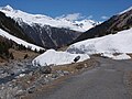 Lawine von P 2727 auf Jamtalstraße, Gaisspitze 2779 m oben links.jpg 2,272 × 1,704; 1.03 MB
-
-
 Jamtalhütte Terasse.jpg 3,264 × 2,448; 3.77 MB


