Category:Jansplein 51, Arnhem
| Object location | | View all coordinates using: OpenStreetMap |
|---|
building in Arnhem, Netherlands  | |||||
| Upload media | |||||
| Instance of | |||||
|---|---|---|---|---|---|
| Location | Arnhem, Gelderland, Netherlands | ||||
| Street address |
| ||||
| Heritage designation |
| ||||
 | |||||
|
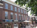
This is a category about rijksmonument number 8329
|
| Address |
|
Media in category "Jansplein 51, Arnhem"
The following 4 files are in this category, out of 4 total.
-
 Arnhem - Jansplein 51.jpg 2,592 × 1,944; 1.76 MB
-
 Jansplein 47-48-49-50-51, overzicht - Arnhem - 20025385 - RCE.jpg 1,200 × 807; 219 KB
-
 Jansplein 51, voorgevel - Arnhem - 20025386 - RCE.jpg 1,200 × 1,195; 423 KB
-
 Our beloved Pizzeria Donatello's and nice buildings at Jansplein Arnhem - panoramio.jpg 3,648 × 2,432; 2.35 MB


