Category:January 2008 in Herefordshire
Deutsch: Bilder, die im Januar 2008 in Herefordshire aufgenommen worden sind. Bitte beachten Sie, dass dies weder das Datum des Uploads noch das Datum des Scannens eines Fotos ist.
English: Images/pictures taken in Herefordshire during January 2008. Note this is not the date of the upload, nor the date a photo was scanned.
Español: Fotografías o imágenes tomadas en Herefordshire durante enero 2008. No es la fecha de subida ni escaneo, sino la fecha en que las fotografías o imágenes se crearon.
Esperanto: Bildoj faritaj en Herefordshire en januaro 2008. Tio ne estas la dato, kiam la bildoj estis alŝutitaj aŭ skanitaj.
Français : Photographies ou images prises en Herefordshire durant janvier 2008. Ce n'est pas la date du téléchargement ou du scan.
Galego: Fotografías ou imaxes tomadas en Herefordshire durante xaneiro 2008. Non é a data de subida nin escaneamento, senón a data na que se crearon as fotografías ou imaxes.
Italiano: Fotografie o immagini scattate a Herefordshire nel gennaio 2008. Nota bene: la data non si riferisce né a quella di upload né a quella in cui la foto è stata digitalizzata.
Norsk bokmål: Bilder tatt i Herefordshire i løpet av januar 2008. Merk at dette ikke er datoen for opplasting, eller når et bilde har blitt skannet.
Norsk nynorsk: Bilete teke i Herefordshire i løpet av januar 2008. Merk at dette ikkje er datoen for opplasting, eller når eit bilete har vorte skanna.
Русский: Изображения, сделанные в Herefordshire в течение январь 2008 (не дата загрузки изображения).
Українська: Зображення, зроблені в Herefordshire протягом січень 2008. Зауважте, що це не дата завантаження чи дата сканування фотографії.
| January 2007 | ← | January 2008 | → | January 2009 | |||||||
| Jan | Feb | Mar | Apr | May | Jun | Jul | Aug | Sep | Oct | Nov | Dec |
| 69 | 88 | 128 | 68 | 122 | 135 | 142 | 135 | 317 | 186 | 188 | 128 |
|---|---|---|---|---|---|---|---|---|---|---|---|
Media in category "January 2008 in Herefordshire"
The following 69 files are in this category, out of 69 total.
-

-
 Brook by Jay Lane - geograph.org.uk - 655054.jpg 640 × 480; 102 KB
-
 Bus shelter at Dormington - geograph.org.uk - 673320.jpg 640 × 480; 86 KB
-
 Bus shelter at King's Thorn - geograph.org.uk - 664688.jpg 640 × 438; 124 KB
-
 Caravan site road at Eastnor Park - geograph.org.uk - 650761.jpg 640 × 480; 106 KB
-
 Deer Gate into Eastnor Park - geograph.org.uk - 652921.jpg 640 × 427; 297 KB
-
 Eastern side of Eastnor Park - geograph.org.uk - 649814.jpg 640 × 480; 67 KB
-
 Eastnor Park - geograph.org.uk - 649751.jpg 640 × 480; 114 KB
-
 Eastnor Park - geograph.org.uk - 745361.jpg 640 × 480; 143 KB
-
 Eastnor Park pond - geograph.org.uk - 649812.jpg 640 × 480; 97 KB
-
 Eastnor Park road at Park Lodge - geograph.org.uk - 649824.jpg 640 × 480; 84 KB
-
 Eastnor Park track - geograph.org.uk - 650717.jpg 640 × 480; 113 KB
-

-

-
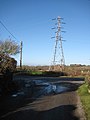
 EWS Class 60 at Pontrilas - geograph.org.uk - 657170.jpg 640 × 401; 62 KB
-
 Footpath to Old Sutton - geograph.org.uk - 673272.jpg 640 × 467; 139 KB
-
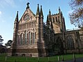
 Hereford Cathedral - geograph.org.uk - 649354.jpg 640 × 480; 80 KB
-
 Hereford cathedral 001.JPG 1,200 × 900; 379 KB
-
 Hereford cathedral 002.JPG 1,200 × 900; 242 KB
-
 Hereford cathedral 003.JPG 1,200 × 900; 233 KB
-
 Minor road junction at Prior's Frome - geograph.org.uk - 673296.jpg 480 × 640; 89 KB
-
 Postbox on country road - geograph.org.uk - 663957.jpg 640 × 480; 154 KB
-
 Road to Heath Farm - geograph.org.uk - 655032.jpg 640 × 359; 62 KB
-
 Ross, looking down Wye Street - geograph.org.uk - 758737.jpg 640 × 480; 60 KB
-
 Roundabout avoiding Ledbury town centre - geograph.org.uk - 655814.jpg 640 × 480; 142 KB
-
 Rusty shed and the Somers Obelisk - geograph.org.uk - 735702.jpg 640 × 480; 78 KB
-
 Second pond at Eastnor Park - geograph.org.uk - 650755.jpg 640 × 480; 65 KB
-
 Shed near The Ridgeway - geograph.org.uk - 650040.jpg 640 × 480; 117 KB
-
 Short footpath from Dormington - geograph.org.uk - 673323.jpg 640 × 480; 141 KB
-

-
 Tangle of branches, Queen's Wood - geograph.org.uk - 668162.jpg 640 × 461; 237 KB
-

-
 The Ridgeway - geograph.org.uk - 649845.jpg 480 × 640; 119 KB
-
 The Yew Tree Inn, Prior's Frome - geograph.org.uk - 673281.jpg 640 × 461; 95 KB
-
 Tight bend in Prior's Frome - geograph.org.uk - 673278.jpg 640 × 448; 109 KB
-
 Timber framed cottage, Ledgemoor - geograph.org.uk - 651216.jpg 640 × 480; 71 KB
-
 Top pond at Eastnor Park - 1 - geograph.org.uk - 650738.jpg 640 × 480; 71 KB
-
 Top pond at Eastnor Park - 2 - geograph.org.uk - 650745.jpg 640 × 480; 69 KB
-
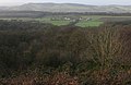
 View across Herefordshire - geograph.org.uk - 646399.jpg 640 × 453; 144 KB
-
 View from The Worcestershire Way - geograph.org.uk - 646407.jpg 640 × 480; 148 KB
-
 Worcestershire Way in winter - geograph.org.uk - 646403.jpg 640 × 480; 161 KB
-

-
 Wye Bridge from Greyfriars Bridge - geograph.org.uk - 664717.jpg 640 × 474; 111 KB
-

-
 Catkins in Queen's Wood - geograph.org.uk - 668174.jpg 640 × 480; 102 KB
-
 Celandines in the hedgerow - geograph.org.uk - 663945.jpg 636 × 640; 257 KB
-
 Clearing in the woodland in Queen's Wood - geograph.org.uk - 668061.jpg 480 × 640; 131 KB
-
 Coldborough Park Farmhouse - geograph.org.uk - 650622.jpg 640 × 480; 202 KB
-
 Cottage on the A449 - geograph.org.uk - 650627.jpg 640 × 480; 219 KB
-
 Country road north of Tedgewood - geograph.org.uk - 663968.jpg 640 × 480; 167 KB
-
 Country road to Tedgewood - geograph.org.uk - 663962.jpg 640 × 480; 116 KB
-

-
 Crossing the pipeline - geograph.org.uk - 650424.jpg 640 × 458; 160 KB
-
 Dutch barn at Tedgewood - geograph.org.uk - 663967.jpg 640 × 462; 177 KB
-
 Entrance to Dymock Woods - geograph.org.uk - 668070.jpg 640 × 480; 229 KB
-
 Entrance to Heath Farm - geograph.org.uk - 655321.jpg 640 × 459; 52 KB
-
 Felled timber - geograph.org.uk - 668075.jpg 480 × 640; 216 KB
-
 Footpath across the football field - geograph.org.uk - 657168.jpg 480 × 640; 202 KB
-
 Gullet Quarry Car Park Notice - geograph.org.uk - 655305.jpg 481 × 640; 312 KB
-

-
 Line of footpath up Linton Hill - geograph.org.uk - 655146.jpg 640 × 480; 82 KB
-
 Mixed woodland, Queen's Wood - geograph.org.uk - 668172.jpg 480 × 640; 107 KB
-
 News Wood - geograph.org.uk - 653022.jpg 640 × 415; 244 KB
-
 Path from British Camp to Walms Well - geograph.org.uk - 650595.jpg 640 × 427; 258 KB
-
 Seat at a junction in the woodland - geograph.org.uk - 668182.jpg 640 × 480; 203 KB
-
 The Old Lower Car Park, Gullet Quarry - geograph.org.uk - 655298.jpg 640 × 427; 313 KB
-
 Track heads NW through Queen's Wood - geograph.org.uk - 668092.jpg 640 × 480; 185 KB
-
 Track off The Ridgeway - geograph.org.uk - 650038.jpg 640 × 480; 107 KB
-
 Track to Netherton Farm - geograph.org.uk - 650591.jpg 640 × 480; 100 KB


