Category:Jeffrey Mine
English: Locality: Jeffrey mine (Jeffrey quarry; Johns-Manville mine), Asbestos, Les Sources RCM, Estrie, Québec, Canada (Locality at mindat.org)
Deutsch: Fundort: Jeffrey mine (Jeffrey quarry; Johns-Manville mine), Asbestos, Les Sources RCM, Estrie, Québec, Kanada (Fundort bei mindat.org)
| Object location | | View all coordinates using: OpenStreetMap |
|---|
 | |||||
| Upload media | |||||
| Instance of | |||||
|---|---|---|---|---|---|
| Location |
| ||||
| Significant event |
| ||||
 | |||||
Media in category "Jeffrey Mine"
The following 200 files are in this category, out of 234 total.
(previous page) (next page)-
 2012 Tucson Gem & Mineral Show 114.JPG 4,000 × 3,000; 2.26 MB
-
 Andradite-261705.jpg 600 × 420; 37 KB
-
 Andradite-261706.jpg 600 × 508; 61 KB
-
 Andradite-Diopside-261620.jpg 546 × 432; 87 KB
-
 Apophyllite-121112.jpg 595 × 456; 57 KB
-
 Asbestos mine, Black Lake, QC, 1895.jpg 2,560 × 1,440; 1.76 MB
-
 Asbestos, Quebec, Canada.jpg 640 × 469; 90 KB
-
 Bâtiments d'usine de la mine Jeffrey à Asbestos.jpg 3,244 × 1,852; 884 KB
-
 Camion sur le chemin de la mine d Asbestos - panoramio.jpg 2,000 × 1,469; 405 KB
-
 Demantoide.jpg 3,804 × 3,056; 7.67 MB
-
 Diopside-Grossular-t5g3b.jpg 384 × 338; 31 KB
-
 Diopside-Prehnite-ve11a.jpg 800 × 748; 90 KB
-
 Diopside-Prehnite-ve11b.jpg 350 × 400; 39 KB
-
 Diopside-Prehnite-ve11c.jpg 367 × 400; 31 KB
-
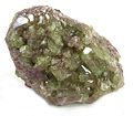
 Garnet-Group-Grossular-23646.jpg 600 × 486; 79 KB
-
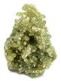
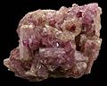
 Granat (garnet), grossular - Asbestos (Jeffrey Mine), Canada..jpg 2,141 × 1,425; 821 KB
-
 Grossular-113271.jpg 600 × 541; 77 KB
-
 Grossular-121948.jpg 538 × 600; 92 KB
-
 Grossular-121949.jpg 400 × 352; 43 KB
-
 Grossular-131556.jpg 528 × 600; 78 KB
-
 Grossular-176270.jpg 600 × 429; 87 KB
-
 Grossular-178753.jpg 600 × 458; 91 KB
-
 Grossular-184611.jpg 600 × 404; 68 KB
-
 Grossular-195461.jpg 593 × 750; 91 KB
-
 Grossular-195705.jpg 295 × 600; 68 KB
-
 Grossular-195706.jpg 750 × 695; 202 KB
-
 Grossular-20128.jpg 426 × 500; 132 KB
-
 Grossular-201594.jpg 600 × 593; 103 KB
-
 Grossular-211558.jpg 700 × 656; 117 KB
-
 Grossular-22529.jpg 600 × 384; 41 KB
-
 Grossular-22531.jpg 600 × 503; 74 KB
-
 Grossular-23838.jpg 432 × 496; 46 KB
-
 Grossular-23839.jpg 389 × 518; 25 KB
-
 Grossular-247771.jpg 600 × 487; 47 KB
-
 Grossular-255142.jpg 600 × 409; 58 KB
-
 Grossular-255143.jpg 400 × 336; 31 KB
-
 Grossular-25823.jpg 494 × 500; 45 KB
-
 Grossular-26320.jpg 478 × 720; 60 KB
-
 Grossular-26444.jpg 591 × 404; 53 KB
-
 Grossular-280358.jpg 600 × 555; 88 KB
-
 Grossular-289042.jpg 1,024 × 697; 219 KB
-
 Grossular-32331.jpg 600 × 464; 72 KB
-
 Grossular-32372.jpg 410 × 500; 43 KB
-
 Grossular-36977.jpg 533 × 600; 73 KB
-
 Grossular-37493.jpg 368 × 574; 44 KB
-
 Grossular-37972.jpg 469 × 500; 50 KB
-
 Grossular-38131.jpg 461 × 650; 52 KB
-
 Grossular-38309.jpg 485 × 625; 72 KB
-
 Grossular-38347.jpg 650 × 536; 120 KB
-
 Grossular-40468.jpg 550 × 650; 69 KB
-
 Grossular-40555.jpg 543 × 650; 79 KB
-
 Grossular-41005.jpg 650 × 566; 75 KB
-
 Grossular-41068.jpg 700 × 489; 78 KB
-
 Grossular-41212.jpg 230 × 350; 21 KB
-
 Grossular-41320.jpg 600 × 473; 70 KB
-
 Grossular-41361.jpg 600 × 533; 74 KB
-
 Grossular-47224.jpg 700 × 688; 103 KB
-
 Grossular-47308.jpg 500 × 389; 49 KB
-
 Grossular-49526.jpg 523 × 600; 69 KB
-
 Grossular-49567.jpg 654 × 700; 80 KB
-
 Grossular-49568.jpg 372 × 700; 70 KB
-
 Grossular-4jg64a.jpg 800 × 627; 85 KB
-
 Grossular-4jg64b.jpg 400 × 377; 33 KB
-
 Grossular-4jg64c.jpg 400 × 384; 36 KB
-
 Grossular-51267.jpg 600 × 460; 57 KB
-
 Grossular-53803.jpg 1,024 × 746; 169 KB
-
 Grossular-57594.jpg 630 × 540; 63 KB
-
 Grossular-62413.jpg 700 × 632; 90 KB
-
 Grossular-71758.jpg 600 × 504; 93 KB
-
 Grossular-71832.jpg 600 × 597; 113 KB
-
 Grossular-d06-163a.jpg 597 × 800; 99 KB
-
 Grossular-d06-163b.jpg 372 × 400; 40 KB
-
 Grossular-Diopside-261619.jpg 433 × 360; 109 KB
-
 Grossular-Diopside-271416.jpg 600 × 510; 79 KB
-
 Grossular-Diopside-271417.jpg 600 × 458; 78 KB
-
 Grossular-Diopside-33890.jpg 600 × 539; 76 KB
-
 Grossular-Diopside-49083.jpg 700 × 681; 82 KB
-
 Grossular-Diopside-52270.jpg 600 × 434; 76 KB
-
 Grossular-Diopside-59261.jpg 600 × 468; 99 KB
-
 Grossular-Diopside-60708.jpg 600 × 490; 83 KB
-
 Grossular-Diopside-Pectolite-179420.jpg 600 × 495; 93 KB
-
 Grossular-Diopside-Pectolite-179421.jpg 550 × 491; 99 KB
-
 Grossular-Diopside-Pectolite-211592.jpg 700 × 465; 68 KB
-
 Grossular-Diopside-Pectolite-211593.jpg 600 × 478; 104 KB
-
 Grossular-dtn22a.jpg 523 × 600; 70 KB
-
 Grossular-gem7-35a.jpg 610 × 656; 56 KB
-
 Grossular-gem7-35b.jpg 523 × 670; 55 KB
-
 Grossular-gem7-35c.jpg 375 × 400; 37 KB
-
 Grossular-gem7-35d.jpg 400 × 364; 38 KB
-
 Grossular-Prehnite-0224-03a.jpg 800 × 772; 135 KB
-
 Grossular-Prehnite-0224-03b.jpg 800 × 596; 81 KB
-
 Grossular-Prehnite-0224-03c.jpg 800 × 615; 94 KB
-
 Grossular-Prehnite-35220.jpg 335 × 600; 77 KB
-
 Grossular-rw21a.jpg 800 × 760; 96 KB
-
 Grossular-rw21b.jpg 634 × 781; 80 KB
-
 Grossular-rw21c.jpg 676 × 560; 68 KB
-
 Grossular-t07-40a.jpg 698 × 800; 97 KB
-
 Grossular-t07-40b.jpg 400 × 351; 32 KB
-
 Grossular-t07-40c.jpg 388 × 400; 38 KB
-
 Grossular-t5g37a.jpg 574 × 700; 95 KB
-
 Grossular-t5g37b.jpg 326 × 400; 48 KB
-
 Grossular-t5g37c.jpg 400 × 349; 53 KB
-
 Grossular-t5g37d.jpg 400 × 398; 68 KB
-
 Grossular-tuc1002a.jpg 1,800 × 1,312; 264 KB
-
 Grossular-tuc1002b.jpg 1,000 × 845; 151 KB
-
 Grossular-tuc1002c.jpg 768 × 800; 135 KB
-
 Grossular-tuc1012a.jpg 1,800 × 1,226; 590 KB
-
 Grossular-tuc1012b.jpg 1,800 × 1,787; 803 KB
-
 Grossular-tuc1012c.jpg 1,800 × 1,700; 618 KB
-
 Grossular-tuc1012d.jpg 976 × 1,000; 293 KB
-
 Grossular-Vesuvianite-113290.jpg 550 × 489; 69 KB
-
 Grossular-ww5a.jpg 548 × 600; 48 KB
-
 Grossular-ww5b.jpg 363 × 400; 28 KB
-
 Grossular-ww5c.jpg 400 × 366; 23 KB
-
 Groutite-Vesuvianite-tmix07-143a.jpg 518 × 800; 92 KB
-
 Groutite-Vesuvianite-tmix07-143b.jpg 361 × 400; 39 KB
-
 Groutite-Vesuvianite-tmix07-143c.jpg 322 × 400; 34 KB
-
 Groutite-Vesuvianite-tmix07-146a.jpg 800 × 518; 94 KB
-
 Groutite-Vesuvianite-tmix07-146b.jpg 343 × 400; 40 KB
-
 Groutite-Vesuvianite-tmix07-146c.jpg 283 × 400; 33 KB
-
 Groutite-Vesuvianite-tmix07-152a.jpg 597 × 800; 98 KB
-
 Groutite-Vesuvianite-tmix07-152b.jpg 315 × 400; 34 KB
-
 Groutite-Vesuvianite-tmix07-152c.jpg 400 × 296; 32 KB
-
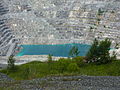 Jeffrey Mine in Asbestos, Quebec - Canada - 29 July 2013.jpg 3,648 × 2,736; 5.86 MB
-
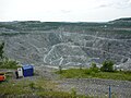 Mine d'Asbestos.jpg 3,264 × 2,448; 1.67 MB
-
 Pectolite-219068.jpg 325 × 550; 33 KB
-
 Pectolite-247768.jpg 415 × 600; 22 KB
-
 Pectolite-lw58a.jpg 600 × 487; 23 KB
-
 Pectolite-lw58b.jpg 399 × 274; 23 KB
-
 Pectolite-lw58c.jpg 400 × 395; 24 KB
-
 Prehnite-201704.jpg 441 × 750; 41 KB
-
 Prehnite-220540.jpg 365 × 400; 29 KB
-
 Prehnite-4jg16a.jpg 764 × 683; 69 KB
-
 Prehnite-4jg16b.jpg 400 × 342; 19 KB
-
 Prehnite-4jg16c.jpg 400 × 373; 24 KB
-
 Prehnite-4jg16d.jpg 400 × 393; 26 KB
-
 Prehnite-57436.jpg 600 × 543; 54 KB
-
 Prehnite-t06-191a.jpg 600 × 543; 72 KB
-
 Prehnite-t06-191b.jpg 400 × 387; 36 KB
-
 Train sur une halde de residus d amiante en 1937.jpg 1,000 × 1,000; 343 KB
-
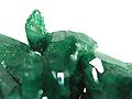
 Vesuvianite-119817.jpg 600 × 474; 79 KB
-
 Vesuvianite-120544.jpg 514 × 600; 72 KB
-
 Vesuvianite-120994.jpg 299 × 600; 56 KB
-
 Vesuvianite-121928.jpg 600 × 505; 101 KB
-
 Vesuvianite-135020.jpg 600 × 548; 96 KB
-
 Vesuvianite-135021.jpg 400 × 323; 43 KB
-
 Vesuvianite-140547.jpg 568 × 600; 104 KB
-
 Vesuvianite-140548.jpg 400 × 274; 41 KB
-
 Vesuvianite-148284.jpg 600 × 498; 76 KB
-
 Vesuvianite-196777.jpg 600 × 492; 74 KB
-
 Vesuvianite-20281.jpg 166 × 375; 12 KB
-
 Vesuvianite-210750.jpg 600 × 543; 76 KB
-
 Vesuvianite-219263.jpg 600 × 454; 65 KB
-
 Vesuvianite-23745.jpg 355 × 400; 41 KB
-
 Vesuvianite-240150.jpg 600 × 361; 68 KB
-
 Vesuvianite-240151.jpg 400 × 323; 46 KB
-
 Vesuvianite-240715.jpg 215 × 400; 21 KB
-
 Vesuvianite-240719.jpg 565 × 800; 83 KB
-
 Vesuvianite-240720.jpg 800 × 747; 108 KB
-
 Vesuvianite-240721.jpg 800 × 592; 97 KB
-
 Vesuvianite-242357.jpg 600 × 571; 82 KB
-
 Vesuvianite-242359.jpg 383 × 800; 73 KB
-
 Vesuvianite-242360.jpg 420 × 800; 80 KB
-
 Vesuvianite-242361.jpg 800 × 680; 100 KB
-
 Vesuvianite-242685.jpg 800 × 708; 103 KB
-
 Vesuvianite-250228.jpg 600 × 475; 30 KB
-
 Vesuvianite-250229.jpg 400 × 258; 30 KB
-
 Vesuvianite-255009.jpg 600 × 528; 70 KB
-
 Vesuvianite-255010.jpg 400 × 333; 31 KB
-
 Vesuvianite-263714.jpg 477 × 432; 59 KB
-
 Vesuvianite-274934.jpg 393 × 400; 92 KB
-
 Vesuvianite-274939.jpg 313 × 400; 71 KB
-
 Vesuvianite-275082.jpg 600 × 530; 84 KB
-
 Vesuvianite-280289.jpg 600 × 450; 173 KB
-
 Vesuvianite-32425.jpg 375 × 500; 43 KB
-
 Vesuvianite-4jg21a.jpg 650 × 544; 62 KB
-
 Vesuvianite-4md11a.jpg 170 × 360; 28 KB
-
 Vesuvianite-4md11b.jpg 193 × 360; 29 KB
-
 Vesuvianite-4md14a.jpg 217 × 360; 29 KB
-
 Vesuvianite-4md14b.jpg 210 × 360; 29 KB
-
 Vesuvianite-4md1a.jpg 141 × 360; 30 KB
-
 Vesuvianite-4md1b.jpg 158 × 360; 27 KB
-
 Vesuvianite-4md3a.jpg 194 × 360; 29 KB
-
 Vesuvianite-4md6a.jpg 360 × 270; 30 KB
-
 Vesuvianite-4md6b.jpg 600 × 450; 74 KB
-
 Vesuvianite-4md8a.jpg 199 × 360; 29 KB
-
 Vesuvianite-4md8b.jpg 194 × 360; 29 KB
-
 Vesuvianite-52113.jpg 700 × 559; 86 KB
-
 Vesuvianite-62835.jpg 600 × 527; 98 KB
-
 Vesuvianite-64017.jpg 600 × 514; 86 KB
-
 Vesuvianite-65529.jpg 700 × 581; 70 KB
-
 Vesuvianite-66686.jpg 459 × 600; 73 KB
-
 Vesuvianite-67914.jpg 564 × 700; 65 KB
-
 Vesuvianite-70721.jpg 600 × 427; 41 KB
-
 Vesuvianite-Groutite-243488.jpg 361 × 400; 85 KB
-
 Vesuvianite-t06-80a.jpg 323 × 600; 73 KB
-
 Vesuvianite-t06-80b.jpg 330 × 400; 37 KB
-
 Vesuvianite-t06-80c.jpg 400 × 299; 40 KB
-
 Vesuvianite-t06-80d.jpg 400 × 275; 31 KB
-
 Vesuvianite-t07-71a.jpg 402 × 800; 97 KB


,_grossular_-_Asbestos_(Jeffrey_Mine),_Canada..jpg)


