Category:Jellum
| Object location | | View all coordinates using: OpenStreetMap |
|---|
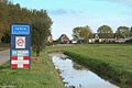
farm village in Friesland, the Netherlands     | |||||
| Upload media | |||||
| Instance of | |||||
|---|---|---|---|---|---|
| Location |
| ||||
 | |||||
Frysk: Jellum is in doarp yn Littenseradiel.
Nederlands: Jellum is een dorp in de Friese gemeente Littenseradiel.
Subcategories
This category has the following 2 subcategories, out of 2 total.
- Rijksmonumenten in Jellum (1 F)
Media in category "Jellum"
The following 7 files are in this category, out of 7 total.
-
 Jellum wapen.svg 390 × 459; 47 KB
-
 Map - NL - Littenseradiel - Wijk 04 - Buurt 01 Jellum.svg 375 × 375; 49 KB
-
 Map NL Littenseradiel Jellum.png 800 × 500; 72 KB
-
 Jellum een niet zo groot dorp in de Provincie Friesland.jpg 1,150 × 767; 295 KB
-
 Jellum Friesland..jpg 4,770 × 3,177; 3.94 MB
-
 Jellum.jpg 1,659 × 1,254; 374 KB
-
 Sicht op Jellum.jpg 4,624 × 2,604; 3.78 MB


