Category:Jesuit maps
This category includes the mission areas' maps designed by Jesuits, usually about areas in which they are involved.
Subcategories
This category has the following 2 subcategories, out of 2 total.
K
S
Media in category "Jesuit maps"
The following 23 files are in this category, out of 23 total.
-
 1755 Bellin Map of the Great Lakes - Geographicus - GreatLakes-bellin-1755.jpg 4,000 × 3,215; 3.49 MB
-

-
 Descripçäo nova, e exacta dos reynos, e provincias do Japäo.jpg 2,703 × 1,758; 1.2 MB
-

-

-
-
 Geographic Map of Brazil WDL1195.png 1,222 × 1,024; 2.39 MB
-

-
-
 IVNNAN IMPERII SINARVM PROVINCIA DECIMAQVINTA (1655).jpg 5,500 × 4,544; 4.18 MB
-
 Jesuit Missions of the Chiquitos-de.png 1,500 × 906; 2.54 MB
-
 Jesuit Missions of the Chiquitos-he.png 1,500 × 906; 2.43 MB
-

-
-

-
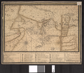
 Lettres édifiantes et curieuses, écrites des missions étrangères (1780) (14598315378).jpg 2,300 × 2,212; 1.24 MB
-
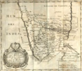 Madurai Mission Map.png 913 × 795; 1.05 MB
-
 MAPA JESUÍTAS BRASIL.jpg 900 × 536; 467 KB
-
 Matemapa.JPG 297 × 296; 16 KB
-

-

-

-
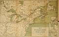
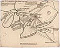 Tiré de la relation des Hurons de 1647 et 48, par Guillaume Delisle.jpg 2,000 × 1,585; 495 KB


_(14595457879).jpg)
_(14595613527).jpg)


_(14586971919).jpg)
.jpg)


_(14577551628).jpg)
_(14760114631).jpg)
_(14784054013).jpg)
_(14598315378).jpg)


.jpg)
.jpg)