Category:Jewish Cemetery (Borne)
| Object location | | View all coordinates using: OpenStreetMap |
|---|
 | |||||
| Upload media | |||||
| Instance of | |||||
|---|---|---|---|---|---|
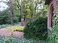
| Location | Borne, Overijssel, Netherlands | ||||
| Street address |
| ||||
| Heritage designation |
| ||||
 | |||||
Deutsch: Jüdischer Friedhof
English: Jewish cemetery
Nederlands: Joodse begraafplaats
|
This is a category about rijksmonument number 9932
|
| Address |
|
Media in category "Jewish Cemetery (Borne)"
The following 6 files are in this category, out of 6 total.
-
 Joodse begraafplaats Twijnerstraat bij 21 Borne Foto 1.jpg 2,592 × 1,936; 1.92 MB
-
 Joodse begraafplaats Twijnerstraat bij 21 Borne Foto 2.jpg 2,592 × 1,936; 2.6 MB
-
 Joodse begraafplaats Twijnerstraat bij 21 Borne Foto 3.jpg 2,592 × 1,936; 2.34 MB
-
 Joodse begraafplaats Twijnerstraat bij 21 Borne Foto 4.jpg 2,592 × 1,936; 2.66 MB
-
 Rijksmonument-9932-20111025144209.jpg 2,592 × 1,936; 1.78 MB
-
 Rijksmonument-9932-20111025144910.jpg 2,592 × 1,936; 2.48 MB


