Category:Johnson County, Kentucky
Counties of Kentucky: Adair · Allen · Anderson · Ballard · Barren · Bath · Bell · Boone · Bourbon · Boyd · Boyle · Bracken · Breathitt · Breckinridge · Bullitt · Butler · Caldwell · Calloway · Campbell · Carlisle · Carroll · Carter · Casey · Christian · Clark · Clay · Clinton · Crittenden · Cumberland · Daviess · Edmonson · Elliott · Estill · Fayette · Fleming · Floyd · Franklin · Fulton · Gallatin · Garrard · Grant · Graves · Grayson · Green · Greenup · Hancock · Hardin · Harlan · Harrison · Hart · Henderson · Henry · Hickman · Hopkins · Jackson · Jefferson · Jessamine · Johnson · Kenton · Knott · Knox · LaRue · Laurel · Lawrence · Lee · Leslie · Letcher · Lewis · Lincoln · Livingston · Logan · Lyon · Madison · Magoffin · Marion · Marshall · Martin · Mason · McCracken · McCreary · McLean · Meade · Menifee · Mercer · Metcalfe · Monroe · Montgomery · Morgan · Muhlenberg · Nelson · Nicholas · Ohio · Oldham · Owen · Owsley · Pendleton · Perry · Pike · Powell · Pulaski · Robertson · Rockcastle · Rowan · Russell · Scott · Shelby · Simpson · Spencer · Taylor · Todd · Trigg · Trimble · Union · Warren · Washington · Wayne · Webster · Whitley · Wolfe · Woodford
county in Kentucky, United States   | |||||
| Upload media | |||||
| Instance of | |||||
|---|---|---|---|---|---|
| Named after | |||||
| Location | Kentucky | ||||
| Capital | |||||
| Inception |
| ||||
| Population |
| ||||
| Area |
| ||||
| official website | |||||
 | |||||
Subcategories
This category has the following 5 subcategories, out of 5 total.
B
M
P
Media in category "Johnson County, Kentucky"
The following 24 files are in this category, out of 24 total.
-
 Box-Turtle-At-Butcher-Holler-Van-Lear-Kentucky.png 421 × 447; 357 KB
-

-
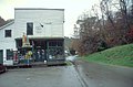 Country Music Highway - Store in Van Lear - NARA - 7717850.jpg 2,992 × 1,962; 1.51 MB
-
 Forrest and Maxie Preston Bridge plaque.jpg 3,648 × 2,432; 2.23 MB
-
 Forrest and Maxie Preston Bridge.jpg 3,648 × 2,432; 2.28 MB
-

-
 Jenny Wiley Grave.jpg 488 × 450; 187 KB
-
 John C C Mayo procession.JPG 360 × 248; 44 KB
-
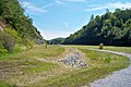
 Johnson County, Kentucky scenery.jpg 2,592 × 1,944; 1.4 MB
-
 Levisa Fork in Paintsville.jpg 2,592 × 1,944; 1.36 MB
-
 MayoMansion.jpg 2,992 × 1,981; 1.7 MB
-
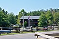 Mountain Homeplace welcome center.jpg 3,648 × 2,432; 2.3 MB
-
 Mountain Homeplace.jpg 3,648 × 2,432; 2.31 MB
-
 Paintsville Lake emergency spillway.jpg 3,648 × 2,432; 2.34 MB
-
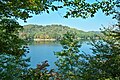 Paintsville Lake framed.jpg 3,648 × 2,432; 2.33 MB
-
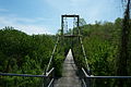
 Paintsville Lake Kiwanis Trail.jpg 3,648 × 2,432; 2.36 MB
-
 Paintsville Lake spillway.jpg 3,648 × 2,432; 2.3 MB
-
 Paintsville Lake.jpg 3,648 × 2,432; 2.27 MB
-
 Paintsville Lake2.jpg 3,648 × 2,432; 2.33 MB
-
 PaintsvilleKYUS23.jpg 532 × 800; 110 KB
-
 Phs lawn.png 266 × 200; 120 KB
-
 Thealka Park.jpg 3,648 × 2,432; 2.28 MB
-
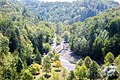
 Tutor Key hills.jpg 2,240 × 1,680; 1.08 MB
-
 USA Johnson County, Kentucky age pyramid.svg 520 × 600; 8 KB


