Category:Johnston, Pembrokeshire
community in Pembrokeshire, Wales  | |||||
| Upload media | |||||
| Pronunciation audio | |||||
|---|---|---|---|---|---|
| Instance of | |||||
| Location | Pembrokeshire, Wales | ||||
 | |||||
Cymraeg: Pentref a chymuned yn ne Sir Benfro yw Johnston. Nid ymddengys fod enw Cymraeg iddo. Saif i'r de-orllewin o dref Hwlffordd ar y briffordd A4076 i Aberdaugleddau. Mae'r eglwys, a gysegrwyd i Sant Pedr, yn dyddio o'r canol oesoedd.
Subcategories
This category has the following 2 subcategories, out of 2 total.
J
- Johnston railway station (4 F)
Media in category "Johnston, Pembrokeshire"
The following 200 files are in this category, out of 247 total.
(previous page) (next page)-
 2010 Wales Pembrokeshire Community Johnston map.svg 512 × 393; 1,018 KB
-
 2024 Wales Pembrokeshire Community Johnston map.svg 512 × 393; 1.19 MB
-
 A4067 direction sign, Johnston - geograph.org.uk - 4832574.jpg 800 × 625; 133 KB
-
 A4076 at Pope Hill - geograph.org.uk - 3272250.jpg 640 × 481; 47 KB
-

-
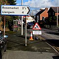
 A4076 directions sign, Johnston - geograph.org.uk - 4835116.jpg 745 × 800; 107 KB
-
 A4076 directions signs, Johnston - geograph.org.uk - 5032167.jpg 800 × 672; 135 KB
-

-
 A477 south of Johnston - geograph.org.uk - 3272237.jpg 640 × 480; 39 KB
-

-

-
 Acorn Drive, Johnston - geograph.org.uk - 5008839.jpg 800 × 490; 79 KB
-
 Anchor on a Johnston grave - geograph.org.uk - 4885380.jpg 800 × 676; 179 KB
-
 Bench and bin in the centre of Johnston - geograph.org.uk - 4835809.jpg 800 × 747; 260 KB
-
 Bend in the road near Johnston - geograph.org.uk - 3161820.jpg 640 × 480; 38 KB
-
 Bilingual red van, Hall Court, Johnston - geograph.org.uk - 4838793.jpg 800 × 726; 125 KB
-
 Blocked part of Langford Road, Johnston - geograph.org.uk - 4950699.jpg 800 × 499; 109 KB
-
 Brickhurst Close, Johnston - geograph.org.uk - 4832578.jpg 800 × 637; 135 KB
-

-
 Brickhurst Park houses, Johnston - geograph.org.uk - 4832649.jpg 800 × 736; 136 KB
-
 Bridge A4076 40, Johnston - geograph.org.uk - 4833925.jpg 800 × 611; 110 KB
-
 Bridleway sign on a Johnston corner - geograph.org.uk - 4832636.jpg 800 × 501; 89 KB
-
 Brookside Avenue, Johnston - geograph.org.uk - 4832380.jpg 800 × 800; 205 KB
-

-
 Bulford Close, Johnston - geograph.org.uk - 775665.jpg 640 × 480; 65 KB
-
 Bulford Road houses, Johnston - geograph.org.uk - 5032136.jpg 800 × 502; 105 KB
-
 Bulford Road, Johnston - geograph.org.uk - 5032127.jpg 800 × 637; 100 KB
-
 Bus shelter on the A4076 road - geograph.org.uk - 2301428.jpg 640 × 480; 70 KB
-

-
 Cafe on the A4076 - geograph.org.uk - 6182276.jpg 1,024 × 768; 235 KB
-

-
 Cars for sale, Johnston - geograph.org.uk - 4833939.jpg 800 × 600; 122 KB
-
 CCF, Station Road, Johnston - geograph.org.uk - 4833436.jpg 800 × 523; 106 KB
-

-
 Chinese Take Away, Johnson - geograph.org.uk - 4835028.jpg 800 × 710; 113 KB
-
 Church Road car park, Johnston - geograph.org.uk - 4838790.jpg 800 × 587; 179 KB
-
 Church Road speed bumps, Johnston - geograph.org.uk - 4838519.jpg 800 × 581; 152 KB
-

-
 Clock Cottage, Johnston - geograph.org.uk - 5032181.jpg 800 × 750; 143 KB
-

-

-
 Cycle route near Johnston - geograph.org.uk - 280669.jpg 640 × 480; 128 KB
-
 Cyclists Rejoin Road sign, Johnston - geograph.org.uk - 5008848.jpg 800 × 494; 84 KB
-
 Demolition site in Johnston - geograph.org.uk - 4835079.jpg 800 × 647; 135 KB
-
 Direction and distances sign in Johnston - geograph.org.uk - 4835052.jpg 799 × 800; 173 KB
-

-
 Doctor's Surgery, Johnston - geograph.org.uk - 4838588.jpg 800 × 471; 75 KB
-
 Doctor's Surgery, Johnston - geograph.org.uk - 5066178.jpg 800 × 600; 157 KB
-
 Down Station Road, Johnston - geograph.org.uk - 4833494.jpg 800 × 462; 92 KB
-
 East along Greenhall Park, Johnston - geograph.org.uk - 4836039.jpg 800 × 639; 106 KB
-
 East side of The Close, Johnston - geograph.org.uk - 4950723.jpg 800 × 694; 146 KB
-

-

-

-

-

-
 End of the 30 zone in Johnston - geograph.org.uk - 4832594.jpg 800 × 566; 111 KB
-
 End of the road, Hillcroft, Johnston - geograph.org.uk - 4950407.jpg 800 × 600; 111 KB
-

-
 Entrance to Glebelands Field, Johnston - geograph.org.uk - 4834006.jpg 800 × 537; 135 KB
-
 Entrance to Johnston Baptist Church - geograph.org.uk - 4834741.jpg 800 × 516; 106 KB
-
 Entrance to Johnston Business Park - geograph.org.uk - 4833443.jpg 800 × 635; 104 KB
-

-
 Entrance to Johnston railway station - geograph.org.uk - 4833481.jpg 800 × 627; 100 KB
-
 Entrance to Lawrence Landfill - geograph.org.uk - 2301468.jpg 640 × 480; 61 KB
-
 Entrance To Lawrence Landfill - geograph.org.uk - 4801630.jpg 1,600 × 940; 193 KB
-

-

-
 Esso filling station, Johnston - geograph.org.uk - 5008501.jpg 800 × 568; 111 KB
-

-
 Fair View, Johnston - geograph.org.uk - 4950446.jpg 800 × 608; 166 KB
-
 Fairfield Care Home, Johnston - geograph.org.uk - 4838784.jpg 800 × 566; 108 KB
-
 Farmhouse Bakery ^ Shop, Johnston - geograph.org.uk - 4833619.jpg 800 × 550; 91 KB
-

-
 Field gate north of Johnston - geograph.org.uk - 4832666.jpg 800 × 600; 164 KB
-

-

-

-
 Follow the Dragon, Johnston - geograph.org.uk - 4833640.jpg 800 × 585; 140 KB
-
 Football match, Glebelands, Johnston, Pembrokeshire - geograph.org.uk - 2099974.jpg 1,600 × 1,200; 541 KB
-
 Glebelands Field notice, Johnston - geograph.org.uk - 4834019.jpg 800 × 612; 123 KB
-
 Glebelands Field pavilion, Johnston - geograph.org.uk - 4834022.jpg 800 × 514; 123 KB
-
 Glebelands Field, Johnston - geograph.org.uk - 4833995.jpg 800 × 504; 91 KB
-
 Glebelands, Johnston, Pembrokeshire - geograph.org.uk - 2086115.jpg 1,600 × 1,200; 564 KB
-

-

-
-
 Hall Court, Johnston - geograph.org.uk - 4838786.jpg 800 × 695; 110 KB
-
 Haverfordwest direction sign in Johnston - geograph.org.uk - 4853906.jpg 800 × 715; 111 KB
-
 Help charity shop, Glebelands, Johnston - geograph.org.uk - 4833964.jpg 752 × 800; 173 KB
-

-
 Hill View near Johnston - geograph.org.uk - 4832628.jpg 800 × 568; 101 KB
-
 Hillcroft bungalows, Johnston - geograph.org.uk - 4885815.jpg 800 × 593; 133 KB
-

-
 Hillcroft houses, Johnston - geograph.org.uk - 4885808.jpg 800 × 469; 94 KB
-
 Hillside bungalow, Johnston - geograph.org.uk - 4854529.jpg 800 × 655; 109 KB
-
 Hillside bus stop, Johnston - geograph.org.uk - 4854528.jpg 800 × 738; 147 KB
-

-

-

-
 Ice cream van drives into the sun, Johnston - geograph.org.uk - 2778978.jpg 1,600 × 966; 245 KB
-
 Identity in Johnston - geograph.org.uk - 4834095.jpg 800 × 746; 186 KB
-

-

-
 Inquisitive horses - geograph.org.uk - 844837.jpg 640 × 480; 52 KB
-
 Iscoed, Johnston - geograph.org.uk - 4833918.jpg 800 × 641; 136 KB
-
 Johnston Baptist Church - geograph.org.uk - 4834740.jpg 800 × 503; 80 KB
-
 Johnston Business Park - geograph.org.uk - 5775460.jpg 1,280 × 851; 342 KB
-
 Johnston Farm buildings, Johnston - geograph.org.uk - 5066230.jpg 800 × 559; 82 KB
-

-
 Johnston FC (8207560128).jpg 2,815 × 2,270; 863 KB
-
 Johnston FC (8207562610).jpg 3,241 × 2,338; 5.83 MB
-
 Johnston FC (8207563150).jpg 2,911 × 2,270; 1.04 MB
-

-
 Johnston Pharmacy - geograph.org.uk - 4834076.jpg 800 × 791; 178 KB
-
 Johnston railway station - geograph.org.uk - 4833116.jpg 800 × 672; 117 KB
-

-
 Johnston railway station name sign - geograph.org.uk - 4833954.jpg 800 × 623; 170 KB
-

-
 Johnston Second World War Memorial - geograph.org.uk - 4838714.jpg 632 × 800; 126 KB
-

-
 Johnston village noticeboard - geograph.org.uk - 4833979.jpg 800 × 547; 102 KB
-
 Johnston War Memorial - geograph.org.uk - 4838603.jpg 800 × 547; 139 KB
-

-

-

-

-
 J^J Motors, Johnston - geograph.org.uk - 4833913.jpg 800 × 609; 113 KB
-
 K.O. Carpets and Beds, Johnston - geograph.org.uk - 4832276.jpg 800 × 500; 108 KB
-
 Kiln Road, Johnston - geograph.org.uk - 4832320.jpg 800 × 644; 142 KB
-
-
 Langford Road bungalows, Johnston - geograph.org.uk - 4950715.jpg 800 × 595; 134 KB
-
 Langford Road railway bridge, Johnston - geograph.org.uk - 4833176.jpg 800 × 800; 249 KB
-
 Langford Road traffic signs, Johnston - geograph.org.uk - 4950401.jpg 800 × 716; 141 KB
-
 Llwybr Ceffyl Hays - Hays Bridleway - geograph.org.uk - 5107390.jpg 640 × 480; 131 KB
-
 Llwybr Ceffyl Hays - Hays Bridleway - geograph.org.uk - 5107400.jpg 640 × 480; 113 KB
-

-
 Mauve house and garage, Johnston - geograph.org.uk - 4838797.jpg 800 × 603; 117 KB
-
 Meadows Care Home, Johnston - geograph.org.uk - 4838791.jpg 800 × 495; 108 KB
-

-

-
 Mike Howlin car ^ van sales, Johnston - geograph.org.uk - 4835039.jpg 800 × 527; 129 KB
-

-

-
 Milford Road, Johnston - geograph.org.uk - 3272241.jpg 640 × 480; 50 KB
-

-

-
 Modern housing, Pond Bridge, Johnston - geograph.org.uk - 4854534.jpg 800 × 555; 118 KB
-

-

-

-

-

-
 Nisa Local car park, Johnston - geograph.org.uk - 4834764.jpg 800 × 500; 93 KB
-

-

-
 Orchard Court, Johnston - geograph.org.uk - 4853896.jpg 800 × 524; 134 KB
-
 Ordnance Survey Cut Mark - geograph.org.uk - 5352789.jpg 640 × 428; 82 KB
-
 Ordnance Survey Cut Mark - geograph.org.uk - 5352794.jpg 640 × 381; 93 KB
-

-
 Ordnance Survey Flush Bracket G5097 - geograph.org.uk - 3481069.jpg 4,000 × 3,000; 2.46 MB
-
 Ordnance Survey Rivet - geograph.org.uk - 5352790.jpg 616 × 640; 168 KB
-
 Outbuilding At Johnston Mill Farm - geograph.org.uk - 4824458.jpg 1,520 × 1,600; 270 KB
-

-
 Path east towards Hillcroft, Johnston - geograph.org.uk - 4885698.jpg 800 × 567; 143 KB
-
 Path to The Close, Johnston - geograph.org.uk - 4835887.jpg 800 × 504; 102 KB
-
 Path west of Johnston - geograph.org.uk - 5779562.jpg 1,280 × 851; 652 KB
-

-

-
-
 Pond Bridge advertising boards, Johnston - geograph.org.uk - 4854531.jpg 800 × 633; 110 KB
-

-
 Pope Hill Villa - geograph.org.uk - 4801626.jpg 1,600 × 1,021; 174 KB
-

-

-

-

-

-
 Railway line to Milford Haven - geograph.org.uk - 280641.jpg 640 × 480; 141 KB
-

-
 Road junction near Johnston - geograph.org.uk - 2301567.jpg 640 × 480; 53 KB
-

-
 Row of houses, Glebelands, Johnston - geograph.org.uk - 4834101.jpg 800 × 677; 184 KB
-
 Row of three houses, Vine Road, Johnston - geograph.org.uk - 4832581.jpg 800 × 593; 126 KB
-
 Royal Mail van in Johnston - geograph.org.uk - 5008837.jpg 800 × 678; 91 KB
-
 Shadows on Hillcroft, Johnston - geograph.org.uk - 4950420.jpg 800 × 716; 119 KB
-
 Shop 'n Drive, Johnston - geograph.org.uk - 5008509.jpg 798 × 800; 164 KB
-

-
 Silverdale Inn and Lodge, Johnston - geograph.org.uk - 4854583.jpg 800 × 487; 77 KB
-
 Simply weird - geograph.org.uk - 5169897.jpg 3,604 × 2,123; 2.03 MB
-
 South side of the Nisa Local, Johnston - geograph.org.uk - 4834767.jpg 800 × 614; 116 KB
-
 South side of the Vine Inn, Johnston - geograph.org.uk - 4832583.jpg 800 × 438; 86 KB
-

-

-
 St Peter's Church, Johnston - geograph.org.uk - 4885353.jpg 800 × 556; 110 KB
-
 St Peter's Road, Johnston - geograph.org.uk - 5778819.jpg 1,280 × 851; 562 KB
-
 St Peters Road looking north - geograph.org.uk - 3272248.jpg 640 × 480; 53 KB
-
 Storage sheds at Brickhurst Park - geograph.org.uk - 3427533.jpg 2,227 × 1,671; 1 MB
-
 Sunshine Cottages, Johnston - geograph.org.uk - 4832577.jpg 800 × 436; 87 KB
-
 Surfer's car - geograph.org.uk - 438684.jpg 640 × 395; 87 KB


.jpg)
.jpg)
.jpg)


_sign,_Bulford_Road,_Johnston_-_geograph.org.uk_-_5032117.jpg)


_-_geograph.org.uk_-_5352793.jpg)


