Category:Kals am Großglockner
municipality in Lienz District, Tyrol, Austria   | |||||
| Upload media | |||||
| Instance of |
| ||||
|---|---|---|---|---|---|
| Location | Lienz District, Tyrol, Austria | ||||
| Mountain range | |||||
| Population |
| ||||
| Area |
| ||||
| Elevation above sea level |
| ||||
| official website | |||||
 | |||||
Kals am Grossglockner (Osttirol) is divided into the following Katastralgemeinden: Unterpeischlach, Oberpeischlach, Staniska, Arnig, Lesach, Lana, Ködnitz, Glor-Berg, Großdorf, Unterburg, and Burg.
Subcategories
This category has the following 14 subcategories, out of 14 total.
Media in category "Kals am Großglockner"
The following 8 files are in this category, out of 8 total.
-
 Böses Weibl 360° Panorama.jpg 5,055 × 1,024; 3.35 MB
-
 Kalser Bach Ausschotterung.jpg 5,874 × 3,487; 29.56 MB
-
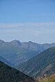
 Rappler, Arnhörner, Hochegg, Blitzkofel, Ochsen Bichl, Regenstein.jpg 4,000 × 6,000; 9.57 MB
-
 Regenstein, Kugelspitze, Hohes Kreuz, Spitz beim Kreuz, Firstkogel.jpg 4,000 × 6,000; 9.57 MB
-

-
 Tramerkamp, Zinggetz, Grindenkarköpfe von südlich unterhalb des Figerhorns.jpg 8,514 × 3,916; 31.1 MB
-
 Tschadinhorn und Schönleitenspitze (2).jpg 6,239 × 3,540; 19.85 MB
-
 Wappen at kals am grossglockner.png 166 × 192; 2 KB


.jpg)