Category:Kapelkerk
| Object location | | View all coordinates using: OpenStreetMap |
|---|
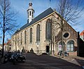
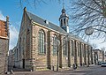
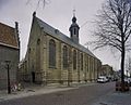
church building in Alkmaar, Netherlands  | |||||
| Upload media | |||||
| Instance of | |||||
|---|---|---|---|---|---|
| Location | Alkmaar, North Holland, Netherlands | ||||
| Street address |
| ||||
| Located on street |
| ||||
| Heritage designation |
| ||||
| Inception |
| ||||
| Significant event |
| ||||
| Religion or worldview |
| ||||
 | |||||
|
This is a category about rijksmonument number 7237
|
| Address |
|
Subcategories
This category has the following 2 subcategories, out of 2 total.
I
K
Media in category "Kapelkerk"
The following 58 files are in this category, out of 58 total.
-
 'Kapelkerk' Kapelsteeg Alkmaar (5574556494).jpg 1,024 × 682; 204 KB
-
 Alkmaar - Hekelstraat - View SSW towards the Kapelkerk.jpg 2,016 × 3,024; 2.65 MB
-

-
-

-

-
 Alkmaar - Laat - View East on Kapelkerk.jpg 2,016 × 3,024; 3.37 MB
-
 Alkmaar - Laat - View East towards Kapelkerk.jpg 3,024 × 2,016; 3.56 MB
-
 Alkmaar - Laat - View ENE on Kapelkerk 1500-1540 - Late Gothic Architecture - March 2011.jpg 3,964 × 5,946; 21.02 MB
-

-
 Alkmaar - Laat - View NNE on Kapelsteeg & Kapelkerk 1500-1540 - March 2011.jpg 3,984 × 5,976; 22.38 MB
-

-
 Alkmaar - Mient - View SSE over De Visbanken 1755 towards Kapelkerk.jpg 2,016 × 3,024; 2.4 MB
-
 Alkmaar - Platte Stenen Brug - View South on Verdronkenoord & Kapelkerk.jpg 3,024 × 2,016; 2.61 MB
-
 Alkmaar - Verdronkenoord - View SSW on Kapelkerk 1536 - March 2011.jpg 3,828 × 5,742; 15.22 MB
-
 Alkmaar - Verdronkenoord - View SW on Dutch Classicist Cross-Bay 1707 of Kapelkerk.jpg 2,016 × 3,024; 2.32 MB
-
 Alkmaar, de Kapelkerk RM7237 foto8 2014-12-26 12.03.jpg 4,352 × 3,264; 10.74 MB
-
 Alkmaar-Kapelsteeg 3.jpg 2,156 × 1,752; 699 KB
-

-

-
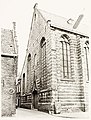
 Exterieur - Alkmaar - 20005897 - RCE.jpg 958 × 1,200; 155 KB
-
 Exterieur - Alkmaar - 20005898 - RCE.jpg 1,200 × 958; 214 KB
-

-
-
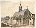 Kapelkerk 1814 (25758464211).jpg 2,710 × 2,105; 1.48 MB
-
-

-

-

-
-

-

-

-
-

-

-

-
 Kapelsteeg in Alkmaar.jpg 2,043 × 2,758; 1.83 MB
-

-
 NL-AmrRAA 1455 0033 0323 - RAA Elsinga.jpg 2,000 × 1,423; 2.95 MB
-
 Overzicht - Alkmaar - 20005896 - RCE.jpg 1,200 × 894; 143 KB
-
 Overzicht - Alkmaar - 20367646 - RCE.jpg 1,067 × 1,200; 286 KB
-
-
 Overzicht kerktoren - Alkmaar - 20367647 - RCE.jpg 1,200 × 1,200; 211 KB
-
 Overzicht van de kerk - Alkmaar - 20420497 - RCE.jpg 794 × 1,200; 224 KB
-

-

-

-

-
-

-
-

-

-

-
-

-
 Zuid-west zijde - Alkmaar - 20005895 - RCE.jpg 881 × 1,200; 266 KB
.jpg)


_Gezichten_op_Alkmaar_(serietitel)_Alle_de_voornaamste_gesigten_van_de_stadt_Alckmaar_geleegen_in_West-Vriesland_(serietitel_o,_RP-P-AO-9A-55-14.jpg)

.jpg)


