Category:Katholische Pfarrhaus Baldingen
| Object location | | View all coordinates using: OpenStreetMap |
|---|
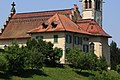
church residence and part of an ensemble in Baldingen in the canton of Aargau, Switzerland .jpg) | |||||
| Upload media | |||||
| Instance of | |||||
|---|---|---|---|---|---|
| Part of | |||||
| Location | Baldingen, Zurzach, Zurzach District, Aargau, Switzerland | ||||
| Street address |
| ||||
| Architect | |||||
| Inception |
| ||||
 | |||||
Media in category "Katholische Pfarrhaus Baldingen"
This category contains only the following file.
-
 Baldingen St Agatha 02 - Rectory (cropped).jpg 1,706 × 1,138; 1.04 MB