Category:Kautenbach train station
| Object location | | View all coordinates using: OpenStreetMap |
|---|

railway station in Luxembourg  | |||||
| Upload media | |||||
| Instance of | |||||
|---|---|---|---|---|---|
| Part of | |||||
| Location |
| ||||
| Owned by | |||||
| Operator | |||||
| Date of official opening |
| ||||
| Elevation above sea level |
| ||||
| Connecting line | |||||
| Adjacent station | |||||
 | |||||
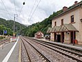
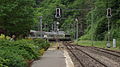
English: Kautenbach railway station, is a railway station serving Kautenbach, in the commune of Kiischpelt, in northern Luxembourg. It is operated by Chemins de Fer Luxembourgeois, the state-owned railway company.
Français : La gare de Kautenbach est une gare ferroviaire de la ligne 1 de Luxembourg à Troisvierges-frontière, située à Kautenbach sur le territoire de la commune de Kiischpelt, dans le District de Diekirch.
Media in category "Kautenbach train station"
The following 13 files are in this category, out of 13 total.
-
 09.06.91 Kautenbach 251 (13175324594).jpg 1,508 × 1,020; 1.5 MB
-
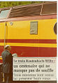 100joerkautebaach-Woltz.jpg 688 × 987; 427 KB
-
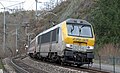
 CFL 2106.jpg 1,600 × 1,200; 1.35 MB
-
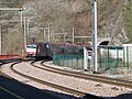
 CFL 3014 Kautenbach.JPG 4,264 × 2,600; 4.43 MB
-
 Gare Kautebaach 02.jpg 1,070 × 1,765; 371 KB
-
 Gare Kautebaach.jpg 1,800 × 1,083; 366 KB
-
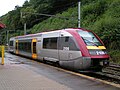
 Kautenbach station 2019.jpg 3,648 × 2,736; 4.86 MB
-
 Kautenbach von Hockslay.jpg 2,048 × 1,536; 1.83 MB
-
 Kautenbach, Gare (101).jpg 3,527 × 2,645; 2.01 MB
-
 Kautenbach, Gare (102).jpg 3,471 × 2,603; 2.23 MB
-
 Kautenbach, Gare (103).jpg 3,471 × 2,603; 2.49 MB
-
 Kautenbach1913d.jpg 480 × 317; 47 KB
-
 Luxemburg Kautenbach station.jpg 4,000 × 2,248; 2.84 MB
.jpg)


.jpg)
.jpg)
.jpg)

