Category:Kazernestraat 41, The Hague
| Object location | | View all coordinates using: OpenStreetMap |
|---|
 | |||||
| Upload media | |||||
| Instance of | |||||
|---|---|---|---|---|---|
| Location | The Hague, South Holland, Netherlands | ||||
| Street address |
| ||||
| Located on street | |||||
| Heritage designation |
| ||||
 | |||||
|
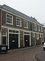
This is a category about rijksmonument number 17610
|
| Address |
|
Media in category "Kazernestraat 41, The Hague"
The following 4 files are in this category, out of 4 total.
-
 Den Haag - Kazernestraat 41.JPG 3,056 × 4,592; 3.76 MB
-
 Den Haag - Kazernestraat 43 en 41.JPG 2,284 × 3,056; 1.64 MB
-
 WLM - roel1943 - kazernestraat.jpg 915 × 1,279; 577 KB
-
 WLM - roel1943 - Kazernestraat.jpg 979 × 1,279; 590 KB


