Category:Kellington
village in United Kingdom  | |||||
| Upload media | |||||
| Instance of | |||||
|---|---|---|---|---|---|
| Location | Selby, North Yorkshire, Yorkshire and the Humber, England | ||||
| Said to be the same as | Kellington (Wikimedia duplicated page, civil parish) | ||||
 | |||||
Subcategories
This category has the following 2 subcategories, out of 2 total.
E
W
Media in category "Kellington"
The following 177 files are in this category, out of 177 total.
-
 A footbridge on the way to Kellington - geograph.org.uk - 2153465.jpg 800 × 600; 379 KB
-
 A small bend on the River Aire - geograph.org.uk - 4729304.jpg 1,024 × 614; 107 KB
-
 A unnamed stream goes under the A19 - geograph.org.uk - 2147469.jpg 800 × 600; 334 KB
-
 A19 at Eggborough Power Station - geograph.org.uk - 5921300.jpg 1,024 × 748; 144 KB
-
 A19 closed - geograph.org.uk - 5998807.jpg 1,280 × 960; 397 KB
-
 A19 towards Selby - geograph.org.uk - 2475925.jpg 1,600 × 1,200; 366 KB
-
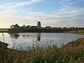
 Aire valley near Kellington - geograph.org.uk - 5998826.jpg 1,280 × 783; 306 KB
-

-
 All Ash, the River Aire - geograph.org.uk - 4729312.jpg 1,024 × 614; 111 KB
-
 Allum Pit, River Aire - geograph.org.uk - 4729344.jpg 1,024 × 614; 116 KB
-
 Along Roall Lane - geograph.org.uk - 5776347.jpg 640 × 427; 191 KB
-
 Approaching the A19 - geograph.org.uk - 5776354.jpg 640 × 427; 216 KB
-
 Barley off Beal Lane - geograph.org.uk - 5774648.jpg 640 × 427; 277 KB
-
 Beal Lane - geograph.org.uk - 5776334.jpg 640 × 427; 209 KB
-
 Beal Lane towards Beal - geograph.org.uk - 2153517.jpg 800 × 600; 194 KB
-
 Broach lane Junction - geograph.org.uk - 1265815.jpg 640 × 417; 39 KB
-
 Canal wharf at Whitley Bridge - geograph.org.uk - 2743592.jpg 1,280 × 840; 213 KB
-
 Carrot Packing Plant - geograph.org.uk - 1265786.jpg 640 × 480; 60 KB
-

-
 Cereal and cooling towers - geograph.org.uk - 2749762.jpg 1,280 × 853; 138 KB
-
 Church Lane, Kellington - geograph.org.uk - 159443.jpg 640 × 480; 69 KB
-
 Church Lane, Kellington - geograph.org.uk - 159458.jpg 640 × 480; 55 KB
-
 Church of St Edmund, Kellington - geograph.org.uk - 5998850.jpg 1,280 × 960; 370 KB
-
 Church of St Edmund, Kellington - geograph.org.uk - 5998854.jpg 1,280 × 1,280; 458 KB
-
 Church of St Edmund, Kellington - geograph.org.uk - 5998858.jpg 1,280 × 959; 385 KB
-
 Church of St Edmund, Kellington - geograph.org.uk - 5998860.jpg 1,280 × 960; 454 KB
-
 Church of St Edmund, Kellington - geograph.org.uk - 5998866.jpg 1,280 × 867; 335 KB
-
 Church of St Edmund, Kellington - geograph.org.uk - 5998867.jpg 960 × 1,280; 513 KB
-
 Church of St Edmund, Kellington - geograph.org.uk - 5998869.jpg 1,280 × 960; 350 KB
-
 Church of St Edmund, Kellington - geograph.org.uk - 5998874.jpg 1,280 × 1,280; 475 KB
-

-
 Converted Chapel, Kellington - geograph.org.uk - 2475959.jpg 1,600 × 1,200; 455 KB
-
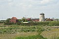
 Converted windmill, Weeland Road (A645) - geograph.org.uk - 2475944.jpg 1,600 × 1,200; 507 KB
-
 Defunct Arbre power station - geograph.org.uk - 2868174.jpg 640 × 480; 60 KB
-

-
 Drainage infrastructure, north bank, River Aire - geograph.org.uk - 4729326.jpg 1,024 × 768; 133 KB
-

-
 Drax Power Station - geograph.org.uk - 5595081.jpg 640 × 475; 64 KB
-
 Eastfield Lane - geograph.org.uk - 5776338.jpg 640 × 427; 235 KB
-
 Eastfield Road, Kellington - geograph.org.uk - 2153487.jpg 800 × 600; 263 KB
-
 Entering Kellington - geograph.org.uk - 2153476.jpg 800 × 600; 177 KB
-

-
 Entrance to Kellington - geograph.org.uk - 5998824.jpg 1,280 × 854; 588 KB
-
 Farm track heading south from the A645 - geograph.org.uk - 2475947.jpg 1,600 × 1,200; 537 KB
-
 Farm Track off Roall Lane - geograph.org.uk - 1482288.jpg 640 × 480; 71 KB
-
 Farm track off Roall Lane - geograph.org.uk - 5998822.jpg 1,280 × 960; 489 KB
-
 Farmland and A19 - geograph.org.uk - 5776358.jpg 640 × 427; 228 KB
-
 Farmland near Eggborough Power Station - geograph.org.uk - 5776356.jpg 640 × 427; 187 KB
-
 Farmland off the A19 - geograph.org.uk - 2475921.jpg 1,600 × 1,103; 388 KB
-

-
 Fields to Roall Manor Farm - geograph.org.uk - 1482293.jpg 640 × 480; 68 KB
-
 Fields towards Kellingley - geograph.org.uk - 1265713.jpg 640 × 480; 37 KB
-
 Fields towards Kellington - geograph.org.uk - 1265637.jpg 640 × 480; 40 KB
-
 Flood bank at Kellington - geograph.org.uk - 5998830.jpg 1,280 × 1,280; 512 KB
-
 Flood level gauge, Marsh Drain, Kellington - geograph.org.uk - 5998833.jpg 960 × 1,280; 433 KB
-
 Footpath to Kellington - geograph.org.uk - 5776343.jpg 640 × 427; 350 KB
-
 Former Wesleyan Methodist Chapel, Kellington - geograph.org.uk - 5998837.jpg 1,280 × 907; 296 KB
-
 Industrial building near Eggborough - geograph.org.uk - 2475932.jpg 1,600 × 1,200; 419 KB
-
 Industrial estate, Whitley Bridge - geograph.org.uk - 4550662.jpg 1,024 × 615; 102 KB
-
 J ^ O Smallholdings - geograph.org.uk - 2155387.jpg 800 × 600; 244 KB
-
 Jolly Miller public house, Eggborough - geograph.org.uk - 3923520.jpg 1,054 × 1,600; 325 KB
-
 Kellington - geograph.org.uk - 1612493.jpg 640 × 426; 77 KB
-
 Kellington Corner Shop - geograph.org.uk - 244243.jpg 640 × 480; 68 KB
-
 Kellington Green - geograph.org.uk - 5998845.jpg 1,280 × 886; 420 KB
-
 Kellington Manor Hotel - geograph.org.uk - 4116352.jpg 1,086 × 1,600; 421 KB
-
 Kellington Manor Hotel - geograph.org.uk - 4116356.jpg 1,600 × 1,064; 550 KB
-
 Kellington Marsh - geograph.org.uk - 579883.jpg 467 × 640; 139 KB
-
 Kellington post office - geograph.org.uk - 2155408.jpg 800 × 600; 262 KB
-
 Kellington Post Office ^ Store - geograph.org.uk - 4116429.jpg 1,600 × 1,064; 495 KB
-
 Kellington War Memorial - geograph.org.uk - 5998846.jpg 1,280 × 960; 696 KB
-
 Kellington windmill - geograph.org.uk - 5999354.jpg 1,280 × 931; 483 KB
-
 Kellington windmill - geograph.org.uk - 5999355.jpg 960 × 1,280; 397 KB
-
 Land drain off Ings Lane - geograph.org.uk - 284661.jpg 640 × 480; 79 KB
-
 Landscape near Eggborough - geograph.org.uk - 5998813.jpg 1,280 × 960; 283 KB
-
 Lane to the north of Kellington Marsh - geograph.org.uk - 3173258.jpg 2,048 × 1,536; 551 KB
-
 Level crossing at Whitley Bridge - geograph.org.uk - 5143771.jpg 1,600 × 1,200; 403 KB
-
 Looking along Roall Lane - geograph.org.uk - 5776353.jpg 640 × 427; 204 KB
-
 Looking towards Kellington - geograph.org.uk - 159447.jpg 640 × 480; 54 KB
-
 Looking towards Roall - geograph.org.uk - 159462.jpg 640 × 480; 91 KB
-
 Lunn Lane - geograph.org.uk - 159457.jpg 640 × 480; 54 KB
-
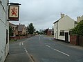
 Main Street - geograph.org.uk - 159451.jpg 640 × 480; 89 KB
-
 Main Street, Kellington - geograph.org.uk - 2475957.jpg 1,600 × 1,200; 342 KB
-
 Main Street, Kellington - geograph.org.uk - 5998847.jpg 1,280 × 835; 374 KB
-
 Marsh Drain, Kellington - geograph.org.uk - 5998831.jpg 1,280 × 960; 565 KB
-
 Marsh Lane, Kellington - geograph.org.uk - 5998834.jpg 1,280 × 960; 579 KB
-
 Meadow Lodge Care Home, Kellington - geograph.org.uk - 2155396.jpg 800 × 600; 269 KB
-

-
 Minor road towards Eggborough - geograph.org.uk - 2475928.jpg 1,600 × 1,200; 496 KB
-
 Old vicarage, Kellington, North Yorkshire.jpg 640 × 480; 72 KB
-
 Old Whitley Bridge - geograph.org.uk - 2743594.jpg 1,280 × 853; 199 KB
-
 Path along the levee near East Ings - geograph.org.uk - 3173271.jpg 2,048 × 1,536; 560 KB
-
 Path leading to the River Aire - geograph.org.uk - 4116513.jpg 1,600 × 1,064; 646 KB
-
 Plough Garth, Kellington - geograph.org.uk - 4116487.jpg 1,600 × 1,064; 627 KB
-
 Police vehicles closing the A19 - geograph.org.uk - 4802069.jpg 1,024 × 615; 112 KB
-

-
 River Aire from the Carrs - geograph.org.uk - 284652.jpg 640 × 480; 81 KB
-
 Roall Hall - geograph.org.uk - 2749758.jpg 1,280 × 853; 187 KB
-
 Roall Ings - geograph.org.uk - 3173247.jpg 2,048 × 1,536; 537 KB
-
 Roall Lane - geograph.org.uk - 5776339.jpg 640 × 427; 245 KB
-
 Roall Lane towards Kellington - geograph.org.uk - 6226888.jpg 1,600 × 1,104; 516 KB
-

-
 Roall Lane, Eggborough - geograph.org.uk - 5998817.jpg 1,280 × 824; 348 KB
-
 Roall Lane, Eggborough - geograph.org.uk - 5998818.jpg 1,280 × 960; 413 KB
-
 Roall Lane, Kellington - geograph.org.uk - 6226891.jpg 1,600 × 1,126; 944 KB
-
 Roall Lane, Kellington heading east - geograph.org.uk - 2475963.jpg 1,600 × 1,200; 418 KB
-
 Roall Manor Farm - geograph.org.uk - 284668.jpg 640 × 480; 74 KB
-
 Roall Plantation - geograph.org.uk - 5776340.jpg 640 × 427; 341 KB
-
 Roall Plantation - geograph.org.uk - 5998827.jpg 1,280 × 960; 636 KB
-
 Selby Road, north of Hut Green - geograph.org.uk - 3183810.jpg 640 × 427; 152 KB
-
 Southfield Lane - geograph.org.uk - 1265780.jpg 640 × 480; 66 KB
-

-
 Southfield Lane, looking south - geograph.org.uk - 5999365.jpg 1,280 × 1,280; 446 KB
-
 St Edmund's Church - geograph.org.uk - 4116372.jpg 1,600 × 1,064; 554 KB
-
 St Edmund's Church - geograph.org.uk - 4116373.jpg 1,600 × 1,064; 474 KB
-
 St Edmund's Church, Kellington - geograph.org.uk - 6226929.jpg 1,600 × 1,065; 630 KB
-
 Standing water - geograph.org.uk - 5998872.jpg 1,280 × 875; 375 KB
-
 Stile leading to the riverside path along the Aire - geograph.org.uk - 4116567.jpg 1,600 × 1,064; 813 KB
-
 Stile near Kellington - geograph.org.uk - 3617780.jpg 1,024 × 768; 301 KB
-
 Sugar beet field near Eggborough - geograph.org.uk - 5998821.jpg 1,280 × 960; 424 KB
-
 Sunset over Kellingley Colliery - geograph.org.uk - 5595084.jpg 640 × 480; 33 KB
-
 Swan on the River Aire at Kellington Marsh - geograph.org.uk - 4729327.jpg 1,024 × 768; 122 KB
-
 The Aire and Calder Navigation at Whitley Bridge - geograph.org.uk - 3617793.jpg 1,024 × 768; 117 KB
-

-
 The graveyard at St Edmund's Church - geograph.org.uk - 4116367.jpg 1,600 × 1,064; 717 KB
-
 The Maltings Industrial Estate - geograph.org.uk - 2143060.jpg 800 × 600; 195 KB
-
 The Old Vicarage, Kellington - geograph.org.uk - 4116414.jpg 1,600 × 1,064; 511 KB
-

-
 The Red Lion - geograph.org.uk - 159905.jpg 640 × 480; 79 KB
-
 The Red Lion - geograph.org.uk - 5776337.jpg 640 × 427; 221 KB
-

-
 The Red Lion Public House, Kellington - geograph.org.uk - 4116446.jpg 1,600 × 1,064; 503 KB
-
 The Red Lion Public House, Kellington - geograph.org.uk - 4116450.jpg 1,194 × 1,600; 558 KB
-
 The Red Lion Public House, Kellington - geograph.org.uk - 6226922.jpg 1,600 × 1,065; 564 KB
-
 The Red Lion Public House, Kellington - geograph.org.uk - 6226925.jpg 1,195 × 1,600; 527 KB
-
 The Red Lion, Kellington - geograph.org.uk - 2475961.jpg 1,600 × 1,200; 386 KB
-
 The Red Lion, Kellington - geograph.org.uk - 5998843.jpg 1,280 × 960; 321 KB
-
 The River Aire at East Ings - geograph.org.uk - 4116609.jpg 1,600 × 1,064; 648 KB
-
 The River Aire at East Ings - geograph.org.uk - 4116707.jpg 1,600 × 1,064; 856 KB
-
 The River Aire upstream of Allum Pit - geograph.org.uk - 4729355.jpg 1,024 × 614; 118 KB
-
 The River Aire, heading west (upstream) - geograph.org.uk - 4729322.jpg 1,024 × 768; 96 KB
-
 The River Aire, looking upstream - geograph.org.uk - 4729306.jpg 1,024 × 768; 114 KB
-
 The River Aire, looking upstream - geograph.org.uk - 4729310.jpg 1,024 × 768; 127 KB
-
 The River Aire, upstream of All Ash - geograph.org.uk - 4729318.jpg 1,024 × 768; 118 KB
-
 The road to Knottingley - geograph.org.uk - 2153504.jpg 800 × 600; 163 KB
-
 The Sallows - geograph.org.uk - 5776351.jpg 640 × 427; 275 KB
-

-
 The village hall at Kellington - geograph.org.uk - 2155404.jpg 800 × 600; 268 KB
-
 The Village Hall, Kellington - geograph.org.uk - 4116410.jpg 1,600 × 1,064; 684 KB
-
 Track junction at Kellington Marsh - geograph.org.uk - 4116508.jpg 1,600 × 1,064; 868 KB
-
 Track off Southfield lane - geograph.org.uk - 1265717.jpg 640 × 480; 62 KB
-
 Undercut northern bank of the River Aire - geograph.org.uk - 4729347.jpg 1,024 × 768; 149 KB
-
 View from Beal Lane - geograph.org.uk - 5999373.jpg 1,280 × 819; 308 KB
-
 View from Old Whitley Bridge - geograph.org.uk - 2743586.jpg 1,280 × 843; 171 KB
-

-
 View towards Eggborough Power Station - geograph.org.uk - 5998823.jpg 1,280 × 869; 334 KB
-

-
 Wand Lane to Hensall - geograph.org.uk - 2147459.jpg 800 × 600; 222 KB
-
 Wand Lane, running east from the A19 - geograph.org.uk - 4801930.jpg 1,024 × 768; 130 KB
-
 War Memorial at Kellington - geograph.org.uk - 4116422.jpg 1,600 × 1,064; 671 KB
-
 Water in the ruts - geograph.org.uk - 5999359.jpg 1,280 × 960; 421 KB
-
 Waterlogged field, north side of Wand Lane - geograph.org.uk - 4802057.jpg 1,024 × 768; 121 KB
-

-

-
 Whitley Bridge level crossing - geograph.org.uk - 2743591.jpg 1,280 × 853; 231 KB
-
 Whitley Bridge level crossing - geograph.org.uk - 3183793.jpg 640 × 427; 145 KB
-
 Whitley Bridge railway station, Yorkshire - geograph.org.uk - 3259785.jpg 1,024 × 768; 198 KB
-
 Whitley Bridge station - geograph.org.uk - 5143772.jpg 1,600 × 1,200; 418 KB
-
 Whitley Bridge Train Station, Eggborough - geograph.org.uk - 3923524.jpg 1,600 × 1,064; 507 KB
-
-
 Windmill, house conversion - geograph.org.uk - 161330.jpg 640 × 427; 84 KB
-
 Beal- The River Aire - geograph.org.uk - 225280.jpg 640 × 423; 65 KB
-
 Coal Trains at Kellingley Colliery - geograph.org.uk - 225269.jpg 640 × 423; 84 KB
-
 Zigzagging across the landscape - geograph.org.uk - 5999362.jpg 1,280 × 960; 299 KB
-
 Kellingley. A derelict farm building - geograph.org.uk - 243380.jpg 640 × 480; 119 KB
-
 Kellington - geograph.org.uk - 159453.jpg 640 × 480; 65 KB
-
 Kellington - geograph.org.uk - 159455.jpg 640 × 480; 81 KB
-
 Kellington Centre - geograph.org.uk - 159456.jpg 640 × 480; 74 KB


_-_geograph.org.uk_-_2475944.jpg)


_-_geograph.org.uk_-_4729322.jpg)


