Category:Kenwyn
suburb of the city of Truro in Cornwall, England, UK  | |||||
| Upload media | |||||
| Instance of | |||||
|---|---|---|---|---|---|
| Location | Truro, Cornwall, South West England, England | ||||
| Elevation above sea level |
| ||||
 | |||||
English: Kenwyn is an area of Truro in Cornwall, England, in the United Kingdom. Kenwyn is now regarded as a suburb of the city of Truro and gives its name to one of three rivers that flow through the city.
Subcategories
This category has the following 2 subcategories, out of 2 total.
K
- Kenwyn Parish Church (4 F)
T
- Truro viaduct (7 F)
Media in category "Kenwyn"
The following 45 files are in this category, out of 45 total.
-
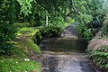
 Binneys Ford - geograph.org.uk - 4681232.jpg 6,000 × 4,000; 6.35 MB
-
 Cemetery at Kenwyn Church - geograph.org.uk - 765798.jpg 640 × 480; 155 KB
-
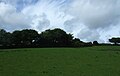
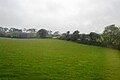 Cornish farmland - geograph.org.uk - 5149043.jpg 640 × 426; 40 KB
-
 Cornish farmland - geograph.org.uk - 5149054.jpg 640 × 426; 32 KB
-
 Cornish scenery - geograph.org.uk - 5104817.jpg 640 × 426; 72 KB
-
 DSCN1660EmidyGrave.jpg 1,224 × 1,632; 876 KB
-
 Farm buildings, Honeysuckle Farm - geograph.org.uk - 5104802.jpg 640 × 426; 68 KB
-
 Farmland, Saveoke Farm - geograph.org.uk - 5104827.jpg 640 × 426; 63 KB
-
 Farmland, Tomperrow - geograph.org.uk - 5104823.jpg 640 × 426; 60 KB
-
 Footpath to Kenwyn Church - geograph.org.uk - 215844.jpg 640 × 427; 158 KB
-
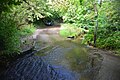
 Ford at Gloweth - geograph.org.uk - 4681256.jpg 6,000 × 4,000; 6.42 MB
-
 Ford at Gloweth - geograph.org.uk - 4681267.jpg 6,000 × 4,000; 6.47 MB
-
 Ford at Gloweth - geograph.org.uk - 4681283.jpg 6,000 × 4,000; 6.38 MB
-
 Grassland - geograph.org.uk - 5149055.jpg 640 × 426; 44 KB
-
 Grazing by the main line - geograph.org.uk - 5104820.jpg 640 × 426; 91 KB
-
 Grazing near Mount Prickle - geograph.org.uk - 5476074.jpg 640 × 405; 42 KB
-
 Hedges and pylons - geograph.org.uk - 5104824.jpg 640 × 426; 63 KB
-
 Highertown (in a rain storm) - geograph.org.uk - 5149039.jpg 640 × 426; 41 KB
-
 House behind the trees - geograph.org.uk - 5110091.jpg 640 × 426; 116 KB
-
 Kenryn , Esso Petrol Station - geograph.org.uk - 6305354.jpg 6,000 × 4,000; 7.09 MB
-
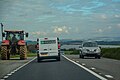
 Kenwyn , A30 - geograph.org.uk - 6305372.jpg 6,000 × 4,000; 5.73 MB
-
 Kenwyn , A30 - geograph.org.uk - 6305373.jpg 6,000 × 4,000; 6.27 MB
-
 Kenwyn , A30 - geograph.org.uk - 6305374.jpg 6,000 × 4,000; 6.28 MB
-
 Kenwyn , A30 - geograph.org.uk - 6305376.jpg 6,000 × 4,000; 7.09 MB
-
 Kenwyn , Track - geograph.org.uk - 6305371.jpg 6,000 × 4,000; 7.07 MB
-
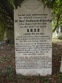
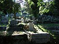 Kenwyn cemetery - geograph.org.uk - 551679.jpg 640 × 480; 115 KB
-
 Kenwyn Church lychgate - geograph.org.uk - 765795.jpg 640 × 480; 129 KB
-
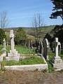
 Kenwyn churchyard - geograph.org.uk - 551189.jpg 640 × 480; 97 KB
-
 Kenwyn churchyard - geograph.org.uk - 765797.jpg 640 × 480; 144 KB
-
 Level crossing at Newbridge - geograph.org.uk - 6021648.jpg 1,024 × 681; 184 KB
-
-
 Maplin, shortly before closure - geograph.org.uk - 5718517.jpg 2,048 × 1,229; 337 KB
-
 Methodist chapel - geograph.org.uk - 4701199.jpg 725 × 544; 70 KB
-
 Paradise Farm - geograph.org.uk - 5104794.jpg 640 × 426; 74 KB
-
 Possible former chapel - geograph.org.uk - 4709044.jpg 722 × 427; 79 KB
-
 Pylon - geograph.org.uk - 6021647.jpg 1,024 × 681; 80 KB
-
 Pylon, Threemilestone - geograph.org.uk - 5149046.jpg 640 × 426; 41 KB
-
 Royal Cornwall Hospital - geograph.org.uk - 4926391.jpg 3,072 × 1,728; 1.34 MB
-
 Shallow valley - geograph.org.uk - 5149052.jpg 640 × 426; 47 KB
-
 South of the railway line - geograph.org.uk - 5105532.jpg 640 × 426; 51 KB
-
 Trevaskis Ford - geograph.org.uk - 4681244.jpg 6,000 × 4,000; 6.31 MB
-
 View from the Cornish Main Line - geograph.org.uk - 5104555.jpg 640 × 338; 39 KB
-

-
 Wooded landscape - geograph.org.uk - 5104800.jpg 640 × 426; 57 KB
-
 Wooded valley near Newbridge - geograph.org.uk - 5104799.jpg 640 × 426; 58 KB


_-_geograph.org.uk_-_5149039.jpg)


