Category:Kerkring 21, Klundert
| Object location | | View all coordinates using: OpenStreetMap |
|---|
 | |||||
| Upload media | |||||
| Instance of | |||||
|---|---|---|---|---|---|
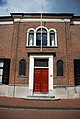
| Location | Klundert, North Brabant, Netherlands | ||||
| Street address |
| ||||
| Located on street |
| ||||
| Heritage designation |
| ||||
 | |||||
|
This is a category about rijksmonument number 521722
|
| Address |
|
Media in category "Kerkring 21, Klundert"
The following 4 files are in this category, out of 4 total.
-
 Detail voorgevel Kerkring 21 Klundert JVL 5710.jpg 1,944 × 2,896; 3.15 MB
-
 Totale voorgevel Kerkring 21 in Klundert JVL 5708.jpg 2,896 × 1,944; 3.65 MB
-
 Voorgevel kerkring 21 Klundert JVL 5709.jpg 2,896 × 1,944; 3.54 MB
-
 Voorgevels - Klundert - 20126052 - RCE.jpg 1,200 × 806; 206 KB


