Category:Kerkstraat 8, Blokzijl
| Object location | | View all coordinates using: OpenStreetMap |
|---|
 | |||||
| Upload media | |||||
| Instance of |
| ||||
|---|---|---|---|---|---|
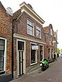
| Location | Blokzijl, Overijssel, Netherlands | ||||
| Located on street |
| ||||
| Heritage designation |
| ||||
 | |||||
|
This is a category about rijksmonument number 10463
|
| Address |
|
Media in category "Kerkstraat 8, Blokzijl"
The following 5 files are in this category, out of 5 total.
-
 Blokzijl 112.JPG 3,264 × 2,448; 1.85 MB
-
 Kerkstraat 10 Blokzijl.jpg 2,736 × 3,648; 698 KB
-
 Kerkstraat 8 Blokzijl.jpg 2,736 × 3,648; 825 KB
-
 Voorgevel - Blokzijl - 20036466 - RCE.jpg 811 × 1,200; 207 KB
-
 Voorgevel - Blokzijl - 20036490 - RCE.jpg 804 × 1,200; 207 KB


