Category:Kerrykeel
village in Ulster, Ireland  | |||||
| Upload media | |||||
| Instance of | |||||
|---|---|---|---|---|---|
| Location | County Donegal, Ulster, Ireland | ||||
 | |||||
English: Kerrykeel (, meaning "the narrow quarter") is a small village in County Donegal, Ireland. It lies between Knockalla Mountain, Ranny hill and the scenic Mulroy Bay.
Gaeilge: Is sráidbhaile é An Cheathrú Chaol (Béarla: Kerrykeel) atá suite i g Contae Dhún na nGall, Poblacht na hÉireann.
Subcategories
This category has only the following subcategory.
C
Media in category "Kerrykeel"
The following 49 files are in this category, out of 49 total.
-

-
 Art gallery, Kerrykeel - geograph.org.uk - 2603140.jpg 640 × 480; 35 KB
-
 Blue-coloured dwellings, Kerrykeel - geograph.org.uk - 2603097.jpg 640 × 480; 53 KB
-
 Cast-iron pump, Kerrykeel - geograph.org.uk - 2603150.jpg 640 × 480; 82 KB
-
 Garda Station, Kerrykeel - geograph.org.uk - 910437.jpg 640 × 392; 61 KB
-
 Glenvar Road, Kerrykeel - geograph.org.uk - 910496.jpg 640 × 480; 84 KB
-
 Guinness mural, Kerrykeel - geograph.org.uk - 1917996.jpg 640 × 480; 44 KB
-
 Hoarding, Kerrykeel - geograph.org.uk - 2603065.jpg 640 × 480; 64 KB
-
 Kerrykeel Hardware - geograph.org.uk - 2603180.jpg 640 × 480; 45 KB
-
 Kerrykeel Post Office - Mace - geograph.org.uk - 2603197.jpg 640 × 480; 46 KB
-
 Kerrykeel, County Donegal - geograph.org.uk - 1917969.jpg 640 × 480; 48 KB
-
 Kerrykeel.JPG 2,048 × 1,536; 1.5 MB
-
 Mace, Kerrykeel - geograph.org.uk - 1917998.jpg 640 × 480; 51 KB
-
 McGinley's Bar ^ Lounge, Kerrykeel - geograph.org.uk - 2603133.jpg 640 × 480; 48 KB
-
 McGinley's Lounge, Kerrykeel - geograph.org.uk - 1917992.jpg 640 × 480; 55 KB
-
 Mulroy Bay, Kerrykeel - geograph.org.uk - 1909792.jpg 640 × 480; 73 KB
-
 Mulroy Bay, Kerrykeel - geograph.org.uk - 2602997.jpg 640 × 480; 60 KB
-
 Mulroy Kerrykeel - geograph.org.uk - 1194110.jpg 640 × 480; 76 KB
-
 Mulroy Kerrykeel - geograph.org.uk - 1194115.jpg 640 × 476; 78 KB
-
 National School, Kerrykeel - geograph.org.uk - 910426.jpg 640 × 480; 69 KB
-
 O'Kane's of Kerrykeel - geograph.org.uk - 1909789.jpg 640 × 480; 50 KB
-
 Our Lady of Lourdes Church, Kerrykeel - geograph.org.uk - 910470.jpg 640 × 480; 84 KB
-

-
 Paddy Jack's Bar, Kerrykeel - geograph.org.uk - 1917970.jpg 640 × 480; 48 KB
-
 Paddy Jack's Bar, Kerrykeel - geograph.org.uk - 2603106.jpg 640 × 480; 51 KB
-
 Paddy Mor's Lounge, Kerrykeel - geograph.org.uk - 1917971.jpg 640 × 480; 55 KB
-
 Pump detail, Kerrykeel - geograph.org.uk - 2603159.jpg 1,920 × 2,560; 1.91 MB
-
 R246 Kerrykeel - Carrowkeel - geograph.org.uk - 2603013.jpg 640 × 480; 55 KB
-
 R246, Kerrykeel - geograph.org.uk - 2602996.jpg 640 × 480; 53 KB
-
 R247 Main Street, Kerrykeel - geograph.org.uk - 2603120.jpg 640 × 480; 49 KB
-
 R247 Main Street, Kerrykeel - geograph.org.uk - 2603129.jpg 640 × 480; 52 KB
-
 R247 Main Street, Kerrykeel - geograph.org.uk - 2603185.jpg 640 × 480; 52 KB
-
 R247, Kerrykeel - geograph.org.uk - 2603176.jpg 640 × 480; 68 KB
-
 R247, Kerrykeel - geograph.org.uk - 2603178.jpg 640 × 480; 47 KB
-
 Road into Kerrykeel - geograph.org.uk - 1194118.jpg 618 × 640; 94 KB
-
 Saldies Bar, Kerrykeel - geograph.org.uk - 910480.jpg 640 × 480; 80 KB
-
 Signpost at top of Shankee - geograph.org.uk - 884779.jpg 640 × 607; 57 KB
-
 Signs and notice boards, Kerrykeel - geograph.org.uk - 2603125.jpg 640 × 480; 63 KB
-
 Snow at the top of Shankey - geograph.org.uk - 1139557.jpg 640 × 480; 88 KB
-
 St Bridget's Terrace, Kerrykeel - geograph.org.uk - 2603190.jpg 640 × 480; 65 KB
-
 Style Station, Kerrykeel - geograph.org.uk - 2603144.jpg 640 × 480; 52 KB
-

-
 The Shilling Hill, Kerrykeel - geograph.org.uk - 910863.jpg 640 × 480; 64 KB
-
 The Tavern Lounge, Kerrykeel - geograph.org.uk - 2603006.jpg 640 × 480; 55 KB
-
 The Village Inn, Kerrykeel - geograph.org.uk - 1918001.jpg 640 × 480; 47 KB
-
 The Village Inn, Kerrykeel - geograph.org.uk - 2603093.jpg 640 × 480; 49 KB
-
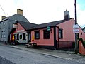 The Village Inn, Kerrykeel - geograph.org.uk - 910394.jpg 640 × 480; 65 KB
-
 Top of Shankey - geograph.org.uk - 910873.jpg 640 × 480; 58 KB
-
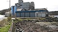 Disused flour mill - geograph.org.uk - 773091.jpg 640 × 360; 74 KB


