Category:Kessingland
English: Kessingland is a large village in the Waveney District in Suffolk, over 3 miles (7 km) south of Lowestoft. It is of interest to archaeologists as Palaeolithic and Neolithic implements have been found here; the remains of an ancient forest lie buried on the seabed
village in the United Kingdom  | |||||
| Upload media | |||||
| Instance of | |||||
|---|---|---|---|---|---|
| Location |
| ||||
| Said to be the same as | Kessingland (Wikimedia duplicated page, civil parish) | ||||
 | |||||
Subcategories
This category has the following 13 subcategories, out of 13 total.
A
E
K
- Kessingland Beach (40 F)
- The Kings Head, Kessingland (8 F)
L
- Livingstone's, Kessingland (3 F)
Q
- Queens Head, Kessingland (1 F)
S
- Sailors Home, Kessingland (7 F)
- The Sweet Retreat Tearooms (3 F)
T
V
- Kessingland Village Sign (4 F)
W
- Kessingland Water Tower (6 F)
- The Waterfront, Kessingland (2 F)
Media in category "Kessingland"
The following 200 files are in this category, out of 255 total.
(previous page) (next page)-

-

-

-
 A12 towards Wrentham - geograph.org.uk - 5155038.jpg 640 × 480; 58 KB
-
 Allotments, Kessingland - geograph.org.uk - 5157769.jpg 640 × 480; 68 KB
-

-
 Approaching the A12 near Kessingland - geograph.org.uk - 5157762.jpg 640 × 480; 68 KB
-
 B1437 from Kessingland - geograph.org.uk - 5994458.jpg 1,600 × 1,200; 319 KB
-
 B1437 High Street, Kessingland - geograph.org.uk - 2848927.jpg 3,072 × 2,304; 1.44 MB
-
 B1437 High Street, Kessingland - geograph.org.uk - 2848952.jpg 3,072 × 2,304; 1.34 MB
-
 B1437 High Street, Kessingland - geograph.org.uk - 2848958.jpg 3,072 × 2,304; 1.26 MB
-
 B1437 London Road - geograph.org.uk - 3362049.jpg 3,072 × 2,304; 1.46 MB
-
 B1437 London Road - geograph.org.uk - 3362055.jpg 3,072 × 2,304; 1.42 MB
-
 B1437 London Road - geograph.org.uk - 3362089.jpg 3,072 × 2,304; 1.23 MB
-
 B1437 London Road - geograph.org.uk - 3362093.jpg 3,072 × 2,304; 1.2 MB
-
 B1437 London Road ^ Oaklands Terrace Postbox - geograph.org.uk - 3362025.jpg 2,856 × 2,145; 846 KB
-
 B1437 White's Lane, Kessingland - geograph.org.uk - 2848236.jpg 3,072 × 2,304; 1.32 MB
-
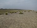
 Beach and shingle at Kessingland - geograph.org.uk - 5824825.jpg 640 × 413; 93 KB
-
 Beach front property in Kessingland - geograph.org.uk - 2164340.jpg 600 × 596; 123 KB
-
 Beach front property in Kessingland - geograph.org.uk - 2164632.jpg 546 × 640; 114 KB
-
 Beach meets sea wall, Kessingland - geograph.org.uk - 2164423.jpg 640 × 469; 122 KB
-
 Black Street - geograph.org.uk - 2971530.jpg 3,072 × 2,304; 1.21 MB
-
 Black Street, Gisleham from Dam Lane - geograph.org.uk - 1976575.jpg 640 × 480; 76 KB
-
 Black-headed Gull - geograph.org.uk - 2163171.jpg 640 × 480; 129 KB
-
 Boat on Kessingland Beach - geograph.org.uk - 5684989.jpg 2,928 × 1,810; 2.03 MB
-

-
 Bus shelter and seat, Black Street - geograph.org.uk - 3811667.jpg 640 × 480; 187 KB
-
 Bus stop in Church Road, Kessingland - geograph.org.uk - 2087915.jpg 640 × 455; 93 KB
-
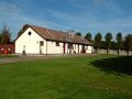
 Camping ^ Caravan Club Site - geograph.org.uk - 4475067.jpg 1,600 × 901; 220 KB
-

-
 Caravans by the coast - geograph.org.uk - 2118594.jpg 640 × 430; 68 KB
-

-
 Changing coastline south of Lowestoft - geograph.org.uk - 2164489.jpg 640 × 496; 133 KB
-
 Children's playground, Kessingland - geograph.org.uk - 5157776.jpg 640 × 480; 72 KB
-
 Church Road (B1437), Kessingland - geograph.org.uk - 5157774.jpg 640 × 480; 64 KB
-
 Church Road (B1437), Kessingland - geograph.org.uk - 5157780.jpg 640 × 480; 55 KB
-
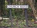 Church Road sign - geograph.org.uk - 3362904.jpg 3,072 × 2,304; 1.54 MB
-
 Church Road, Kessingland - geograph.org.uk - 3362905.jpg 3,072 × 2,304; 1.49 MB
-
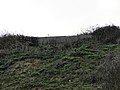
 Cliff erosion at Kessingland - geograph.org.uk - 2150482.jpg 640 × 480; 126 KB
-
 Cliff Farm Lane - geograph.org.uk - 5160449.jpg 640 × 480; 100 KB
-
 Cliff Farm Lane ^ entrance to Heathland Caravan Park - geograph.org.uk - 3362060.jpg 3,072 × 2,304; 1.49 MB
-
 Cliffs at Kessingland - geograph.org.uk - 2147693.jpg 640 × 480; 107 KB
-

-

-

-

-
-
 Co-operative food store, Kessingland - geograph.org.uk - 5156183.jpg 640 × 473; 56 KB
-
 Coastal cliff path Kessingland to Lowestoft - geograph.org.uk - 6268649.jpg 4,032 × 2,268; 5.48 MB
-
 Converted chapel, Kessingland - geograph.org.uk - 5157778.jpg 640 × 480; 66 KB
-
 Coopers Lane - geograph.org.uk - 4805899.jpg 1,024 × 768; 206 KB
-
 Crop field off Cliff Farm Lane - geograph.org.uk - 5160448.jpg 640 × 480; 64 KB
-
 Crop field, Black Street - geograph.org.uk - 5157757.jpg 640 × 480; 47 KB
-
 Cycle path beside the A12 roundabout - geograph.org.uk - 5160463.jpg 640 × 480; 69 KB
-
 Cycle path towards Kessingland - geograph.org.uk - 5157764.jpg 640 × 480; 76 KB
-

-

-

-
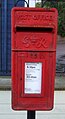
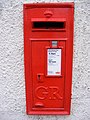
 Elizabeth II postbox on Lloyds Avenue, Kessingland - geograph.org.uk - 5158282.jpg 2,848 × 2,136; 1.37 MB
-

-

-
 Elizabeth II postbox outside the Co-op, Kessingland - geograph.org.uk - 5156175.jpg 2,338 × 2,882; 1.13 MB
-

-
 Eroding cliffs at Kessingland - geograph.org.uk - 2164538.jpg 640 × 480; 96 KB
-
 Erosion at Kessingland Cliffs - geograph.org.uk - 2164533.jpg 640 × 480; 102 KB
-
-
 Farmland near Kessingland - geograph.org.uk - 5155036.jpg 640 × 480; 53 KB
-
 Farmland next to the A12 London Road - geograph.org.uk - 6057045.jpg 800 × 556; 116 KB
-
 Farmland north of Kessingland - geograph.org.uk - 6057270.jpg 800 × 528; 157 KB
-

-
 Fields by the hamlet of Black Street - geograph.org.uk - 3811621.jpg 640 × 480; 156 KB
-
 Fisherman's Way, Kessingland - geograph.org.uk - 5996530.jpg 1,600 × 1,200; 337 KB
-
 Flat farmland near Poppy Dale Farm - geograph.org.uk - 5160455.jpg 640 × 480; 56 KB
-
 Footpath And Track - geograph.org.uk - 5059574.jpg 1,024 × 768; 218 KB
-
 Footpath in field by Glebe Farm - geograph.org.uk - 3884350.jpg 640 × 404; 165 KB
-
 Footpath Junction Sign - geograph.org.uk - 4805792.jpg 1,024 × 768; 258 KB
-
 Footpath past Five Acres, Kessingland - geograph.org.uk - 2164616.jpg 480 × 640; 168 KB
-
 Footpath past pond by Moat Farm - geograph.org.uk - 3884354.jpg 640 × 428; 227 KB
-
 Footpath past pond by Moat Farm - geograph.org.uk - 3884362.jpg 640 × 420; 196 KB
-

-
 Footpath to Pond Farm ^ A12 - geograph.org.uk - 3362085.jpg 3,072 × 2,304; 1.43 MB
-
 Footpath to the A12 ^ Gisleham - geograph.org.uk - 2971570.jpg 3,072 × 2,304; 1.22 MB
-
 Footpath to the A12 ^ Gisleham - geograph.org.uk - 2971571.jpg 3,072 × 2,304; 1.21 MB
-
 Footprints - geograph.org.uk - 2163177.jpg 640 × 480; 112 KB
-
 Former Post Office, Kessingland - geograph.org.uk - 5156203.jpg 640 × 480; 48 KB
-
 Frozen Ditch - geograph.org.uk - 4805806.jpg 1,024 × 768; 228 KB
-

-
 Gate to Private Fishing Lake - geograph.org.uk - 440140.jpg 640 × 480; 77 KB
-
 George V postbox, former Post Office, Kessingland - geograph.org.uk - 5156194.jpg 1,506 × 2,688; 439 KB
-

-
 Grazing, Moat Farm - geograph.org.uk - 5160440.jpg 640 × 480; 77 KB
-

-

-

-
 Heathland Caravan Park sign - geograph.org.uk - 3362063.jpg 2,304 × 3,072; 1.44 MB
-

-
-

-
 Here the promenade ends - geograph.org.uk - 2164351.jpg 640 × 480; 97 KB
-
 High Street George V Postbox - geograph.org.uk - 2848965.jpg 2,304 × 3,072; 1.41 MB
-
 High Street George V Postbox - geograph.org.uk - 2848969.jpg 2,304 × 3,072; 1.42 MB
-
 High Street George V Postbox - geograph.org.uk - 2848971.jpg 2,304 × 3,072; 1.44 MB
-
 High Street sign - geograph.org.uk - 2848287.jpg 3,072 × 2,304; 1.69 MB
-
 High Street, Kessingland - geograph.org.uk - 5991454.jpg 1,600 × 1,200; 225 KB
-

-
 Holiday Park - geograph.org.uk - 1903238.jpg 640 × 480; 86 KB
-
 House on Cliff Farm Lane - geograph.org.uk - 5160450.jpg 640 × 480; 74 KB
-
 House on the beach front, Kessingland - geograph.org.uk - 2164341.jpg 640 × 467; 112 KB
-
 Houses above the sea wall in Kessingland - geograph.org.uk - 2164327.jpg 640 × 480; 116 KB
-

-
 Houses on London Road (B1437) - geograph.org.uk - 5160451.jpg 640 × 480; 67 KB
-
 Houses on the beach front, Kessingland - geograph.org.uk - 2164301.jpg 640 × 480; 152 KB
-
 Human figures and wind turbines - geograph.org.uk - 2689628.jpg 4,048 × 3,040; 2.32 MB
-
 Hundred River - geograph.org.uk - 782293.jpg 640 × 480; 81 KB
-
 Kessingland Beach - geograph.org.uk - 5155022.jpg 640 × 480; 43 KB
-
 Kessingland Beach - geograph.org.uk - 5162778.jpg 640 × 480; 59 KB
-
 Kessingland Beach - geograph.org.uk - 5824499.jpg 640 × 480; 105 KB
-
 Kessingland Beach - geograph.org.uk - 5996531.jpg 1,600 × 1,200; 455 KB
-
 Kessingland Beach - geograph.org.uk - 6074815.jpg 6,351 × 4,233; 5.21 MB
-
 Kessingland Beach - geograph.org.uk - 6074829.jpg 6,314 × 4,211; 7.79 MB
-
 Kessingland Beach - geograph.org.uk - 6074833.jpg 6,378 × 4,251; 7.78 MB
-
 Kessingland Beach in Suffolk - geograph.org.uk - 6062013.jpg 800 × 512; 150 KB
-
 Kessingland Beach, 'The Waterfront' restaurant - geograph.org.uk - 6074835.jpg 7,326 × 4,884; 5.42 MB
-
 Kessingland Beach, Boats protected against the elements - geograph.org.uk - 6074821.jpg 7,146 × 4,764; 7.34 MB
-
 Kessingland Beach, Rusting small boat - geograph.org.uk - 6074824.jpg 6,685 × 4,457; 7.75 MB
-
 Kessingland Beach, The Sailors Home PH - geograph.org.uk - 6074812.jpg 6,032 × 4,021; 4.72 MB
-
 Kessingland Boatshed - geograph.org.uk - 2652387.jpg 3,648 × 2,736; 1.79 MB
-
 Kessingland Car Boot Sale Car Park - geograph.org.uk - 440366.jpg 640 × 480; 59 KB
-
 Kessingland Cliffs - geograph.org.uk - 2164542.jpg 640 × 480; 93 KB
-
 Kessingland Cliffs - geograph.org.uk - 2652398.jpg 3,648 × 2,736; 1.7 MB
-
 Kessingland cliffs - geograph.org.uk - 6253674.jpg 4,032 × 2,268; 3.53 MB
-
 Kessingland cliffs and beach - geograph.org.uk - 6268642.jpg 4,032 × 2,268; 3.48 MB
-
 Kessingland cliffs and beach in 2007.jpg 640 × 480; 69 KB
-
 Kessingland Methodist Church - geograph.org.uk - 4805890.jpg 1,024 × 768; 186 KB
-
 Kessingland old chapel conversion - geograph.org.uk - 2113462.jpg 640 × 480; 164 KB
-
 Kessingland Service Station - geograph.org.uk - 2848950.jpg 3,072 × 2,304; 1.29 MB
-
 Kessingland village sign - geograph.org.uk - 6057283.jpg 800 × 760; 185 KB
-
 Kessingland Wind Farm - geograph.org.uk - 3811637.jpg 480 × 640; 137 KB
-
 Kessingland wind turbines - geograph.org.uk - 2988556.jpg 2,736 × 2,736; 1.2 MB
-
 Kessingland, Church Road - geograph.org.uk - 6075914.jpg 6,217 × 4,144; 5.89 MB
-
 Kessingland, Lloyds Avenue - geograph.org.uk - 6075911.jpg 6,822 × 4,548; 6.57 MB
-

-

-

-

-

-
 Kessingland, St. Edmund's Church, The font 1 - geograph.org.uk - 6078514.jpg 7,188 × 4,793; 6.87 MB
-
 Kessingland, St. Edmund's Church, The font 2 - geograph.org.uk - 6078516.jpg 3,969 × 5,954; 4.21 MB
-
 Kessingland, St. Edmund's Church, The font 3 - geograph.org.uk - 6078518.jpg 6,055 × 4,037; 4.41 MB
-
 Kessingland, St. Edmund's Church, The font 4 - geograph.org.uk - 6078520.jpg 7,641 × 5,094; 7.09 MB
-
 Kessingland, St. Edmund's Church, The Kempe east window - geograph.org.uk - 6075917.jpg 7,347 × 4,899; 6.85 MB
-
 Kessingland, St. Edmund's Church, The nave - geograph.org.uk - 6075916.jpg 6,865 × 4,577; 6.09 MB
-
 Kessingland, St. Edmund's Church, The nave - geograph.org.uk - 6078510.jpg 7,756 × 5,170; 7.55 MB
-
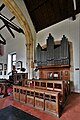 Kessingland, St. Edmund's Church, The organ - geograph.org.uk - 6078508.jpg 4,744 × 7,116; 5.77 MB
-
 Kessingland, St. Edmund's Church, The pulpit - geograph.org.uk - 6078527.jpg 6,962 × 4,642; 6.41 MB
-

-
 Kessingland, St. Edmund's Church, The War Memorial - geograph.org.uk - 6075926.jpg 6,812 × 4,541; 5.06 MB
-
 Kessingland, St. Edmund's Church, Wall mounted wheel - geograph.org.uk - 6078524.jpg 6,688 × 4,459; 5.87 MB
-
 Kessingland, St. Edmund's Church, Wall plaque 1 - geograph.org.uk - 6078543.jpg 6,223 × 4,148; 3.93 MB
-
 Kessingland, St. Edmund's Church, Wall plaque 2 - geograph.org.uk - 6078548.jpg 5,789 × 3,859; 4.8 MB
-
 Kessingland, St. Edmund's Church, Wall plaque 3 - geograph.org.uk - 6078552.jpg 6,261 × 4,174; 6.48 MB
-
 Kings Terrace, Kessingland - geograph.org.uk - 5991457.jpg 1,600 × 1,200; 231 KB
-
 Layby on the A12 - geograph.org.uk - 3362915.jpg 3,072 × 2,304; 1.33 MB
-
 London Road (B1437) - geograph.org.uk - 5160444.jpg 640 × 480; 75 KB
-
 London Road (B1437) - geograph.org.uk - 5160452.jpg 640 × 480; 75 KB
-
 London Road, Oaklands Terrace - geograph.org.uk - 5168401.jpg 2,848 × 2,136; 1.44 MB
-

-
 New use for old conveyor belt - geograph.org.uk - 2164311.jpg 640 × 637; 253 KB
-
 No cycling along the sea wall - geograph.org.uk - 2149292.jpg 640 × 480; 141 KB
-
 No cycling on the promenade - geograph.org.uk - 2164354.jpg 640 × 480; 124 KB
-
 No digging in the cliff face - geograph.org.uk - 2147708.jpg 640 × 480; 166 KB
-
 Oaklands Terrace Postbox - geograph.org.uk - 3362043.jpg 2,304 × 3,072; 1.61 MB
-
 Oaklands Terrace Postbox - geograph.org.uk - 3362044.jpg 2,304 × 3,072; 1.61 MB
-
 Oaklands Terrace Postbox - geograph.org.uk - 3362046.jpg 2,304 × 3,072; 1.64 MB
-

-
 Old House - geograph.org.uk - 4805905.jpg 1,024 × 768; 255 KB
-
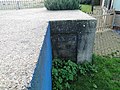
 Ordnance Survey Cut Mark - geograph.org.uk - 5764949.jpg 640 × 399; 81 KB
-
 Pasture by Five Acres, Kessingland - geograph.org.uk - 2164618.jpg 480 × 640; 131 KB
-

-
 Path to Pakefield along beach - geograph.org.uk - 2483115.jpg 640 × 480; 71 KB
-
 Pillbox in the garden of clifftop houses - geograph.org.uk - 2147729.jpg 640 × 480; 122 KB
-
 Pillbox on the cliffs at Kessingland - geograph.org.uk - 2147697.jpg 640 × 480; 147 KB
-
 Plank bridge over field boundary ditch - geograph.org.uk - 3884344.jpg 640 × 480; 215 KB
-
 Pond beside the footpath to Moat Farm - geograph.org.uk - 3884352.jpg 640 × 480; 209 KB
-
 Pond by Moat Farm - geograph.org.uk - 3884361.jpg 640 × 480; 214 KB
-
 Pond in fields by Moat Farm - geograph.org.uk - 3884357.jpg 640 × 480; 279 KB
-
 Pond on the edge of marshland - geograph.org.uk - 2158254.jpg 640 × 448; 133 KB
-
 Private Track to Moat Farm - geograph.org.uk - 5160443.jpg 640 × 480; 120 KB
-
 Promenade, Kessingland Beach - geograph.org.uk - 5155026.jpg 640 × 480; 67 KB
-
 Pumping station at end of Hundred River - geograph.org.uk - 5994671.jpg 1,600 × 1,200; 381 KB
-
 Pumping station outflow - geograph.org.uk - 5994673.jpg 1,600 × 1,200; 318 KB
-

-
 Remains of old groynes - geograph.org.uk - 2164466.jpg 480 × 640; 137 KB
-
 Rider Haggard Lane, Kessingland - geograph.org.uk - 5156216.jpg 640 × 452; 38 KB
-
 Ridges in Kessingland Beach - geograph.org.uk - 5994720.jpg 1,600 × 1,200; 447 KB
-
 Ripples in the sand - geograph.org.uk - 2164524.jpg 480 × 640; 139 KB
-

-
 Road Works - geograph.org.uk - 4805768.jpg 1,024 × 768; 274 KB
-
 Road, Kessingland Beach Holiday Park - geograph.org.uk - 5162777.jpg 640 × 480; 50 KB
-
 Roadsign at the Black Street junction - geograph.org.uk - 2971533.jpg 2,304 × 3,072; 1.25 MB


,_Kessingland_-_geograph.org.uk_-_5157774.jpg)
,_Kessingland_-_geograph.org.uk_-_5157780.jpg)


_-_geograph.org.uk_-_5160451.jpg)


_-_geograph.org.uk_-_6078536.jpg)


_-_geograph.org.uk_-_5160444.jpg)
_-_geograph.org.uk_-_5160452.jpg)


