Category:Kilcloon
civil parish in County Meath, Ireland  | |||||
| Upload media | |||||
| Instance of | |||||
|---|---|---|---|---|---|
| Location |
| ||||
| Elevation above sea level |
| ||||
 | |||||
English: Kilcloon (, "Church of the meadow") is a parish situated in the south-east of County Meath in Ireland. The parish is composed of the six medieval parishes of Moyglare, Kilclone, Balfeighan, Rodanstown, Ballymaglassan an Rathregan. The medieval parish of Kilclone was in turn made up of the townlands of Kilclone, Pagestown, Mulhussey, Milltown, Longtown, Jenkinstown, Collistown, Barstown, and Kimmin’s Mill. The townland of Kilclone is modernly known as Kilcloon also.
Media in category "Kilcloon"
The following 20 files are in this category, out of 20 total.
-
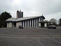 Church, Kilcloon, Co Meath - geograph.org.uk - 1817640.jpg 640 × 480; 52 KB
-
 Country Road, Kilclone, Co Meath - geograph.org.uk - 1817824.jpg 640 × 480; 102 KB
-
 Deserted Cottage, Butlerstown, Co Meath - geograph.org.uk - 1817635.jpg 680 × 510; 263 KB
-
 Housing Scheme, Brownstown, Co Meath - geograph.org.uk - 1817637.jpg 640 × 480; 60 KB
-
 Kilclone townlands.png 704 × 601; 201 KB
-
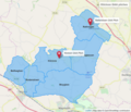
 Kilcloon churches map.png 1,050 × 900; 516 KB
-
 Kilcloon civil parishes.png 1,050 × 900; 614 KB
-
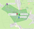
 Kilcloon GAA pitches.png 1,050 × 900; 512 KB
-
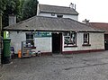 Kilcloon Post Office.jpg 3,877 × 2,872; 3.29 MB
-
 Kilcloon postal town with townlands.png 1,050 × 900; 396 KB
-
 Kilcloon postal town.png 1,050 × 900; 514 KB
-
 Kilcloon schools.png 1,050 × 900; 519 KB
-
 Kilcloon village and census town.png 700 × 608; 178 KB
-
 Kilcloon village.png 700 × 602; 205 KB
-
 Landscape, Kilclone, Co Meath - geograph.org.uk - 1817820.jpg 640 × 480; 75 KB
-
 Memorial Park, Kilcloon, Co Meath - geograph.org.uk - 1817816.jpg 640 × 480; 127 KB
-
 OliverPlunkettBust.jpg 832 × 1,600; 415 KB
-
-
 Rodanstown chapel.jpg 4,056 × 2,280; 5.49 MB
-
 Scoil Oilibheir Naofa.jpg 4,056 × 2,280; 4.05 MB


