Category:Kilcot
hamlet in Gloucestershire, England  | |||||
| Upload media | |||||
| Instance of | |||||
|---|---|---|---|---|---|
| Location | Gorsley and Kilcot, Forest of Dean, Gloucestershire, South West England, England | ||||
 | |||||
English: Kilcot is a hamlet in the civil parish of Gorsley and Kilcot, in the Forest of Dean district, in the county of Gloucestershire, England.
Media in category "Kilcot"
The following 47 files are in this category, out of 47 total.
-
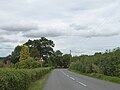
 Approaching Kilcot from Aston Ingham - geograph.org.uk - 492882.jpg 640 × 480; 356 KB
-
 B4221 at Kews lane, Kilcot - geograph.org.uk - 5249639.jpg 1,600 × 901; 645 KB
-
 B4221 at Kews lane, Kilcot - geograph.org.uk - 5249645.jpg 1,600 × 901; 660 KB
-
 B4221 at Kilcot - geograph.org.uk - 5187004.jpg 1,600 × 899; 473 KB
-
 Barn and hayfield - geograph.org.uk - 859438.jpg 640 × 342; 54 KB
-
 Brassfields Farm, Kilcot - geograph.org.uk - 2692408.jpg 640 × 358; 77 KB
-
 Entrance to the Kilcot Inn - geograph.org.uk - 4461930.jpg 800 × 451; 183 KB
-
 Entrance to The Kilcot Inn - geograph.org.uk - 4670896.jpg 800 × 434; 64 KB
-
 Field of Maize at Kilcot - geograph.org.uk - 58279.jpg 640 × 426; 164 KB
-
 Five Ways junction, Kilcot - geograph.org.uk - 5187007.jpg 1,600 × 899; 561 KB
-
 Ford Lane, Kilcot - geograph.org.uk - 5218452.jpg 1,024 × 768; 437 KB
-

-
 Junction of five ways at Kilcot - geograph.org.uk - 5060308.jpg 800 × 533; 112 KB
-
 Kews Lane, Kilcot - geograph.org.uk - 5249649.jpg 1,600 × 901; 711 KB
-
 Kews Lane, Kilcot - geograph.org.uk - 5887070.jpg 1,600 × 1,000; 648 KB
-
 Kilcot corner - geograph.org.uk - 4492922.jpg 800 × 451; 69 KB
-
 Kilcot Garage - geograph.org.uk - 5187005.jpg 1,600 × 902; 449 KB
-
 Kilcot Green - geograph.org.uk - 4744636.jpg 1,600 × 901; 690 KB
-
 Kilcot Hill - geograph.org.uk - 4528103.jpg 800 × 451; 186 KB
-
 Kilcot Hill - geograph.org.uk - 4547854.jpg 800 × 600; 257 KB
-
 Mini Heaven, Kilcott - geograph.org.uk - 104184.jpg 640 × 479; 126 KB
-
 Mini Hell, Kilcott - geograph.org.uk - 104191.jpg 640 × 479; 148 KB
-
 Notices at Kilcot - geograph.org.uk - 492866.jpg 640 × 457; 426 KB
-
 Oak tree shading road junction, Kilcot - geograph.org.uk - 5887062.jpg 1,600 × 1,199; 756 KB
-
 Old barn at the Kilcot Inn - geograph.org.uk - 4080992.jpg 3,872 × 2,592; 3.45 MB
-
 Overgrown footpath, Kilcot - geograph.org.uk - 492885.jpg 640 × 521; 566 KB
-
 Parish Council Notice Board, Kilcot - geograph.org.uk - 492870.jpg 618 × 640; 498 KB
-
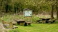 Picnic area at Kilcot Green - geograph.org.uk - 4440371.jpg 800 × 450; 259 KB
-
 Road Junction at Kilcot - geograph.org.uk - 492890.jpg 640 × 434; 311 KB
-

-
 Road to Gorsley from Newent at Kilcot - geograph.org.uk - 492895.jpg 640 × 471; 298 KB
-

-
 Stony Lane, Kilcot - geograph.org.uk - 492872.jpg 515 × 640; 347 KB
-
 Telephone box on the road to Newent - geograph.org.uk - 492861.jpg 640 × 480; 366 KB
-
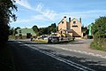
 The Kilcot Inn - geograph.org.uk - 4080840.jpg 3,872 × 2,592; 2.92 MB
-
 The Kilcot Inn by B4221 in Kilcot - geograph.org.uk - 5887077.jpg 4,417 × 3,309; 4.16 MB
-
 The Kilcot Inn, Kilcot - geograph.org.uk - 58277.jpg 640 × 426; 112 KB
-
 Timber and Building Suppliers, Kilcot - geograph.org.uk - 492858.jpg 640 × 465; 338 KB
-

-
 Wild daffodils at Kilcot Green, 1 - geograph.org.uk - 5326969.jpg 1,600 × 1,600; 1.4 MB
-
 Wild daffodils at Kilcot Green, 2 - geograph.org.uk - 5326971.jpg 1,600 × 914; 874 KB
-
 Wood Lane, Kilcot - geograph.org.uk - 4528101.jpg 800 × 451; 200 KB
-
 Farm drive up to Hill House, Kilcot - geograph.org.uk - 436871.jpg 640 × 426; 112 KB
-
 Farmland to the East of Kilcot - geograph.org.uk - 58017.jpg 640 × 426; 138 KB
-
 Ford Farm and Ford Lane near Kilcot - geograph.org.uk - 765691.jpg 640 × 426; 88 KB
-
 Oil Seed Rape at Kilcot - geograph.org.uk - 436745.jpg 640 × 426; 123 KB
-
 Ploughed field near Kilcot - geograph.org.uk - 674308.jpg 640 × 440; 141 KB


