Category:Kilpin
English: Kilpin is a village and civil parish in the East Riding of Yorkshire, England. It is situated approximately 2.5 miles (4 km) north east of Goole town centre and about 1.5 miles (2.4 km) south east of Howden.
village and civil parish in East Riding of Yorkshire, UK  | |||||
| Upload media | |||||
| Instance of | |||||
|---|---|---|---|---|---|
| Location | East Riding of Yorkshire, Yorkshire and the Humber, England | ||||
| Said to be the same as | Kilpin (Wikimedia duplicated page, civil parish) | ||||
 | |||||
Subcategories
This category has the following 6 subcategories, out of 6 total.
Media in category "Kilpin"
The following 200 files are in this category, out of 280 total.
(previous page) (next page)-
 "Fast Julia" manoeuvres into Goole Docks - geograph.org.uk - 5767389.jpg 1,024 × 768; 151 KB
-
 A Fallow Field - geograph.org.uk - 202541.jpg 640 × 480; 101 KB
-
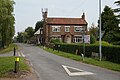
 A farmhouse at Kilpin near Howden - geograph.org.uk - 3132621.jpg 4,099 × 2,928; 2.45 MB
-
 A Fine Avenue of Trees - geograph.org.uk - 202846.jpg 640 × 480; 106 KB
-
 A footpath to Kilpin, East Yorkshire - geograph.org.uk - 2209132.jpg 800 × 600; 220 KB
-
 A Nursery by the M62 - geograph.org.uk - 202815.jpg 640 × 480; 106 KB
-
 An abandoned wagon - geograph.org.uk - 6202434.jpg 640 × 480; 177 KB
-
 An Underused Public Bridleway - geograph.org.uk - 248032.jpg 640 × 480; 102 KB
-
 Approaching the junction with B1230 Main Road - geograph.org.uk - 6102978.jpg 4,608 × 3,456; 2.93 MB
-
 B1230 Main Road near Balkholme - geograph.org.uk - 6202827.jpg 640 × 480; 122 KB
-
 B1230 near Balkholme - geograph.org.uk - 4486104.jpg 1,024 × 545; 146 KB
-
 B1230 towards Gilberdyke - geograph.org.uk - 2324992.jpg 1,600 × 1,200; 490 KB
-
 Balkholme common Layby on the B1230 heading West - geograph.org.uk - 4486102.jpg 1,024 × 768; 207 KB
-

-
 Balkholme crashed bombers memorial - geograph.org.uk - 6202814.jpg 640 × 480; 136 KB
-
 Balkholme Drain - geograph.org.uk - 2023734.jpg 640 × 480; 119 KB
-
 Barley Field and Kilpin - geograph.org.uk - 202587.jpg 640 × 480; 102 KB
-
 Barley Field and Wood - geograph.org.uk - 202602.jpg 640 × 480; 111 KB
-
 Bellcross Lane - geograph.org.uk - 1299032.jpg 640 × 482; 55 KB
-
 Bellcross Lane near Elmtree Farm - geograph.org.uk - 5838732.jpg 4,000 × 3,000; 3.28 MB
-
 Bellcross Lane towards Howden - geograph.org.uk - 202851.jpg 640 × 480; 106 KB
-
 Bend in the Ouse - geograph.org.uk - 1522051.jpg 640 × 426; 204 KB
-
 Bend in the Ouse embankment - geograph.org.uk - 1522056.jpg 640 × 426; 200 KB
-
 Boat moored at the works jetty, Howdendyke - geograph.org.uk - 5128819.jpg 1,024 × 768; 133 KB
-
 Bridge over stretch of water - geograph.org.uk - 2288375.jpg 1,500 × 1,125; 1.66 MB
-
 Bridleway by Cogan's Plantation - geograph.org.uk - 6219747.jpg 1,024 × 768; 210 KB
-
 Bridleway to Kilpin - geograph.org.uk - 5052176.jpg 1,200 × 799; 445 KB
-
 Bridleway to Kilpin - geograph.org.uk - 5052184.jpg 1,200 × 799; 388 KB
-
 Bridleway to Skelton - geograph.org.uk - 2023781.jpg 640 × 480; 109 KB
-
 Broad Lane - geograph.org.uk - 202808.jpg 640 × 480; 111 KB
-
 Brow Lane towards West Linton Farm - geograph.org.uk - 2023772.jpg 640 × 480; 117 KB
-
 Buildings at Elmtree Farm - geograph.org.uk - 2288047.jpg 1,500 × 843; 1.3 MB
-
 Buildings at Sand Hall from Trans Pennine Trail - geograph.org.uk - 6188808.jpg 4,608 × 3,456; 5.06 MB
-
 By Balkholme Drain, near Kilpin - geograph.org.uk - 5264450.jpg 539 × 640; 196 KB
-
 Cottage and Newclose Plantation - geograph.org.uk - 3700972.jpg 1,024 × 768; 161 KB
-
 Crop spraying in a wheatfield - geograph.org.uk - 6202774.jpg 640 × 360; 63 KB
-
 CRT work boats rounding the 'hook' at Hook - geograph.org.uk - 5128826.jpg 1,024 × 768; 116 KB
-
 Derelict barn at Sand Hall - geograph.org.uk - 6206341.jpg 640 × 480; 116 KB
-
 Dick Lane heading north, Balkholme - geograph.org.uk - 2023750.jpg 640 × 480; 67 KB
-
 Disused building near Howden - geograph.org.uk - 6083042.jpg 1,024 × 768; 209 KB
-
 Downstream pier, Goole Bridge - geograph.org.uk - 5113500.jpg 1,024 × 768; 120 KB
-
 Drainage ditch beside Skelton Broad Lane - geograph.org.uk - 2023646.jpg 640 × 480; 106 KB
-
 Ebuyer.com - geograph.org.uk - 1978190.jpg 800 × 600; 77 KB
-
 Ebuyer.com, Howdendyke - geograph.org.uk - 5052541.jpg 1,200 × 799; 298 KB
-
 Elm Tree Farm on Bellcross Lane - geograph.org.uk - 5052260.jpg 1,200 × 799; 395 KB
-
 Elm Tree Manor - geograph.org.uk - 1244400.jpg 640 × 480; 38 KB
-
 Elm Tree Manor off Howden Dyke Road - geograph.org.uk - 5052529.jpg 1,200 × 799; 287 KB
-
 Elmtree Farm, Kilpin - geograph.org.uk - 472935.jpg 640 × 441; 71 KB
-
 Emergency Access Lane - geograph.org.uk - 1246601.jpg 640 × 480; 98 KB
-
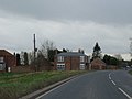
 Entering Kilpin from the west - geograph.org.uk - 2209237.jpg 800 × 600; 311 KB
-
 Entering Kilpin.jpg 640 × 480; 77 KB
-
 Factory- Gone. Kilpin. - geograph.org.uk - 1871957.jpg 4,000 × 3,000; 3.23 MB
-
 Farm buildings, Belby Hall - geograph.org.uk - 2324995.jpg 1,600 × 1,200; 338 KB
-
 Farm Buildings, Elmtree Farm - geograph.org.uk - 2023619.jpg 640 × 480; 61 KB
-
 Farm track (footpath), Howdendyke - geograph.org.uk - 2023631.jpg 640 × 480; 117 KB
-
 Farmland east of Skelton - geograph.org.uk - 2023654.jpg 640 × 480; 98 KB
-
 Farmland near East Lynton Farm - geograph.org.uk - 2023786.jpg 640 × 480; 72 KB
-
 Farmland near Kilpin - geograph.org.uk - 2023739.jpg 640 × 480; 109 KB
-
 Farmland south of Moorfields Lane - geograph.org.uk - 2023661.jpg 640 × 480; 66 KB
-
 Feed silo near Kilpin.jpg 640 × 480; 34 KB
-
 Ferry Road, Howdendyke - geograph.org.uk - 5585516.jpg 5,376 × 3,024; 2.75 MB
-
 Field drain near Skelton - geograph.org.uk - 6020367.jpg 1,024 × 768; 118 KB
-
 Field edge - geograph.org.uk - 3946761.jpg 1,024 × 768; 120 KB
-
 Field edge to the Footbridge - geograph.org.uk - 1876710.jpg 4,000 × 3,000; 2.5 MB
-
 Field Gateway near Kilpin.jpg 640 × 480; 114 KB
-
 Field south-east of Skelton - geograph.org.uk - 2288330.jpg 1,500 × 945; 1.15 MB
-
 Fields northeast of Howdendyke - geograph.org.uk - 1876739.jpg 4,000 × 3,000; 2.54 MB
-
 Fishing pond - geograph.org.uk - 3700985.jpg 1,024 × 768; 180 KB
-
 Flat Fields and Drainage Dyke - geograph.org.uk - 1869057.jpg 4,000 × 3,000; 2.89 MB
-
 Flood Bank 6 metres fields 3 Metres above sea level - geograph.org.uk - 6188833.jpg 4,608 × 3,456; 4.59 MB
-
 Footbridge and footpath sign - geograph.org.uk - 6202782.jpg 640 × 480; 124 KB
-
 Footbridge of Skelton Broad Lane - geograph.org.uk - 5052131.jpg 1,200 × 799; 524 KB
-

-
 Footpath marked through crop - geograph.org.uk - 1876726.jpg 4,000 × 3,000; 3.36 MB
-
 Footpath over fields to Skelton - geograph.org.uk - 2023650.jpg 640 × 480; 95 KB
-
 Footpath to Laxton - geograph.org.uk - 3671822.jpg 1,024 × 768; 183 KB
-
 Footpaths don't get any flatter - geograph.org.uk - 1876721.jpg 4,000 × 3,000; 2.44 MB
-
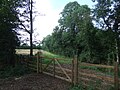
 Gate by Kilpin Broad Lane - geograph.org.uk - 6219737.jpg 1,024 × 768; 168 KB
-
 Gate Farm, Balkholme - geograph.org.uk - 2023748.jpg 640 × 480; 82 KB
-
 Gate near Balkholme - geograph.org.uk - 6219763.jpg 1,024 × 768; 278 KB
-
 Gated farm track near Balkholme - geograph.org.uk - 2023744.jpg 640 × 480; 88 KB
-
 Gateway to Linton Lane - geograph.org.uk - 6202806.jpg 640 × 480; 166 KB
-
 Gateway to Sandhall or Sand Hall - geograph.org.uk - 5584947.jpg 5,376 × 3,024; 2.91 MB
-
 Gerda being unloaded at Howdendyke, River Ouse - geograph.org.uk - 5128375.jpg 1,024 × 768; 123 KB
-
 Goole Bridge from the south - geograph.org.uk - 2290482.jpg 1,500 × 1,125; 1.4 MB
-
 Goole Bridge, from the south - geograph.org.uk - 5113494.jpg 1,024 × 615; 95 KB
-
 Goole Mill - geograph.org.uk - 2549814.jpg 1,600 × 1,161; 226 KB
-
 Goole Point, River Ouse - geograph.org.uk - 3570948.jpg 1,024 × 768; 83 KB
-
 Goole rail bridge - geograph.org.uk - 6020374.jpg 1,024 × 768; 179 KB
-
 Goole Reach (2) - geograph.org.uk - 2309236.jpg 1,024 × 768; 131 KB
-
 Goole Swing Bridge over the River Ouse - geograph.org.uk - 5585958.jpg 5,376 × 3,024; 2.23 MB
-
 Grange Cottage, Kilpin - geograph.org.uk - 5052208.jpg 1,200 × 799; 409 KB
-
 Heading east towards Kilpin - geograph.org.uk - 2209228.jpg 800 × 600; 330 KB
-
 Heading north into Kilpin Pike - geograph.org.uk - 2209192.jpg 800 × 600; 180 KB
-
 Hide at Saltmarshe Delph - geograph.org.uk - 3671812.jpg 1,024 × 768; 278 KB
-
 House on Broad Lane - geograph.org.uk - 2023779.jpg 640 × 480; 58 KB
-
 Houses at Kilpin Pike - geograph.org.uk - 5128364.jpg 1,024 × 615; 89 KB
-
 Houses at Sunnybank near Howdendyke - geograph.org.uk - 5052247.jpg 1,200 × 799; 286 KB
-
 Houses on Mill Lane, Kilpin - geograph.org.uk - 5052204.jpg 1,200 × 799; 411 KB
-
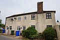
 Houses on Narrow Lane, Kilpin - geograph.org.uk - 5052214.jpg 1,200 × 799; 337 KB
-
 Houses, Kilpin Pike - geograph.org.uk - 2023635.jpg 640 × 480; 79 KB
-
 Howden Dyke Road goes over the M62 - geograph.org.uk - 5052547.jpg 1,200 × 799; 371 KB
-
 Hunters Chase off Mill Lane, Kilpin - geograph.org.uk - 5052203.jpg 1,200 × 799; 363 KB
-
 Interesting brickwork on minor railway bridge - geograph.org.uk - 5585951.jpg 5,376 × 3,024; 3.3 MB
-
 Irrigation pond - geograph.org.uk - 3700982.jpg 1,024 × 768; 162 KB
-
 It looks ancient but it has tyres - geograph.org.uk - 6188817.jpg 4,608 × 3,456; 5.42 MB
-
 Kilpin - geograph.org.uk - 121406.jpg 640 × 480; 140 KB
-
 Kilpin Brick Ponds - geograph.org.uk - 472893.jpg 640 × 448; 87 KB
-
 Kilpin Brick Ponds - geograph.org.uk - 472901.jpg 478 × 640; 123 KB
-
 Kilpin Broad Lane towards Balkholme - geograph.org.uk - 2023745.jpg 640 × 480; 74 KB
-
 Kilpin Grange - geograph.org.uk - 2288255.jpg 1,500 × 777; 1.25 MB
-
 Kilpin Narrow Lane - geograph.org.uk - 202537.jpg 640 × 480; 108 KB
-
 Kilpin North End.jpg 640 × 432; 211 KB
-
 Kilpin Pike Beacon from 2000 - geograph.org.uk - 5585894.jpg 5,298 × 2,876; 2.09 MB
-
 Kilpin South End.jpg 640 × 426; 172 KB
-
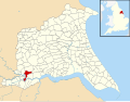 Kilpin UK parish locator map.svg 1,425 × 1,107; 1.68 MB
-
 Kilpin, East Riding of Yorkshire (cropped).jpg 2,219 × 1,784; 1.33 MB
-
 Kilpin, East Riding of Yorkshire.jpg 2,424 × 2,334; 1.85 MB
-
 Land by Kilpin Broad Lane - geograph.org.uk - 3718273.jpg 1,024 × 768; 125 KB
-
 Lane entering Kilpin - geograph.org.uk - 5838737.jpg 4,000 × 3,000; 4.17 MB
-
 Lane linking Moorfields Lane with Skelton Broad Lane - geograph.org.uk - 5838780.jpg 4,000 × 3,000; 4.47 MB
-
 Levee of River Ouse at Skelton - geograph.org.uk - 2290458.jpg 1,500 × 1,125; 1.55 MB
-
 Levee of River Ouse south-east of Kilpendyke - geograph.org.uk - 2289528.jpg 1,500 × 1,125; 1.82 MB
-
 Looking back toward Goole over River Ouse - geograph.org.uk - 6188843.jpg 4,608 × 3,456; 4.56 MB
-

-
 Looking down the B1230, from Long Lane - geograph.org.uk - 2392837.jpg 800 × 600; 327 KB
-
 Looking east along B1230 to Gilberdyke - geograph.org.uk - 2209260.jpg 800 × 600; 281 KB
-
 Looking east along Near Drain - geograph.org.uk - 5264396.jpg 476 × 640; 163 KB
-
 Lower East Goole light (no. 27), River Ouse - geograph.org.uk - 5513800.jpg 1,024 × 768; 145 KB
-
 M62 eastbound near Howden - geograph.org.uk - 2287810.jpg 1,500 × 910; 380 KB
-
 M62 eastbound towards Hull - geograph.org.uk - 2023618.jpg 640 × 480; 53 KB
-
 M62 looking east from bridge carrying the B1230 over it - geograph.org.uk - 4556372.jpg 2,999 × 2,197; 1.73 MB
-
 M62 near Howden - geograph.org.uk - 5925215.jpg 1,024 × 752; 110 KB
-
 Mast and wind turbine - geograph.org.uk - 3715249.jpg 1,024 × 756; 136 KB
-
 Memorial to lost airmen - geograph.org.uk - 6219781.jpg 1,024 × 768; 226 KB
-
 Mid afternoon on the M62 - geograph.org.uk - 1876746.jpg 4,000 × 3,000; 2.31 MB
-
 Mill Lane Junction Kilpin.jpg 640 × 480; 55 KB
-
 Mill Lane Kilpin 1.jpg 640 × 471; 96 KB
-
 Mill Lane Kilpin.jpg 640 × 426; 198 KB
-
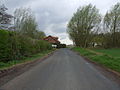
 Mill Lane to Kilpin - geograph.org.uk - 202600.jpg 640 × 480; 99 KB
-
 Mill Lane towards Kilpin - geograph.org.uk - 2023648.jpg 640 × 480; 89 KB
-
 Minor road approaching Kilpin - geograph.org.uk - 2288138.jpg 1,500 × 795; 1.25 MB
-
 Minor road towards Kilpin - geograph.org.uk - 2023621.jpg 640 × 480; 111 KB
-
 Moorfields Lane being crossed by Railway Bridge TJG 2 - geograph.org.uk - 5838776.jpg 4,000 × 3,000; 3.75 MB
-
 Moorfields Lane railway bridge - geograph.org.uk - 6202770.jpg 640 × 480; 122 KB
-
 Narrow Lane Junction Kilpin.jpg 640 × 448; 82 KB
-
 Narrow Lane towards Balkholme - geograph.org.uk - 2023741.jpg 640 × 480; 75 KB
-
 Narrow Lane, Kilpin.jpg 475 × 640; 81 KB
-
 Near Drain - geograph.org.uk - 5264395.jpg 480 × 640; 194 KB
-
 Near Drain - geograph.org.uk - 6020362.jpg 1,024 × 768; 331 KB
-
 New house at Elmtree Farm near Howden - geograph.org.uk - 3132615.jpg 4,384 × 2,923; 2.62 MB
-
 New Kitchen anybody^ - geograph.org.uk - 1978198.jpg 800 × 600; 75 KB
-

-

-
 North Lynton Farm - geograph.org.uk - 2023784.jpg 640 × 480; 78 KB
-
 North of Kilpin.jpg 640 × 462; 211 KB
-
 North to Kilpin, East Yorkshire - geograph.org.uk - 2290063.jpg 800 × 600; 265 KB
-
 Oak tree by Near Drain - geograph.org.uk - 5264451.jpg 640 × 485; 195 KB
-
 Old Chapel facing the River Ouse at Kilpin Pike - geograph.org.uk - 5585886.jpg 5,376 × 3,024; 2.62 MB
-
 Old farm buildings behind Sand Hall - geograph.org.uk - 5584940.jpg 5,376 × 3,024; 4.07 MB
-
 Ordnance Survey Cut Mark - geograph.org.uk - 5839618.jpg 4,000 × 3,000; 4.92 MB
-
 Ouse embankment - geograph.org.uk - 1521396.jpg 584 × 640; 225 KB
-
 Overgrown bridleway - geograph.org.uk - 3946750.jpg 1,024 × 768; 301 KB
-
 Paradise Farm - geograph.org.uk - 3700974.jpg 1,024 × 768; 156 KB
-
 Parking ahead sign on the B1230 heading West - geograph.org.uk - 4486099.jpg 1,024 × 623; 117 KB
-
 Passing place on Kilpin Broad Lane - geograph.org.uk - 6202822.jpg 640 × 480; 90 KB
-
 Pasture Farm - geograph.org.uk - 1172561.jpg 640 × 480; 222 KB
-
 Path by River Ouse - geograph.org.uk - 6020381.jpg 1,024 × 768; 231 KB
-
 Path towards Laxton - geograph.org.uk - 5585930.jpg 5,336 × 2,952; 2.78 MB
-
 Pond at Belby Hall - geograph.org.uk - 3946770.jpg 1,024 × 768; 166 KB
-
 Pond, Belby Hall - geograph.org.uk - 2324998.jpg 1,600 × 1,200; 582 KB
-
 Priory Farm Kilpin.jpg 640 × 457; 62 KB
-
 Prospect of Swinefleet - geograph.org.uk - 5586055.jpg 5,320 × 2,922; 2.73 MB
-
 Pumping Station beside Skelton Broad Lane - geograph.org.uk - 5585898.jpg 5,376 × 3,024; 2.49 MB
-
 R.A.F. memorial, Balkholme - geograph.org.uk - 2023756.jpg 640 × 480; 94 KB
-
 Railway bridge over Moorfields Lane - geograph.org.uk - 2023659.jpg 640 × 480; 96 KB
-
 Railway Bridge over Moorfields Lane - geograph.org.uk - 5585944.jpg 5,376 × 3,024; 2.89 MB
-
 Railway bridge over Moorfields Lane - geograph.org.uk - 5585945.jpg 5,376 × 3,024; 3.79 MB
-
 Railway bridge over track from Pasture Farm - geograph.org.uk - 5585949.jpg 5,376 × 3,024; 3.14 MB
-
 Rear view of Sand Hall - geograph.org.uk - 5778112.jpg 1,024 × 768; 256 KB
-
 Recently planted field opposite Goole Reach - geograph.org.uk - 5585971.jpg 5,376 × 3,024; 2.84 MB
-
 Recently tilled field but no sign of a path - geograph.org.uk - 5585925.jpg 5,346 × 2,968; 2.47 MB
-
 Reeds beside the River Ouse - geograph.org.uk - 5586006.jpg 5,376 × 3,024; 2.38 MB
-
 Right turn ahead to Eastrington - geograph.org.uk - 4486107.jpg 1,024 × 587; 130 KB
-
 River bank flood defence near Goole - geograph.org.uk - 6020390.jpg 1,024 × 768; 214 KB
-
 River Ouse at Goole Reach - geograph.org.uk - 6020385.jpg 1,024 × 768; 152 KB
-
 River Ouse at Skelton - geograph.org.uk - 6020370.jpg 1,024 × 768; 133 KB
-
 River Ouse at Swinefleet.jpg 640 × 480; 92 KB
-
 River Ouse near Goole - geograph.org.uk - 2549828.jpg 640 × 480; 50 KB
-
 River Ouse near Sand Hall - geograph.org.uk - 5584946.jpg 5,376 × 3,024; 2.53 MB
-
 River Ouse River and Flood Bank - geograph.org.uk - 1869045.jpg 4,000 × 3,000; 2.77 MB
-
 River Ouse towards Sandhall - geograph.org.uk - 1257319.jpg 640 × 480; 51 KB
-
 River Ouse towards Sandhall Farm - geograph.org.uk - 1257321.jpg 640 × 480; 47 KB
-
 Road leading to Howendyke - geograph.org.uk - 5052238.jpg 1,200 × 799; 440 KB
-
 Road leading to Howendyke - geograph.org.uk - 5052240.jpg 1,200 × 799; 469 KB
-
 Road through Kilpin - geograph.org.uk - 5838739.jpg 4,000 × 3,000; 3.27 MB
-
 Sand Hall - geograph.org.uk - 6020376.jpg 1,024 × 768; 355 KB
-
 Sand Hall lodge - geograph.org.uk - 1520514.jpg 640 × 461; 212 KB
-
 Sand Hall trees - geograph.org.uk - 1520515.jpg 426 × 640; 196 KB
-
 Sandhall fields, near Goole - geograph.org.uk - 1522045.jpg 468 × 640; 214 KB


_-_geograph.org.uk_-_6202812.jpg)


,_Howdendyke_-_geograph.org.uk_-_2023631.jpg)


_-_geograph.org.uk_-_2309236.jpg)


.jpg)


,_River_Ouse_-_geograph.org.uk_-_5513800.jpg)


