Category:Kingsbury, Warwickshire
large village and civil parish in the North Warwickshire district of the county of Warwickshire in the United Kingdom  | |||||
| Upload media | |||||
| Instance of | |||||
|---|---|---|---|---|---|
| Location | North Warwickshire, Warwickshire, West Midlands, England | ||||
| Population |
| ||||
| Area |
| ||||
| Said to be the same as | Kingsbury (Wikimedia duplicated page, civil parish) | ||||
 | |||||
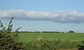
English: Kingsbury is a large village and civil parish in the North Warwickshire district of the county of Warwickshire, in the West Midlands region of England.
Subcategories
This category has the following 13 subcategories, out of 13 total.
B
F
H
- Kingsbury Hall, Warwickshire (1 F)
- Hurley Common (9 F)
K
- Kingsbury Oil Terminal (3 F)
- Kingsbury Water Park (55 F)
W
- Whateley (24 F)
- Wood End, Kingsbury (17 F)
Media in category "Kingsbury, Warwickshire"
The following 200 files are in this category, out of 248 total.
(previous page) (next page)-
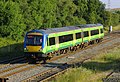 170507 at Kingsbury.jpg 1,280 × 870; 524 KB
-
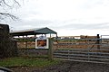 19 Gales Farmhouse Foods - geograph.org.uk - 2729026.jpg 640 × 428; 64 KB
-

-
-
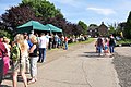 19 Gales Farmhouse Foods Pig Roast - geograph.org.uk - 3159846.jpg 640 × 425; 100 KB
-
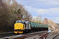 37418 with TTA tanks.jpg 2,048 × 1,365; 998 KB
-
 48101 8F John Griffiths.jpg 636 × 639; 30 KB
-
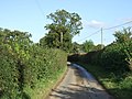
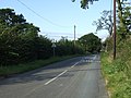
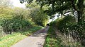 A country lane - geograph.org.uk - 5570950.jpg 1,600 × 900; 708 KB
-
 A country lane - geograph.org.uk - 5571371.jpg 1,600 × 900; 265 KB
-
 A Country lane with very neat hedges - geograph.org.uk - 2729001.jpg 640 × 428; 78 KB
-
 A duck on a rock - geograph.org.uk - 1296643.jpg 640 × 541; 102 KB
-
 A field of oil seed rape near Kingsbury - geograph.org.uk - 6170343.jpg 6,000 × 4,000; 5.11 MB
-
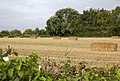
 A harvested field near Cottage Farm - geograph.org.uk - 2561074.jpg 640 × 480; 388 KB
-

-
 A view that could get me shot. - geograph.org.uk - 108597.jpg 640 × 350; 78 KB
-
 A wet December day at Cottage Farm - geograph.org.uk - 2730840.jpg 640 × 339; 46 KB
-
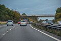
 A51 approaching the southern outskirts of Tamworth - geograph.org.uk - 5834854.jpg 1,469 × 1,102; 531 KB
-
 Across a paddock to Flanders Hall Farm - geograph.org.uk - 2728935.jpg 640 × 428; 111 KB
-
 An Old Barn on Hipsley Lane - geograph.org.uk - 2730846.jpg 640 × 428; 84 KB
-
 Arable farmland by Willowbrook Farm - geograph.org.uk - 6015958.jpg 6,000 × 4,000; 3.74 MB
-
 At the end of the lane, Cliff - geograph.org.uk - 1073614.jpg 640 × 480; 195 KB
-
 Atherstone Lane - geograph.org.uk - 3168518.jpg 640 × 480; 99 KB
-
 Atherstone Lane - geograph.org.uk - 3168527.jpg 640 × 480; 85 KB
-
 Barn, Heanley View - geograph.org.uk - 3168612.jpg 640 × 480; 97 KB
-
 Beautiful country lane - geograph.org.uk - 5571373.jpg 1,600 × 900; 528 KB
-
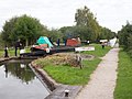
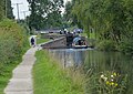
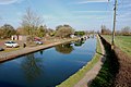
 Birmingham and Fazeley Canal - geograph.org.uk - 142375.jpg 640 × 433; 76 KB
-

-
 Birmingham and Fazeley Canal, Common Lock No 10 - geograph.org.uk - 3672660.jpg 2,000 × 1,500; 787 KB
-
 Birmingham and Fazeley Canal, Curdworth Bottom Lock - geograph.org.uk - 3677952.jpg 2,000 × 1,392; 843 KB
-
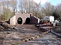
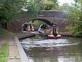 Birmingham and Fazeley Canal, Double Bridge - geograph.org.uk - 3673688.jpg 2,000 × 1,500; 862 KB
-
 Birmingham and Fazeley Canal, Lock No 8 - geograph.org.uk - 3673663.jpg 1,500 × 2,000; 807 KB
-
 Birmingham and Fazeley Canal, Lock No 9 - geograph.org.uk - 3677797.jpg 2,000 × 1,500; 645 KB
-
 Birmingham ^ Fazeley Canal - geograph.org.uk - 6011982.jpg 640 × 480; 108 KB
-
 Birmingham ^ Fazeley Canal - geograph.org.uk - 6013339.jpg 640 × 480; 33 KB
-

-

-
 Bodymoor Green Farm - geograph.org.uk - 6171750.jpg 6,000 × 4,000; 4.2 MB
-
 Bodymoor Heath Road crossing M42 - geograph.org.uk - 3195215.jpg 1,024 × 768; 541 KB
-
 Bodymoor Heath Road crossing the canal - geograph.org.uk - 4676939.jpg 800 × 587; 135 KB
-
 Bridge carrying A4097 - geograph.org.uk - 2873313.jpg 1,479 × 1,600; 856 KB
-

-
 Bridge to Holt and Hill Brow - geograph.org.uk - 1084344.jpg 640 × 480; 181 KB
-
 Busy Jet Ski Lake - geograph.org.uk - 1873285.jpg 800 × 514; 195 KB
-
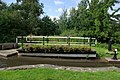
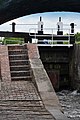 Canal Lock - geograph.org.uk - 1296688.jpg 425 × 640; 78 KB
-
-
 Cheatle's Farm Bridge - geograph.org.uk - 5049404.jpg 640 × 427; 106 KB
-
 Cheatles Farm Bridge - geograph.org.uk - 4676952.jpg 800 × 634; 177 KB
-
-
 Cliff - geograph.org.uk - 1084164.jpg 640 × 366; 200 KB
-
 Cliff Hall Lane - geograph.org.uk - 1084161.jpg 640 × 480; 189 KB
-
 Close by the track - geograph.org.uk - 6206080.jpg 2,000 × 1,330; 1.08 MB
-
 Clowning Around - geograph.org.uk - 1321226.jpg 425 × 640; 62 KB
-
 Confluence on the River Tame - geograph.org.uk - 6170264.jpg 6,000 × 4,000; 4.6 MB
-
 Cottage Farm - geograph.org.uk - 6011988.jpg 6,000 × 4,000; 7.04 MB
-
 Cottage Farm, Hipsley Lane - geograph.org.uk - 2561006.jpg 640 × 480; 364 KB
-
-
 Country roads meet - geograph.org.uk - 5577265.jpg 1,600 × 900; 396 KB
-
 Coventry Canal below Common Lock - geograph.org.uk - 5049395.jpg 640 × 427; 79 KB
-
 Cows grazing at Lower Farm - geograph.org.uk - 5049397.jpg 640 × 427; 100 KB
-
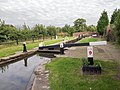
 Curdworth Bottom Lock - geograph.org.uk - 5049358.jpg 640 × 427; 85 KB
-
 Curdworth Bottom Lock - geograph.org.uk - 5183060.jpg 1,280 × 960; 372 KB
-
 Curdworth Bottom Lock No 38 - geograph.org.uk - 4842628.jpg 800 × 480; 123 KB
-

-
 Curdworth Lock No 10 - geograph.org.uk - 4842650.jpg 800 × 569; 151 KB
-

-
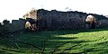 Curtain Wall, Kingsbury Old Hall - geograph.org.uk - 1073315.jpg 640 × 320; 185 KB
-
 Double Bridge - Disused canal bridge - geograph.org.uk - 1368462.jpg 640 × 425; 235 KB
-
 Double Bridge - geograph.org.uk - 5049409.jpg 640 × 427; 107 KB
-
 Double Bridge and Curdworth Lock 8 - geograph.org.uk - 4677632.jpg 800 × 569; 135 KB
-
 Double Bridge, Birmingham ^ Fazeley Canal - geograph.org.uk - 5183117.jpg 1,280 × 960; 517 KB
-
 Drainage channel near Brook End Farm - geograph.org.uk - 6015355.jpg 6,000 × 4,000; 4.25 MB
-
 Drakenage Farm - geograph.org.uk - 6170789.jpg 6,000 × 4,000; 5.19 MB
-
 East House Farm - geograph.org.uk - 3168507.jpg 640 × 480; 66 KB
-
 Echill's Wood Railway - geograph.org.uk - 1195151.jpg 640 × 480; 137 KB
-
 Edge Hill - geograph.org.uk - 3168642.jpg 640 × 480; 69 KB
-
 Emerging crop near Brook End Farm - geograph.org.uk - 6015974.jpg 6,000 × 4,000; 4.45 MB
-
 Entrance to road to Holt Hall Farm - geograph.org.uk - 1084385.jpg 640 × 315; 184 KB
-
 Farmland by Heanley Lane - geograph.org.uk - 5978055.jpg 6,000 × 4,000; 2.86 MB
-
 Farmland by the M42 - geograph.org.uk - 3672725.jpg 2,000 × 1,333; 662 KB
-
 Farmland near Brook End Farm - geograph.org.uk - 3168477.jpg 640 × 480; 99 KB
-
 Farmland near Camp Farm - geograph.org.uk - 4842948.jpg 800 × 533; 163 KB
-

-
 Farmland off Atherstone Lane - geograph.org.uk - 3168521.jpg 640 × 378; 41 KB
-
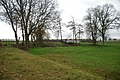
 Farmland south of Kingsbury - geograph.org.uk - 3407414.jpg 640 × 490; 54 KB
-
 Farmland, Willowbrook Farm - geograph.org.uk - 3168488.jpg 640 × 480; 74 KB
-
 Fazeley Canal Lock - geograph.org.uk - 1296547.jpg 640 × 425; 65 KB
-
 Field entrance from public footpath - geograph.org.uk - 1082374.jpg 640 × 421; 179 KB
-
 Field entrance off Heanley Lane - geograph.org.uk - 5977722.jpg 6,000 × 4,000; 4.59 MB
-
 Field entrance off Whateley Lane - geograph.org.uk - 3168651.jpg 640 × 480; 58 KB
-
 Fields of wheat by the railway line - geograph.org.uk - 6206071.jpg 2,000 × 1,330; 1.09 MB
-
 Flood defence works near Curdworth Bottom Lock - geograph.org.uk - 3677923.jpg 2,000 × 1,500; 784 KB
-
 Footpath across a field - geograph.org.uk - 6019160.jpg 6,000 × 4,000; 7.31 MB
-
 Footpath to Heanley Lane - geograph.org.uk - 5979447.jpg 6,000 × 4,000; 5.51 MB
-
 Footpath to Hipsley Lane - geograph.org.uk - 5978180.jpg 6,000 × 4,000; 4.9 MB
-
 Footpath to Hurley Common - geograph.org.uk - 5976074.jpg 6,000 × 4,000; 3.97 MB
-
 Footpaths crossing a field - geograph.org.uk - 6019150.jpg 6,000 × 4,000; 4.16 MB
-
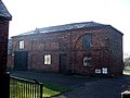
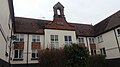 Former School, Kingsbury - geograph.org.uk - 5716651.jpg 4,128 × 2,322; 2.83 MB
-

-
 Freightliner Class 66 at Kingsbury - geograph.org.uk - 1923726.jpg 800 × 600; 89 KB
-
 Grassyard House, Heanley Lane - geograph.org.uk - 2564943.jpg 640 × 480; 347 KB
-
 Growing wheat near Kingsbury - geograph.org.uk - 6170325.jpg 6,000 × 4,000; 4.93 MB
-
 Growing wheat near Kingsbury - geograph.org.uk - 6170355.jpg 6,000 × 4,000; 4.18 MB
-
 Harvested field near Heanley Farm - geograph.org.uk - 5979432.jpg 6,000 × 4,000; 3.86 MB
-
 Heanley Lane - geograph.org.uk - 3168610.jpg 640 × 480; 78 KB
-

-
 Hemlingford Water, Kingsbury - geograph.org.uk - 5716662.jpg 4,128 × 2,322; 2.53 MB
-
 High hedgerows on Heanley Lane - geograph.org.uk - 5978019.jpg 6,000 × 4,000; 5.05 MB
-
 Hipsley Lane - geograph.org.uk - 2561088.jpg 640 × 480; 398 KB
-
 Hipsley Lane - geograph.org.uk - 3168524.jpg 640 × 480; 94 KB
-
 Holt Hall Farm bridge - geograph.org.uk - 1084314.jpg 640 × 480; 193 KB
-
 Holt Hall Farm bridge over M42 - geograph.org.uk - 3195225.jpg 1,024 × 768; 516 KB
-
 Houses by Curdworth Bottom Lock - geograph.org.uk - 5049356.jpg 640 × 427; 95 KB
-
 Houses in Church Lane - geograph.org.uk - 5571409.jpg 1,600 × 900; 364 KB
-

-
 Kimberley Hall Farm - geograph.org.uk - 5577244.jpg 1,600 × 900; 625 KB
-
 Kingsbury church - geograph.org.uk - 196200.jpg 640 × 458; 103 KB
-
 Kingsbury Foot bridge - geograph.org.uk - 2217498.jpg 1,280 × 960; 474 KB
-
 Kingsbury Junction - geograph.org.uk - 603353.jpg 640 × 480; 61 KB
-
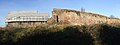 Kingsbury Old Hall - geograph.org.uk - 1073303.jpg 640 × 242; 143 KB
-
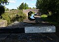
 Kingsbury Swing Bridge - geograph.org.uk - 1232038.jpg 640 × 429; 102 KB
-
 Kissing Gate and footpath to Hurley - geograph.org.uk - 2729008.jpg 640 × 428; 126 KB
-
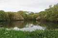 Lake near Kingsbury - geograph.org.uk - 6170285.jpg 6,000 × 4,000; 4.09 MB
-
 Lane at Kimberley Hall Farm - geograph.org.uk - 5286232.jpg 1,600 × 901; 681 KB
-
 Lane heading east towards the B4116 - geograph.org.uk - 3168493.jpg 640 × 480; 89 KB
-
 Lane near Brook End Farm - geograph.org.uk - 6015988.jpg 6,000 × 4,000; 5.14 MB
-
-
 Lock and Cheatle Farm Bridge, B^F canal - geograph.org.uk - 4263393.jpg 1,333 × 1,000; 921 KB
-
 Lock at Cheatle's Farm Bridge - geograph.org.uk - 142381.jpg 640 × 424; 80 KB
-
 Lock just North of Marston Farm Hotel - geograph.org.uk - 142379.jpg 640 × 424; 85 KB
-

-
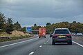
 Looking south along the M42 motorway - geograph.org.uk - 4842820.jpg 800 × 549; 108 KB
-

-
-

-
 M42 motorway crossing the River Tame - geograph.org.uk - 2333664.jpg 640 × 480; 47 KB
-
-
 M42 Motorway near Cliff - geograph.org.uk - 2333705.jpg 640 × 480; 54 KB
-
 M42 Motorway near Edge Hill - geograph.org.uk - 2333723.jpg 640 × 480; 46 KB
-
 M42 Motorway near Marston Farm Hotel - geograph.org.uk - 2332792.jpg 640 × 480; 45 KB
-
 M42 Motorway near Slateley Hall Farm - geograph.org.uk - 2333711.jpg 640 × 480; 57 KB
-
-
 Miniature railway - geograph.org.uk - 798231.jpg 640 × 480; 120 KB
-
 Miniature Railway Station Crossing - geograph.org.uk - 1321581.jpg 640 × 425; 100 KB
-
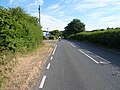
 Minor road in the country - geograph.org.uk - 5570955.jpg 1,600 × 900; 579 KB
-

-
 Name Plate - Double Bridge - geograph.org.uk - 1368466.jpg 640 × 425; 200 KB
-
-
 Natural Boggy Pool - geograph.org.uk - 1871439.jpg 800 × 532; 194 KB
-
 New tunnel on the Echill's Wood Railway - geograph.org.uk - 1195149.jpg 640 × 480; 115 KB
-
 New tunnel on the Echill's Wood Railway - geograph.org.uk - 1195150.jpg 640 × 480; 115 KB
-
 North Warwickshire , M42 Motorway - geograph.org.uk - 5951566.jpg 6,000 × 4,000; 7.23 MB
-
 North Warwickshire , M42 Motorway - geograph.org.uk - 5951567.jpg 6,000 × 4,000; 7.05 MB
-
 North Warwickshire , M42 Motorway - geograph.org.uk - 5951568.jpg 6,000 × 4,000; 7.19 MB
-
 North Warwickshire , M42 Motorway - geograph.org.uk - 5951569.jpg 6,000 × 4,000; 7.1 MB
-
 North Warwickshire , M42 Motorway - geograph.org.uk - 5951570.jpg 6,000 × 4,000; 6.53 MB
-
 North Warwickshire , M42 Motorway - geograph.org.uk - 5951571.jpg 6,000 × 4,000; 7.25 MB
-
 North Warwickshire , M42 Motorway - geograph.org.uk - 5951572.jpg 6,000 × 4,000; 6.33 MB
-
 North Warwickshire , M42 Motorway - geograph.org.uk - 5951573.jpg 6,000 × 4,000; 6.61 MB
-
 Oil Seed Rape on the HOEW - geograph.org.uk - 451196.jpg 640 × 480; 154 KB
-
 Old canal side cottages - geograph.org.uk - 1296625.jpg 393 × 640; 94 KB
-
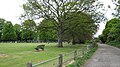 Open space near Kingsbury Church - geograph.org.uk - 1899319.jpg 1,168 × 656; 219 KB
-
 Ornamental trees near Hipsley Farm - geograph.org.uk - 2561102.jpg 640 × 480; 372 KB
-
 Part of the Kingsbury Oil Depot - geograph.org.uk - 2892203.jpg 640 × 425; 75 KB
-

-
 Path by the River Tame - geograph.org.uk - 6170193.jpg 6,000 × 4,000; 5.58 MB
-

-
 Planters Garden Centre - geograph.org.uk - 4690512.jpg 800 × 450; 175 KB
-
 Pond by Heanley Farm - geograph.org.uk - 5978149.jpg 6,000 × 4,000; 4.48 MB
-
 Power lines cross the M42 - geograph.org.uk - 1888026.jpg 640 × 480; 43 KB
-
 Preparing to Ride - geograph.org.uk - 1321588.jpg 425 × 640; 91 KB
-

-
 Railway embankment and fencing - geograph.org.uk - 3407408.jpg 640 × 525; 71 KB
-
 River Tame and part of Water Park - geograph.org.uk - 856117.jpg 640 × 480; 164 KB
-
 River Tame at Hemlingford - geograph.org.uk - 5716615.jpg 4,128 × 2,322; 4.07 MB
-
 River Tame at Hemlingford Mill - geograph.org.uk - 4842909.jpg 800 × 600; 88 KB
-
 River Tame, Hemlingford - geograph.org.uk - 5716624.jpg 2,448 × 688; 471 KB
-

-

-
 Silage bales in a field - geograph.org.uk - 6019175.jpg 6,000 × 4,000; 4.16 MB
-
 Slateley - geograph.org.uk - 1084194.jpg 640 × 244; 159 KB
-
 Slateley from Holt - geograph.org.uk - 1084221.jpg 640 × 186; 71 KB
-
 Slateley Hall - geograph.org.uk - 1084192.jpg 640 × 480; 181 KB
-
 Solar panels and Monkey Puzzle - geograph.org.uk - 2567424.jpg 640 × 480; 384 KB
-

-
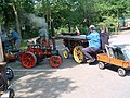 Steam Rally - geograph.org.uk - 798233.jpg 640 × 480; 116 KB
-

-
 Stile on footpath, Cliff - geograph.org.uk - 1082372.jpg 640 × 480; 181 KB
-
 Straw bales in a field - geograph.org.uk - 3672691.jpg 2,000 × 1,349; 822 KB
-
 Tamworth Road (A51) bridge over M42 - geograph.org.uk - 3195218.jpg 1,024 × 768; 529 KB
-
 Tamworth Road heading north - geograph.org.uk - 3168615.jpg 640 × 480; 86 KB
-
 The A4097 at Hemlingford Green - geograph.org.uk - 4842913.jpg 800 × 572; 122 KB
-
 The A51 Tamworth Road just north of Cliff Farm - geograph.org.uk - 5834839.jpg 1,403 × 1,052; 652 KB
-
-
 The Heart of England Way at Kingsbury - geograph.org.uk - 6170307.jpg 6,000 × 4,000; 4.91 MB
-
 The Heart of England Way at Kingsbury - geograph.org.uk - 6170312.jpg 6,000 × 4,000; 5.18 MB
-

-
 The Heart of England Way footpath - geograph.org.uk - 4787514.jpg 450 × 600; 44 KB
-
 The Heart of England Way near Kingsbury - geograph.org.uk - 6170321.jpg 6,000 × 4,000; 5.35 MB
-
 The Holly Equestrian Centre - geograph.org.uk - 2727691.jpg 640 × 428; 63 KB
-


_bridge_over_M42_-_geograph.org.uk_-_3195218.jpg)


