Category:Kinsham
civil parish in Herefordshire, England, UK .jpg) | |||||
| Upload media | |||||
| Instance of | |||||
|---|---|---|---|---|---|
| Location | Herefordshire, West Midlands, England | ||||
 | |||||
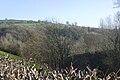
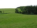
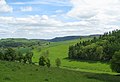
English: The village of Kinsham lies in the wooded hills of Herefordshire, England in the Marches near to the border with Wales and near the town of Presteigne. Surrounding villages include Stapleton and Lingen. Kinsham lies on the River Lugg. The 2001 census records that 71 people lived in the parish of Kinsham, of whom 32 were male and 39 female.
Subcategories
This category has the following 4 subcategories, out of 4 total.
A
- All Saints' Church, Kinsham (1 F)
C
- Kinsham Court (3 F)
L
- Lower Kinsham (3 F)
U
- Upper Kinsham (2 F)
Media in category "Kinsham"
The following 59 files are in this category, out of 59 total.
-

-
 An Ancient Yew at Kinsham Chapel - geograph.org.uk - 4444057.jpg 1,980 × 1,320; 3.25 MB
-
 Around Limebrook - geograph.org.uk - 5014577.jpg 640 × 427; 77 KB
-
 Bluebells in Down's Wood - Lingen, Herefordshire - geograph.org.uk - 4103372.jpg 3,072 × 2,304; 3.73 MB
-
 Choose wisely^ - geograph.org.uk - 846878.jpg 640 × 480; 112 KB
-
 Cole's Hill Wood - geograph.org.uk - 6004926.jpg 1,024 × 683; 498 KB
-
 Down's Wood - geograph.org.uk - 6004908.jpg 1,024 × 683; 512 KB
-
 Down's Wood - geograph.org.uk - 6005541.jpg 1,024 × 683; 383 KB
-
 Down's Wood pasture - geograph.org.uk - 846861.jpg 640 × 480; 97 KB
-
 Edge of Birchen Coppice - geograph.org.uk - 846855.jpg 640 × 480; 98 KB
-
 Edge of Coles Hill wood - geograph.org.uk - 846865.jpg 640 × 480; 60 KB
-
 Edge of the woods - geograph.org.uk - 846906.jpg 640 × 480; 118 KB
-
 Endless wheat - geograph.org.uk - 846909.jpg 640 × 480; 92 KB
-
 Entrance to Upper Kinsham Farm - geograph.org.uk - 903969.jpg 640 × 459; 51 KB
-
 Field beneath Cole's Hill - geograph.org.uk - 4701331.jpg 1,024 × 684; 358 KB
-
 Field gate at Kinsham Cross in the rain - geograph.org.uk - 5590306.jpg 1,600 × 1,067; 717 KB
-
 Ford at Lower Yeld - geograph.org.uk - 4294413.jpg 3,872 × 2,592; 4.9 MB
-
 Fortified depression, Cole's Hill - geograph.org.uk - 6004925.jpg 1,024 × 683; 421 KB
-
 Gate on the edge of Down's Wood - geograph.org.uk - 3550595.jpg 640 × 480; 95 KB
-
 Hillside and fields - geograph.org.uk - 822845.jpg 640 × 480; 27 KB
-
 Hillside near Down's Wood - geograph.org.uk - 3550593.jpg 640 × 480; 72 KB
-
 House in Kinsham - geograph.org.uk - 765739.jpg 640 × 426; 92 KB
-
 Into Birchen Coppice - geograph.org.uk - 846858.jpg 640 × 480; 143 KB
-
 Into the shade at Birchen Coppice - Lingen, Herefordshire - geograph.org.uk - 4103364.jpg 2,754 × 2,304; 2.65 MB
-
 Karting Circuit - geograph.org.uk - 846923 (cropped).jpg 640 × 290; 125 KB
-
 Karting Circuit - geograph.org.uk - 846923.jpg 640 × 480; 77 KB
-
 Karting track, Kinsham - geograph.org.uk - 5230678.jpg 1,024 × 683; 212 KB
-
 Kinsham - geograph.org.uk - 765731.jpg 640 × 426; 76 KB
-
 Kinsham Baptist Church - geograph.org.uk - 61486.jpg 640 × 541; 211 KB
-
 Kinsham Court, view from the terrace (1294466).jpg 1,000 × 711; 74 KB
-
 Kinsham Cross junction - geograph.org.uk - 2587673.jpg 640 × 480; 64 KB
-
 Kinsham from the air - geograph.org.uk - 930081.jpg 640 × 426; 63 KB
-
 Kinsham Village Sign - geograph.org.uk - 4264865.jpg 640 × 480; 71 KB
-

-
 Lane to Lingen - geograph.org.uk - 903983.jpg 640 × 475; 52 KB
-
 Looking back at Birchen - Lingen, Herefordshire - geograph.org.uk - 4103386.jpg 3,067 × 2,092; 1.41 MB
-
 Looking towards Lingen, Herefordshire - geograph.org.uk - 4103394.jpg 3,072 × 1,995; 1.11 MB
-
 Noisy Hall - geograph.org.uk - 846872.jpg 640 × 480; 106 KB
-
 On Cole's Hill - geograph.org.uk - 6005536.jpg 1,024 × 683; 314 KB
-
 Path on the edge of Downs Wood - geograph.org.uk - 3550589.jpg 640 × 480; 110 KB
-
 Road to Cole's Hill - geograph.org.uk - 4686021.jpg 800 × 450; 354 KB
-
 Sheep, Letchmoor - geograph.org.uk - 4686026.jpg 800 × 450; 344 KB
-
 Summit, Cole's Hill - geograph.org.uk - 6005535.jpg 1,024 × 683; 336 KB
-
 The drive Kinsham Court (1294670).jpg 1,000 × 717; 116 KB
-
 Toposcope on Cole's Hill - geograph.org.uk - 6005554.jpg 1,024 × 683; 322 KB
-
 Tractor Tracks - geograph.org.uk - 846846.jpg 480 × 640; 103 KB
-
 View off Cole's Hill - geograph.org.uk - 6005548.jpg 1,024 × 683; 285 KB
-
 Viewpoint indicator detail - geograph.org.uk - 6005543.jpg 1,024 × 683; 322 KB
-
 Viewpoint indicator detail - geograph.org.uk - 6005544.jpg 1,024 × 683; 320 KB
-
 Woodland on Cole's Hill - geograph.org.uk - 6005533.jpg 1,024 × 683; 479 KB
-
 Yeld Wood - geograph.org.uk - 71865.jpg 640 × 480; 112 KB
-

-
 Fields, Limebrook Wood and the hill beyond - geograph.org.uk - 44217.jpg 640 × 480; 146 KB
-
 Ford at Lower Yeld - geograph.org.uk - 60935.jpg 640 × 480; 130 KB
-
 Gathering pens, Deerfold - geograph.org.uk - 506885.jpg 480 × 640; 91 KB
-
 Gravel Extraction - geograph.org.uk - 67974.jpg 640 × 479; 51 KB
-
 Ryland's Wood - geograph.org.uk - 71860.jpg 640 × 480; 96 KB
-
 The lane between Cadwell and Upper Kinsham - geograph.org.uk - 44212.jpg 640 × 480; 152 KB
-
 Waterloo - geograph.org.uk - 61488.jpg 640 × 464; 120 KB


.jpg)


.jpg)


