Category:Kirche Kosel (Niesky)
| Object location | | View all coordinates using: OpenStreetMap |
|---|
church building in Niesky, Saxony, Germany  | |||||
| Upload media | |||||
| Instance of | |||||
|---|---|---|---|---|---|
| Location | Kosel, Niesky, Görlitz, Saxony, Germany | ||||
| Street address |
| ||||
| Heritage designation | |||||
| Inception |
| ||||
 | |||||
| (Wikidata) |
Subcategories
This category has only the following subcategory.
I
Media in category "Kirche Kosel (Niesky)"
The following 8 files are in this category, out of 8 total.
-
 Niesky Kosel - Krebaer Straße - Kirche ex 01 ies.jpg 5,616 × 3,744; 7.47 MB
-
 Niesky Kosel - Krebaer Straße - Kirche ex 02 ies.jpg 5,616 × 3,744; 7.85 MB
-
 Niesky Kosel - Krebaer Straße - Kirche ex 03 ies.jpg 5,616 × 3,744; 9.63 MB
-
 Niesky Kosel - Krebaer Straße - Kirche ex 04 ies.jpg 3,744 × 5,616; 5.97 MB
-
 Niesky Kosel - Krebaer Straße - Kirche ex 05 ies.jpg 5,616 × 3,744; 7.67 MB
-
 Niesky Kosel - Krebaer Straße - Kirche ex 06 ies.jpg 5,616 × 3,744; 11.8 MB
-
 Niesky Kosel - Krebaer Straße - Kirche ex 07 ies.jpg 5,616 × 3,744; 7.35 MB
-
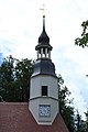
 Niesky Kosel Kirche.jpg 1,824 × 1,368; 1.08 MB


