Category:Kirche Kunnersdorf
| Object location | | View all coordinates using: OpenStreetMap |
|---|
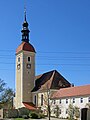
church building in Schöpstal, Germany  | |||||
| Upload media | |||||
| Instance of | |||||
|---|---|---|---|---|---|
| Location | Kunnersdorf (Schöpstal), Schöpstal, Q879194, Görlitz, Saxony, Germany | ||||
| Street address |
| ||||
| Heritage designation | |||||
| Inception |
| ||||
 | |||||
| (Wikidata) |
Media in category "Kirche Kunnersdorf"
The following 23 files are in this category, out of 23 total.
-
 20070519010DR Kunnersdorf (Schöpstal) Kirche Kretscham.jpg 2,380 × 1,848; 3.59 MB
-
 Kirche Kunnersdorf am Abend.jpeg 3,024 × 4,032; 1.08 MB
-
 Kirche Kunnersdorf Juni 2018 (1).jpg 3,648 × 5,472; 4.2 MB
-
 Kirche Kunnersdorf Juni 2018 (10).jpg 3,648 × 5,472; 4.04 MB
-
 Kirche Kunnersdorf Juni 2018 (11).jpg 5,472 × 3,648; 5.03 MB
-
 Kirche Kunnersdorf Juni 2018 (12).jpg 5,472 × 3,648; 4.88 MB
-
 Kirche Kunnersdorf Juni 2018 (13).jpg 3,648 × 5,472; 7.92 MB
-
 Kirche Kunnersdorf Juni 2018 (14).jpg 5,472 × 3,648; 7.73 MB
-
 Kirche Kunnersdorf Juni 2018 (15).jpg 5,472 × 3,648; 4.62 MB
-
 Kirche Kunnersdorf Juni 2018 (2).jpg 3,648 × 5,472; 4.14 MB
-
 Kirche Kunnersdorf Juni 2018 (3).jpg 5,472 × 3,648; 4.58 MB
-
 Kirche Kunnersdorf Juni 2018 (4).jpg 3,648 × 5,472; 4.84 MB
-
 Kirche Kunnersdorf Juni 2018 (5).jpg 5,472 × 3,648; 4.97 MB
-
 Kirche Kunnersdorf Juni 2018 (6).jpg 5,472 × 3,648; 5.04 MB
-
 Kirche Kunnersdorf Juni 2018 (7).jpg 3,648 × 5,472; 4.94 MB
-
 Kirche Kunnersdorf Juni 2018 (8).jpg 5,472 × 3,648; 4.93 MB
-
 Kirche Kunnersdorf Juni 2018 (9).jpg 3,648 × 5,472; 5.04 MB
-
 Schoepstal Kunnersdorf Kirche 1.jpg 1,642 × 2,189; 1.14 MB
-
 Schoepstal Kunnersdorf Kirche.jpg 2,189 × 1,642; 966 KB
-
 Schöpstal Kunnersdorf - Kirchplatz - Friedhof+Kirche 01 ies.jpg 5,616 × 3,744; 11.23 MB
-
 Schöpstal Kunnersdorf - Kirchplatz - Friedhof+Kirche 02 ies.jpg 5,616 × 3,744; 11.21 MB
-
 Schöpstal Kunnersdorf - Kirchplatz - Kirche 01 ies.jpg 3,744 × 5,616; 11.24 MB
-
 Schöpstal Kunnersdorf - Kirchplatz - Kirche 02 ies.jpg 3,744 × 5,616; 13.21 MB
_Kirche_Kretscham.jpg)

.jpg)
.jpg)
.jpg)
.jpg)
.jpg)
.jpg)
.jpg)
.jpg)
.jpg)
.jpg)
.jpg)
.jpg)
.jpg)
.jpg)
.jpg)


