Category:Kirkgunzeon
village in Dumfries and Galloway, Scotland, UK  | |||||
| Upload media | |||||
| Instance of | |||||
|---|---|---|---|---|---|
| Location |
| ||||
 | |||||
Kirkgunzeon is a Civil Parish area in Kirkcudbrightshire.
For placenames in Kirkgunzeon see : http://www.kirkcudbright.co/places.asp?ID=28
Subcategories
This category has the following 5 subcategories, out of 5 total.
C
- Corra Castle, Kirkgunzeon (1 F)
D
- Drumcoltran Tower (14 F)
F
- Loch Fern (1 F)
K
- Kirkgunzeon railway station (2 F)
Media in category "Kirkgunzeon"
The following 79 files are in this category, out of 79 total.
-
 Abandoned cottage - geograph.org.uk - 609969.jpg 639 × 479; 101 KB
-
 Across the Fields - geograph.org.uk - 879439.jpg 640 × 466; 90 KB
-
 Apartheid^ - geograph.org.uk - 609962.jpg 639 × 479; 74 KB
-
 Barclosh Hill - geograph.org.uk - 134946.jpg 640 × 480; 162 KB
-
 Barn by Drumjohn. - geograph.org.uk - 134236.jpg 640 × 480; 59 KB
-
 Below Porterbelly Hill. - geograph.org.uk - 134250.jpg 640 × 466; 48 KB
-
 Bend by the gate - geograph.org.uk - 609952.jpg 639 × 479; 77 KB
-
 Blairshinnoch - geograph.org.uk - 582706.jpg 640 × 480; 67 KB
-
 Blairshinnoch Cottage - geograph.org.uk - 906612.jpg 640 × 361; 28 KB
-
 Blairshinnoch Farm - geograph.org.uk - 906465.jpg 640 × 480; 87 KB
-
 Blocked Track Near Byrecroft - geograph.org.uk - 263687.jpg 640 × 480; 194 KB
-
 Breconside farm - geograph.org.uk - 610212.jpg 639 × 479; 50 KB
-
 Bridge in Kirkgunzeon - geograph.org.uk - 582683.jpg 640 × 480; 91 KB
-
 Bridge to Culkiest - geograph.org.uk - 724732.jpg 640 × 480; 125 KB
-
 Burn Near Killywhan - geograph.org.uk - 263588.jpg 640 × 480; 206 KB
-
 Cattle at Porterbelly - geograph.org.uk - 907054.jpg 640 × 403; 85 KB
-
 Clawbelly Hill Summit - geograph.org.uk - 1775369.jpg 3,264 × 2,318; 748 KB
-
 Clouds over Kirkgunzeon - geograph.org.uk - 1520107.jpg 640 × 480; 54 KB
-
 Corra Castle - geograph.org.uk - 134240.jpg 640 × 480; 76 KB
-
 Country Road - geograph.org.uk - 672455.jpg 640 × 424; 88 KB
-
 Cowar farm - geograph.org.uk - 609997.jpg 639 × 479; 96 KB
-
 Culkiest Sign - geograph.org.uk - 724704.jpg 640 × 416; 55 KB
-
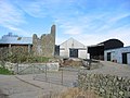
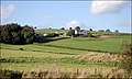
 Drumcoltran Farm - geograph.org.uk - 254125.jpg 640 × 480; 191 KB
-
 Dyke, Corgeith - geograph.org.uk - 134244.jpg 639 × 426; 45 KB
-
 Edge of a small wooded area at Plascow - geograph.org.uk - 582558.jpg 640 × 480; 112 KB
-
 Edge of Wood - geograph.org.uk - 1775400.jpg 3,264 × 2,448; 801 KB
-
 Falgunzeon Farm - geograph.org.uk - 687412.jpg 640 × 413; 71 KB
-
 Farm Shed - geograph.org.uk - 877527.jpg 640 × 449; 97 KB
-

-
 Glaisters Cottage - geograph.org.uk - 582577.jpg 640 × 480; 83 KB
-
 Glaisters, Kirkgunzeon - geograph.org.uk - 743949.jpg 640 × 480; 67 KB
-
 Hawthorn Tree - geograph.org.uk - 906544.jpg 640 × 449; 67 KB
-
 How Far to Killywhan^ - geograph.org.uk - 129328.jpg 640 × 480; 162 KB
-
 Isles - geograph.org.uk - 134958.jpg 640 × 480; 83 KB
-
 Kenmuir Knowe - geograph.org.uk - 134659.jpg 640 × 480; 93 KB
-
 Killywhan - geograph.org.uk - 906452.jpg 640 × 480; 81 KB
-
 Kirk in Kirkgunzeon - geograph.org.uk - 582685.jpg 640 × 480; 96 KB
-
 Kirkgunzeon - geograph.org.uk - 672468.jpg 640 × 411; 55 KB
-
 Kirkgunzeon - geograph.org.uk - 879397.jpg 640 × 372; 73 KB
-
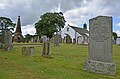 Kirkgunzeon Churchyard Dumfries and Galloway.jpg 4,928 × 3,264; 9.69 MB
-
 Kirkgunzeon Kirk and McWhire Monument - geograph.org.uk - 797307.jpg 640 × 480; 148 KB
-
 Kirkgunzeon Lane - geograph.org.uk - 724716.jpg 640 × 480; 83 KB
-
 Kirkgunzeon Parish Church.jpg 4,928 × 3,264; 9.42 MB
-
 Kirkgunzeon War Memorial - geograph.org.uk - 724777.jpg 389 × 640; 63 KB
-
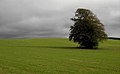 Lone Tree - geograph.org.uk - 1520079.jpg 640 × 395; 41 KB
-
 Looking over to Drum - geograph.org.uk - 518964.jpg 640 × 385; 94 KB
-
 Lotus Hill - geograph.org.uk - 412729.jpg 640 × 428; 130 KB
-
 Lower Porterbelly - geograph.org.uk - 571314.jpg 640 × 480; 145 KB
-
 Maxwell Memorial Hall, Kirkgunzeon - geograph.org.uk - 582678.jpg 640 × 480; 82 KB
-
 Minor Road Near Old Blairshinnoch - geograph.org.uk - 263641.jpg 640 × 480; 225 KB
-
 Northern slope of Lotus Hill - geograph.org.uk - 1418444.jpg 640 × 480; 92 KB
-
 Once a farm - geograph.org.uk - 609955.jpg 639 × 479; 81 KB
-
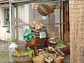 Organic Fruit and Vegetables - geograph.org.uk - 582964.jpg 640 × 480; 109 KB
-
 Outbuildings - geograph.org.uk - 907080.jpg 640 × 386; 87 KB
-
 Overlooking the Culloch burn - geograph.org.uk - 609989.jpg 640 × 480; 82 KB
-
 Road past Plascow Cottage - geograph.org.uk - 582570.jpg 640 × 480; 89 KB
-
 Road to Conniven - geograph.org.uk - 609974.jpg 639 × 479; 84 KB
-
 Road, looking toward Killymingan - geograph.org.uk - 582689.jpg 640 × 480; 84 KB
-
 Rough Land - geograph.org.uk - 907066.jpg 640 × 480; 85 KB
-
 Sawmill, Barclosh. - geograph.org.uk - 134925.jpg 640 × 480; 141 KB
-
 Sawmill, Barclosh. - geograph.org.uk - 134930.jpg 618 × 400; 64 KB
-
 Shetland ponies at Killywhan - geograph.org.uk - 582709.jpg 640 × 480; 74 KB
-
 Still Air - geograph.org.uk - 1050676.jpg 640 × 381; 23 KB
-
 Substantial field wall - geograph.org.uk - 609948.jpg 639 × 479; 67 KB
-
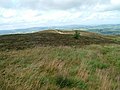
 Summit of Clawbelly Hill - geograph.org.uk - 1775376.jpg 3,264 × 2,070; 802 KB
-
 Sunlit Tree Clump - geograph.org.uk - 530951.jpg 640 × 341; 73 KB
-
 The A711 road north of Dalbeattie - geograph.org.uk - 571319.jpg 640 × 480; 146 KB
-
 The Ram - geograph.org.uk - 687428.jpg 480 × 640; 102 KB
-
 Towards Lotus - geograph.org.uk - 906526.jpg 640 × 450; 78 KB
-
 Track to a gate at Plascow - geograph.org.uk - 582555.jpg 640 × 480; 141 KB
-
 Track to Lawston - geograph.org.uk - 263590.jpg 640 × 480; 282 KB
-
 Trees around Cowar farm - geograph.org.uk - 609994.jpg 639 × 479; 86 KB
-
 Trunk shadows on dead leaves - geograph.org.uk - 610224.jpg 639 × 479; 66 KB
-
 View of Glaisters - geograph.org.uk - 582574.jpg 640 × 480; 76 KB
-
 View towards Drum - geograph.org.uk - 530941.jpg 640 × 311; 74 KB
-
 View towards Lochfoot - geograph.org.uk - 530953.jpg 640 × 267; 67 KB
-
 Whiteside - geograph.org.uk - 134233.jpg 640 × 480; 89 KB
-
 Whiteside - geograph.org.uk - 135140.jpg 640 × 480; 81 KB
-
 Whiteside - geograph.org.uk - 870771.jpg 640 × 364; 82 KB


