Category:Kirknewton, Northumberland
village and civil parish in Northumberland, United Kingdom  | |||||
| Upload media | |||||
| Instance of | |||||
|---|---|---|---|---|---|
| Location | Northumberland, North East England, England | ||||
 | |||||
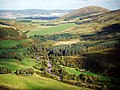
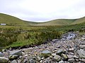
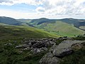
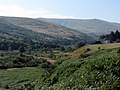
English: Kirknewton is a Northumbrian village to the north of the county of Northumberland, about from the town of Wooler and roughly the same distance to the Scottish Borders. The village lies in the valley of Glendale, which takes its name from the River Glen, whose source at the confluence of the Bowmont Water and the College Burn lies at the west end of the village.
Subcategories
This category has the following 24 subcategories, out of 24 total.
B
- Black Hag, Kirknewton (4 F)
C
- Coldside Hill (1 F)
- Crookhouse, Northumberland (3 F)
E
- Ell's Knowe, Kirknewton (1 F)
- Elsdonburn Farm, Kirknewton (3 F)
G
- Great Hetha (3 F)
H
- Hare Law, Kirknewton (2 F)
M
- Madam Law, Kirknewton (5 F)
N
- Newton Tors (7 F)
S
- Saughieside Hill, Kirknewton (1 F)
- Scaldhill Shank, Kirknewton (2 F)
- Shorthope Shank, Kirknewton (2 F)
T
- Trowup Burn, Kirknewton (2 F)
W
- Westnewton, Northumberland (49 F)
- White Law (11 F)
- Wideopen Head, Kirknewton (1 F)
Y
- Yeavering (9 F)
- Yeavering Bell (23 F)
Media in category "Kirknewton, Northumberland"
The following 200 files are in this category, out of 1,015 total.
(previous page) (next page)-
 1-4 Hethpool Cottages - geograph.org.uk - 5068186.jpg 1,066 × 800; 236 KB
-
 A boulder in the Bizzle Burn - geograph.org.uk - 2484558.jpg 427 × 640; 276 KB
-
 A cairn on West Hill - geograph.org.uk - 2484481.jpg 640 × 427; 214 KB
-
 A dried up Bizzle Burn - geograph.org.uk - 2484569.jpg 640 × 427; 236 KB
-
 A dry stream bed - geograph.org.uk - 6228745.jpg 1,200 × 1,600; 912 KB
-
 A fence at Foulburn Gair - geograph.org.uk - 1021526.jpg 640 × 427; 142 KB
-
 A glaciated corrie in the Cheviot Hills - geograph.org.uk - 2487517.jpg 640 × 427; 275 KB
-
 A power line pole at Kirknewton - geograph.org.uk - 2423509.jpg 416 × 640; 202 KB
-
 A prominent waterfall in the Hen Hole - geograph.org.uk - 6223280.jpg 1,200 × 1,600; 895 KB
-
 A series of waterfalls in the Hen Hole - geograph.org.uk - 6223292.jpg 1,200 × 1,600; 805 KB
-
 A small waterfall in the Hen Hole - geograph.org.uk - 6223262.jpg 1,200 × 1,600; 875 KB
-
 A splendid dry stone wall climbs up towards Wester Tor - geograph.org.uk - 3659696.jpg 1,600 × 1,200; 408 KB
-
 A view to The Bizzle - geograph.org.uk - 6228726.jpg 1,600 × 1,200; 679 KB
-
 About to cross the stream below Yeavering Bell - geograph.org.uk - 3107209.jpg 4,000 × 3,000; 4.62 MB
-
 Above the Hen Hole - geograph.org.uk - 6223222.jpg 1,600 × 1,200; 918 KB
-
 Above the upper waterfall on College Burn - geograph.org.uk - 4089504.jpg 768 × 1,024; 401 KB
-
 Above the waterfall, Hen Hole - geograph.org.uk - 3131224.jpg 1,024 × 769; 337 KB
-
 Access Land sign - geograph.org.uk - 4118909.jpg 1,024 × 678; 189 KB
-
 Access road to Kirknewton - geograph.org.uk - 5996025.jpg 4,000 × 3,000; 2.96 MB
-
 Adoration of the Magi, Kirknewton Church - geograph.org.uk - 2105153.jpg 768 × 1,024; 193 KB
-
 Aircraft crash site near Braydon Crag - geograph.org.uk - 3132838.jpg 3,000 × 1,602; 1.51 MB
-
 Aircraft wreckage and Braydon Crag, West Hill - geograph.org.uk - 6134220.jpg 1,200 × 1,600; 686 KB
-
 Aircraft wreckage on West Hill - geograph.org.uk - 2484506.jpg 640 × 427; 291 KB
-
 Aircraft wreckage on West Hill - geograph.org.uk - 2484516.jpg 419 × 640; 245 KB
-
 Aircraft wreckage on West Hill - geograph.org.uk - 2484523.jpg 480 × 640; 228 KB
-

-

-
 Amongst Bog Asphodels - geograph.org.uk - 6228731.jpg 1,600 × 1,200; 698 KB
-
 Another waterfall in the Hen Hole - geograph.org.uk - 3132539.jpg 768 × 1,024; 315 KB
-
-
 Ash tree near Torleehouse - geograph.org.uk - 3723912.jpg 640 × 480; 309 KB
-
 Auchope Cairn - geograph.org.uk - 2051296.jpg 640 × 480; 91 KB
-
 Auchope Cairn - geograph.org.uk - 2051297.jpg 640 × 480; 77 KB
-
 Auchope Cairn - geograph.org.uk - 2051300.jpg 640 × 480; 85 KB
-
 Auchope Cairn - geograph.org.uk - 3047084.jpg 1,024 × 768; 279 KB
-
 Auchope Cairn - geograph.org.uk - 4566719.jpg 1,024 × 769; 234 KB
-
 Auchope Cairn from the west - geograph.org.uk - 4569680.jpg 1,024 × 768; 214 KB
-
 Auchope Mountain Refuge Hut - geograph.org.uk - 3047193.jpg 1,024 × 768; 202 KB
-
 B6351 - geograph.org.uk - 4851292.jpg 1,024 × 768; 257 KB
-
 B6351, Yeavering - geograph.org.uk - 4852895.jpg 1,024 × 768; 461 KB
-
 Bales, Yeavering - geograph.org.uk - 4852893.jpg 1,024 × 768; 304 KB
-
 Bath planter, Mounthooly Cottage - geograph.org.uk - 4096584.jpg 1,024 × 768; 368 KB
-
 Battlestone, Yeavering - geograph.org.uk - 3446251.jpg 4,516 × 3,330; 5.73 MB
-
 Bellyside Burn - geograph.org.uk - 3117156.jpg 3,648 × 2,736; 4.35 MB
-
 Bellyside Burn - geograph.org.uk - 4149834.jpg 1,600 × 1,200; 816 KB
-
 Bellyside Burn - geograph.org.uk - 6195195.jpg 1,600 × 1,200; 759 KB
-
 Bellyside Crag - geograph.org.uk - 2484530.jpg 640 × 427; 270 KB
-
 Bellyside Crag - geograph.org.uk - 5393762.jpg 1,600 × 1,200; 668 KB
-
 Bellyside Crag - geograph.org.uk - 5787655.jpg 1,600 × 1,200; 644 KB
-
 Bellyside Crag and beyond - geograph.org.uk - 6134294.jpg 1,600 × 1,200; 619 KB
-
 Bellyside Crag from south-east - geograph.org.uk - 4089182.jpg 767 × 1,024; 454 KB
-
 Bellyside Hill - geograph.org.uk - 2484545.jpg 640 × 427; 234 KB
-
 Bellyside Hill - geograph.org.uk - 5393777.jpg 1,600 × 1,200; 715 KB
-
 Bellyside Hill towards The Bizzle - geograph.org.uk - 4088972.jpg 1,024 × 769; 335 KB
-
 Bend in fence, Great Moor - geograph.org.uk - 4016632.jpg 1,024 × 767; 304 KB
-
 Beneath Easter Tor - geograph.org.uk - 3777257.jpg 640 × 480; 312 KB
-
 Birnie Brae moorland - geograph.org.uk - 4506836.jpg 640 × 480; 63 KB
-
 Bizzle Burn - geograph.org.uk - 3102676.jpg 2,736 × 3,648; 3.69 MB
-
 Bizzle Burn - geograph.org.uk - 5787610.jpg 1,600 × 1,200; 595 KB
-
 Bizzle Burn - geograph.org.uk - 6195177.jpg 1,600 × 1,200; 852 KB
-
 Bizzle Burn above Dunsdale - geograph.org.uk - 3100706.jpg 1,024 × 768; 269 KB
-
 Bizzle Burn by Dunsdale - geograph.org.uk - 4088924.jpg 1,024 × 767; 360 KB
-
 Bizzle Crags - geograph.org.uk - 2487510.jpg 640 × 427; 248 KB
-
 Bizzle Crags - geograph.org.uk - 3100058.jpg 1,024 × 768; 265 KB
-
 Bizzle Crags from Mid Hill - geograph.org.uk - 3100037.jpg 1,024 × 768; 192 KB
-
 Bizzle Crags from north-east - geograph.org.uk - 3100105.jpg 1,024 × 768; 298 KB
-
 Bizzle Crags from the west - geograph.org.uk - 3133864.jpg 1,024 × 768; 177 KB
-
 Black Bog east of Haddon Hill - geograph.org.uk - 3154556.jpg 1,024 × 769; 279 KB
-
 Black Hag - geograph.org.uk - 4156473.jpg 2,560 × 1,920; 2.81 MB
-
 Black Hag - geograph.org.uk - 4506819.jpg 640 × 480; 73 KB
-
 Bleached rushes by the upper Common Burn - geograph.org.uk - 4017010.jpg 1,024 × 768; 327 KB
-
 Bluebells In Bloom By The Bowmont Water - geograph.org.uk - 5375937.jpg 1,600 × 1,201; 1.02 MB
-
 Boeing B-17G Flying Fortress tailwheel remains - geograph.org.uk - 6134228.jpg 1,600 × 1,200; 938 KB
-

-
 Boeing B-17G Flying Fortress turbo-supercharger - geograph.org.uk - 6134242.jpg 1,200 × 1,600; 862 KB
-

-
 Boeing B-17G Flying Fortress undercarriage - geograph.org.uk - 6134276.jpg 1,200 × 1,600; 666 KB
-
 Boggy moorland north-east of Coldburn Hill - geograph.org.uk - 4017000.jpg 1,024 × 768; 250 KB
-
 Boulder on Saughieside Hill - geograph.org.uk - 3883066.jpg 1,200 × 1,600; 657 KB
-
 Boundary corner between Hare Law ^ Newton Tors - geograph.org.uk - 4017422.jpg 1,024 × 768; 242 KB
-
 Bowmont Water - geograph.org.uk - 5375926.jpg 1,201 × 1,600; 661 KB
-
 Bowmont Water Near Westnewton - geograph.org.uk - 5375920.jpg 1,600 × 1,039; 417 KB
-
 Bracken hides the College Burn - geograph.org.uk - 3659302.jpg 1,600 × 1,200; 423 KB
-
 Braydon Crag - geograph.org.uk - 2484498.jpg 640 × 427; 214 KB
-

-
 Braydon Crag, West Hill - geograph.org.uk - 3132811.jpg 1,024 × 768; 187 KB
-
 Bridge across College Burn, Hethpool - geograph.org.uk - 3105348.jpg 4,000 × 3,000; 4.8 MB
-

-
 Bridleway to Mid Hill - geograph.org.uk - 3445933.jpg 3,264 × 2,448; 3.85 MB
-
 Bridleway to Yetholm - geograph.org.uk - 5126222.jpg 1,600 × 1,157; 394 KB
-
 Bridleway towards Mounthooley - geograph.org.uk - 5075076.jpg 1,043 × 783; 216 KB
-
 Bridleway towards the College Valley - geograph.org.uk - 5063629.jpg 997 × 749; 152 KB
-
 Broadstruthers Burn towards Watch Hill - geograph.org.uk - 6201299.jpg 1,024 × 768; 250 KB
-
 Bungalow at Mounthooly, College Valley - geograph.org.uk - 3128048.jpg 1,024 × 769; 289 KB
-
 Burn between Yeavering Bell and Easter Tor - geograph.org.uk - 3001170.jpg 750 × 1,000; 242 KB
-
 Burn, Old Yeavering - geograph.org.uk - 1600582.jpg 640 × 480; 113 KB
-
 By the dry bed of the Bizzle Burn - geograph.org.uk - 6228747.jpg 1,600 × 1,200; 783 KB
-
 Cabin on a hillside - geograph.org.uk - 3658558.jpg 1,600 × 1,200; 311 KB
-
 Cairn (lowest of three) on unnamed crag above the Hen Hole - geograph.org.uk - 2046908.jpg 3,648 × 2,736; 3.53 MB
-
 Cairn and shelter on Hare Law - geograph.org.uk - 4017411.jpg 1,024 × 768; 228 KB
-
 Cairn and shelter on Hare Law summit - geograph.org.uk - 3208936.jpg 3,648 × 2,736; 2.76 MB
-
 Cairn marking St Cuthbert's Way footpath - geograph.org.uk - 1508899.jpg 640 × 480; 123 KB
-
 Cairn on Auchope Cairn - geograph.org.uk - 4505232.jpg 640 × 404; 55 KB
-
 Cairn on Great Hetha - geograph.org.uk - 3163275.jpg 1,024 × 768; 213 KB
-
 Cairn on Mid Hill - geograph.org.uk - 3102666.jpg 3,648 × 2,736; 3.6 MB
-
 Cairn on Mid Hill - geograph.org.uk - 4991539.jpg 1,024 × 768; 265 KB
-
 Cairn on Shorthope Shank - geograph.org.uk - 1923026.jpg 640 × 480; 81 KB
-
 Cairn on south west slope of Coldburn Hill - geograph.org.uk - 5905621.jpg 1,600 × 1,200; 610 KB
-
 Cairn on summit of Coldburn Hill - geograph.org.uk - 5905657.jpg 1,600 × 1,200; 452 KB
-
 Cairn on the summit of Coldburn Hill - geograph.org.uk - 6173621.jpg 1,600 × 1,200; 622 KB
-
 Cairn on the summit of Yeavering Bell - geograph.org.uk - 3001087.jpg 1,600 × 1,200; 352 KB
-
 Cairn on unnamed crags on West Hill - geograph.org.uk - 3117387.jpg 3,648 × 2,736; 3.54 MB
-
 Cairn, Preston Hill - geograph.org.uk - 4016906.jpg 1,024 × 768; 305 KB
-
 Cairns above Hen Hole - geograph.org.uk - 6134209.jpg 1,600 × 1,200; 536 KB
-
 Cairns on misty West Hill - geograph.org.uk - 3132749.jpg 1,024 × 768; 205 KB
-
 Cairns on south west slope of Coldburn Hill - geograph.org.uk - 6173608.jpg 1,600 × 1,200; 704 KB
-
 Can I come and play^ - geograph.org.uk - 1514664.jpg 424 × 640; 149 KB
-
 Carpet of Bog Asphodel in Hen Hole - geograph.org.uk - 4089700.jpg 1,024 × 768; 440 KB
-
 Cattle east of Torleehouse - geograph.org.uk - 5533216.jpg 1,024 × 768; 265 KB
-
 Cheviot from Lambden Burn valley - geograph.org.uk - 4068637.jpg 1,024 × 768; 213 KB
-
 Cheviot hills - geograph.org.uk - 4313562.jpg 1,842 × 1,227; 200 KB
-
 Cheviot Summit - geograph.org.uk - 3990515.jpg 2,560 × 1,920; 2.11 MB
-
 Cheviot View Girlguiding Outdoor Activity Centre, Kirknewton - geograph.org.uk - 4100758.jpg 4,608 × 3,456; 3.01 MB
-
 Cheviots from near Horncliffe - geograph.org.uk - 4187945.jpg 1,325 × 802; 242 KB
-

-
 Clump of trees, Newton Tors - geograph.org.uk - 3718049.jpg 640 × 480; 242 KB
-
 Coldburn cottage - geograph.org.uk - 1223654.jpg 640 × 424; 91 KB
-
 Coldburn Cottage - geograph.org.uk - 4088864.jpg 1,024 × 768; 353 KB
-
 Coldburn Cottage, Lambden Valley - geograph.org.uk - 1254752.jpg 640 × 424; 100 KB
-
 Coldside Hill - geograph.org.uk - 4851277.jpg 1,024 × 768; 288 KB
-
 College Burn - geograph.org.uk - 3129566.jpg 1,024 × 768; 291 KB
-
 College Burn - geograph.org.uk - 3658474.jpg 1,600 × 1,118; 351 KB
-
 College Burn - geograph.org.uk - 3658603.jpg 1,600 × 1,136; 359 KB
-
 College Burn - geograph.org.uk - 3658609.jpg 1,600 × 1,195; 415 KB
-
 College Burn - geograph.org.uk - 3658617.jpg 1,600 × 1,200; 402 KB
-
 College Burn - geograph.org.uk - 3658648.jpg 1,600 × 1,200; 402 KB
-
 College Burn - geograph.org.uk - 3658656.jpg 1,600 × 1,133; 374 KB
-
 College Burn - geograph.org.uk - 3659679.jpg 1,600 × 1,200; 383 KB
-
 College Burn - geograph.org.uk - 3659704.jpg 1,600 × 1,200; 405 KB
-
 College Burn - geograph.org.uk - 3718021.jpg 640 × 480; 270 KB
-
 College Burn - geograph.org.uk - 3718350.jpg 640 × 480; 281 KB
-
 College Burn - geograph.org.uk - 3777256.jpg 640 × 360; 204 KB
-
 College Burn - geograph.org.uk - 3979241.jpg 1,600 × 1,200; 787 KB
-
 College Burn - geograph.org.uk - 4089670.jpg 1,024 × 770; 426 KB
-
 College Burn - geograph.org.uk - 4856936.jpg 1,600 × 1,177; 380 KB
-
 College Burn - geograph.org.uk - 5888950.jpg 1,600 × 1,200; 590 KB
-
 College Burn - geograph.org.uk - 6131487.jpg 1,600 × 1,200; 528 KB
-
 College Burn above Hen Hole - geograph.org.uk - 4089491.jpg 1,024 × 768; 321 KB
-
 College Burn and another waterfall, Hen Hole - geograph.org.uk - 6223252.jpg 1,200 × 1,600; 881 KB
-
 College Burn at Westnewton Bridge (geograph 6348167).jpg 1,024 × 768; 386 KB
-
 College Burn below the Border Ridge - geograph.org.uk - 3132698.jpg 1,024 × 768; 230 KB
-
 College Burn below the Hen Hole - geograph.org.uk - 3129664.jpg 1,024 × 768; 266 KB
-
 College Burn below the Hen Hole - geograph.org.uk - 3130942.jpg 1,024 × 768; 269 KB
-

-
 College Burn descending towards Hen Hole - geograph.org.uk - 4089676.jpg 768 × 1,024; 478 KB
-

-
 College Burn erodes its eastern bank - geograph.org.uk - 3659296.jpg 1,600 × 1,200; 578 KB
-
 College Burn Ford - geograph.org.uk - 5837471.jpg 3,000 × 2,000; 6.74 MB
-
 College Burn in the Hen Hole - geograph.org.uk - 6223241.jpg 1,600 × 1,200; 846 KB
-
 College Burn near Hethpool from Great Hetha - geograph.org.uk - 3163662.jpg 1,024 × 768; 288 KB
-
 College Burn panorama below Hare Law - geograph.org.uk - 3122409.jpg 3,000 × 1,223; 1.18 MB
-
 College Burn south of Westnewton - geograph.org.uk - 1740215.jpg 1,024 × 768; 243 KB
-
 College Burn towards Hethpool Bell - geograph.org.uk - 4088733.jpg 1,024 × 768; 389 KB
-
 College Burn towards the Border Ridge - geograph.org.uk - 3129582.jpg 1,024 × 768; 220 KB
-
 College Burn towards Westnewton - geograph.org.uk - 1740232.jpg 1,024 × 768; 255 KB
-
 College Burn valley from the south - geograph.org.uk - 5533197.jpg 1,024 × 768; 322 KB
-
 College Burn west of Hen Hole - geograph.org.uk - 6223330.jpg 1,200 × 1,600; 806 KB
-
 College Valley below Great Hetha - geograph.org.uk - 3122436.jpg 1,024 × 768; 274 KB
-
 College Valley below Sinkside Hill - geograph.org.uk - 3122481.jpg 1,024 × 768; 266 KB
-
 College Valley from Great Hetha - geograph.org.uk - 3163604.jpg 1,024 × 768; 175 KB
-
 College Valley from Hare Law - geograph.org.uk - 4017388.jpg 1,024 × 768; 194 KB
-
 College Valley near Mounthooly - geograph.org.uk - 3136475.jpg 1,024 × 769; 289 KB
-
 College Valley north from the Pennine Way - geograph.org.uk - 3047222.jpg 1,024 × 769; 228 KB
-
 College Valley north from West Hill - geograph.org.uk - 3132772.jpg 1,024 × 768; 136 KB
-
 College Valley north of Whitehall - geograph.org.uk - 4088720.jpg 1,024 × 768; 263 KB
-
 College Valley road - geograph.org.uk - 3718018.jpg 640 × 480; 251 KB
-
 College Valley road-block - geograph.org.uk - 3139544.jpg 1,024 × 768; 288 KB
-
 College Valley south of Mounthooly - geograph.org.uk - 4095497.jpg 1,024 × 768; 329 KB
-
 College Valley towards West Newton - geograph.org.uk - 4017459.jpg 1,024 × 767; 348 KB
-
 College Valley, Hethpool - geograph.org.uk - 3722489.jpg 640 × 480; 269 KB
-
 Comb Fellside - geograph.org.uk - 17616.jpg 640 × 480; 89 KB
-
 Common Burn and Broadstruthers Burn merging - geograph.org.uk - 4245300.jpg 1,600 × 1,200; 886 KB
-
 Commonburn House (again^) - geograph.org.uk - 3257651.jpg 1,024 × 685; 159 KB
-
 Commonburn House - geograph.org.uk - 4857143.jpg 1,024 × 768; 324 KB
-
 Commonburn House - geograph.org.uk - 5533507.jpg 1,024 × 769; 262 KB
-
 Commonburn House from south-east - geograph.org.uk - 4016579.jpg 1,024 × 768; 382 KB
-
 Commonburn House from the north - geograph.org.uk - 5533481.jpg 1,024 × 767; 285 KB
-

-
 Community Hall, Kirknewton - geograph.org.uk - 3445980.jpg 3,264 × 2,448; 3.51 MB
-
 Concrete base, Commonburn - geograph.org.uk - 4857134.jpg 1,024 × 768; 368 KB
-
 Confluence of Bellyside and Bizzle Burns - geograph.org.uk - 6195182.jpg 1,600 × 1,200; 810 KB
-
 Cornhill Branch trackbed - geograph.org.uk - 4851298.jpg 1,024 × 768; 455 KB
-
 Corrie backwall east of Hen Hole - geograph.org.uk - 6131594.jpg 1,200 × 1,600; 692 KB
-
 Cottage gardens, Hethpool - geograph.org.uk - 3153796.jpg 1,024 × 769; 419 KB
-
 Cottages at Hethpool - geograph.org.uk - 2213000.jpg 2,592 × 1,944; 2.24 MB
-
 Cotton grass against The Cheviot - geograph.org.uk - 4016939.jpg 1,024 × 768; 256 KB
-
 Coupland Ford - geograph.org.uk - 3984357.jpg 3,872 × 2,592; 4.77 MB
-

-
 Crags in the Hen Hole - geograph.org.uk - 2484455.jpg 640 × 427; 239 KB
-
 Crags in the Hen Hole - geograph.org.uk - 2484463.jpg 640 × 427; 299 KB


_on_unnamed_crag_above_the_Hen_Hole_-_geograph.org.uk_-_2046908.jpg)


_near_Bellyside_Crag_-_geograph.org.uk_-_4089124.jpg)


.jpg)


_-_geograph.org.uk_-_3257651.jpg)


