Category:Kis-Hárs Hill
| Object location | | View all coordinates using: OpenStreetMap |
|---|
 | |||||
| Upload media | |||||
| Instance of | |||||
|---|---|---|---|---|---|
| Location | Budapest, Hungary | ||||
| Mountain range | |||||
| Elevation above sea level |
| ||||
 | |||||
Subcategories
This category has the following 3 subcategories, out of 3 total.
Media in category "Kis-Hárs Hill"
The following 6 files are in this category, out of 6 total.
-
 Children's Railway under Kis-Hárs Hill.JPG 2,560 × 1,920; 3.28 MB
-
 Kis-Hárs-hegy (2).jpg 4,000 × 3,000; 4.57 MB
-
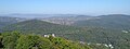
 Kis-Hárs-hegy és a Rózsadomb a Kaán Károly-kilátóból.jpg 3,264 × 1,292; 3.5 MB
-
 Kis-Hárs-hegy.jpg 4,000 × 3,000; 4.71 MB
-
 Nagy- és a Kis-Hárs-hegy az Erzsébet-kilátóból.jpg 3,264 × 1,232; 3.53 MB
-
 Resting place at Kis-Hárs Hill.JPG 2,560 × 1,920; 3.18 MB

.jpg)

