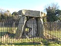
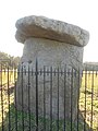
Category:Kit's Coty House

This is a category about listed building number 1012939. |
| Object location | | View all coordinates using: OpenStreetMap |
|---|
dolmen in England  | |||||
| Upload media | |||||
| Instance of | |||||
|---|---|---|---|---|---|
| Location | Aylesford, Tonbridge and Malling, Kent, South East England, England | ||||
| Owned by | |||||
| Operator | |||||
| Heritage designation | |||||
| official website | |||||
 | |||||
Media in category "Kit's Coty House"
The following 46 files are in this category, out of 46 total.
-
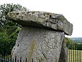
 Detail of the Eastern Face of Kit's Coty House (01).jpg 3,448 × 4,592; 12.88 MB
-
 Detail of the Eastern Face of Kit's Coty House (02).jpg 3,448 × 4,592; 13.08 MB
-
 Detail of the Western Face of Kit's Coty House (01).jpg 3,448 × 4,592; 12.42 MB
-
 Detail of the Western Face of Kit's Coty House (02).jpg 4,592 × 3,448; 11.69 MB
-
 Detail of the Western Face of Kit's Coty House (03).jpg 4,592 × 3,448; 10.88 MB
-
 Detail of the Western Face of Kit's Coty House (04).jpg 4,592 × 3,448; 11.55 MB
-
 Detail of the Western Face of Kit's Coty House (05).jpg 4,398 × 3,318; 13.24 MB
-
 Detail on the Southern Face of Kit's Coty House (01).jpg 4,159 × 3,346; 12.55 MB
-
 Kit's Coty - geograph.org.uk - 1577354.jpg 640 × 480; 47 KB
-
 Kit's Coty Graffiti.jpg 2,592 × 1,552; 716 KB
-
 Kit's Coty House 01.jpg 5,152 × 3,864; 4.4 MB
-
 Kit's Coty House 02.jpg 5,152 × 3,864; 4.39 MB
-
 Kit's Coty House 03.jpg 5,152 × 3,864; 4.4 MB
-
 Kit's Coty House 04.jpg 5,152 × 3,864; 4.35 MB
-
 Kit's Coty House 05.jpg 5,152 × 3,864; 4.5 MB
-
 Kit's Coty House 06.jpg 5,152 × 3,864; 4.28 MB
-
 Kit's Coty House 07.jpg 3,864 × 5,152; 4.33 MB
-
 Kit's Coty House 08.jpg 3,864 × 5,152; 4.33 MB
-
 Kit's Coty House 09.jpg 5,152 × 3,864; 4.29 MB
-
 Kit's Coty House 10.jpg 3,864 × 5,152; 4.34 MB
-
 Kit's Coty House 11.jpg 5,152 × 3,864; 4.16 MB
-
 Kit's Coty House 12.jpg 5,152 × 3,864; 4.38 MB
-
 Kit's Coty House 13.jpg 5,152 × 3,864; 4.48 MB
-
 Kit's Coty House 14.jpg 5,152 × 3,864; 4.33 MB
-
 Kit's Coty House 15.jpg 5,152 × 3,864; 4.48 MB
-
 Kit's Coty House 16.jpg 5,152 × 3,864; 4.51 MB
-
 Kit's Coty House 2014-09-01.jpg 3,636 × 2,386; 2.56 MB
-
 Kit's Coty House in February 2014.jpg 1,552 × 2,592; 1,010 KB
-
 Kit's Coty House slab backside.jpg 1,552 × 2,592; 1.08 MB
-
 Kit's Coty, Kent.jpg 1,600 × 1,200; 411 KB
-
 Kit's Coty, Nov 2021 01.jpg 5,184 × 3,888; 5.82 MB
-
 Kit's Coty, Nov 2021 02.jpg 5,005 × 3,753; 4.18 MB
-
 Kit's Coty.jpg 2,592 × 1,552; 1.05 MB
-
 Kits Coty House - geograph.org.uk - 1381286.jpg 640 × 480; 81 KB
-
 Kits Coty House - geograph.org.uk - 1381288.jpg 640 × 480; 136 KB
-
 Kits Coty House - panoramio.jpg 1,424 × 2,144; 996 KB
-
 Kitscoty, Blue Bell Hill.jpg 1,248 × 720; 225 KB
-
 Medwaymegalith.jpg 1,248 × 720; 209 KB
-
 Northern Side of Kit's Coty House.jpg 4,592 × 3,448; 12.31 MB
-
 Offering at Kit's Coty.jpg 3,888 × 5,184; 3.73 MB
-
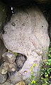
 Smaller Stones at the Base of Kit's Coty House (01).jpg 4,115 × 3,255; 15.88 MB
-
 Smaller Stones at the Base of Kit's Coty House (02).jpg 3,448 × 4,592; 14.8 MB
-
 Smaller Stones at the Base of Kit's Coty House (03).jpg 3,448 × 4,592; 18.12 MB
-
 Smaller Stones at the Base of Kit's Coty House (04).jpg 4,592 × 3,448; 13.73 MB
-
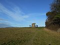
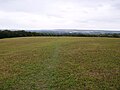 West-Facing View along the Former Tumulus of Kit's Coty House.jpg 4,592 × 3,448; 15.18 MB
-
 Kit's Coty monument - geograph.org.uk - 26578.jpg 640 × 432; 28 KB
.jpg)
.jpg)
.jpg)
.jpg)
.jpg)
.jpg)
.jpg)
.jpg)


.jpg)
.jpg)
.jpg)
.jpg)

