Category:Kneeton
English: Kneeton is a village in the county of Nottinghamshire, England. The village lies on the A46 road between Nottingham and Newark and is on the escarpment of the Trent Hills that sit above the flood plain of the River Trent. There is an airfield nearby. There is a railway station at Lowdham.
village in United Kingdom | |||||
| Upload media | |||||
| Instance of | |||||
|---|---|---|---|---|---|
| Location | Rushcliffe, Nottinghamshire, East Midlands, England | ||||
 | |||||
Media in category "Kneeton"
The following 100 files are in this category, out of 100 total.
-
 21km marker by River Trent opposite College Wood - geograph.org.uk - 5056695.jpg 3,070 × 1,724; 4.32 MB
-
 A derelict building near Flintham, Nottinghamshire - geograph.org.uk - 4881192.jpg 1,600 × 1,067; 240 KB
-
 A46 along Fosse Way - geograph.org.uk - 3464054.jpg 2,238 × 1,386; 1,004 KB
-
 A46 at Red Lodge Lane - geograph.org.uk - 3922155.jpg 1,280 × 960; 184 KB
-
 A46 at Red Lodge Lane - geograph.org.uk - 3922164.jpg 1,280 × 960; 174 KB
-
 A46 heading south west - geograph.org.uk - 4579835.jpg 2,256 × 1,496; 911 KB
-
 A46 northbound - geograph.org.uk - 3657591.jpg 640 × 480; 53 KB
-
 A46 parking area ahead - geograph.org.uk - 4579807.jpg 2,256 × 1,496; 911 KB
-
 Across the Trent - geograph.org.uk - 1030171.jpg 640 × 480; 60 KB
-
 At Red Lodge junction - geograph.org.uk - 1611622.jpg 640 × 479; 91 KB
-
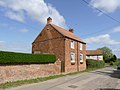
 Baker's Yard, Kneeton - geograph.org.uk - 3933230.jpg 1,280 × 960; 230 KB
-
 Barn in Slack's Lane - geograph.org.uk - 2843783.jpg 1,024 × 768; 149 KB
-
 Barns in Bridgford Road - geograph.org.uk - 5127683.jpg 1,600 × 1,064; 349 KB
-
 Bars and stripes - geograph.org.uk - 1599217.jpg 640 × 479; 175 KB
-
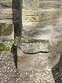 Bench mark with bolt, St Helen's Church, Kneeton - geograph.org.uk - 3933222.jpg 960 × 1,280; 379 KB
-
 Boarded up farmhouse in Slack's Lane - geograph.org.uk - 5127696.jpg 1,600 × 1,200; 444 KB
-
 Bridleway beside the new A46 - geograph.org.uk - 2887693.jpg 640 × 480; 51 KB
-
 Cottages in Kneeton - geograph.org.uk - 2843759.jpg 1,024 × 768; 199 KB
-
 Derelict farm in Kneeton - geograph.org.uk - 2843440.jpg 1,024 × 768; 171 KB
-
 Disused farmhouse in Slack's Lane - geograph.org.uk - 5127702.jpg 1,600 × 1,200; 411 KB
-
 Farm building on Slack's Lane - geograph.org.uk - 2887708.jpg 640 × 480; 51 KB
-
 Farmhouse at Hill's Yard, Kneeton - geograph.org.uk - 3933254.jpg 1,280 × 960; 228 KB
-
 Farmland off Slack's Lane - geograph.org.uk - 2887699.jpg 640 × 480; 57 KB
-
 Farmland towards Ti's Wood - geograph.org.uk - 2887709.jpg 640 × 480; 37 KB
-
 Field entrance off Slack's Lane - geograph.org.uk - 2887703.jpg 640 × 480; 75 KB
-
 Footpath north west from Bridgford Road - geograph.org.uk - 5372673.jpg 3,696 × 2,448; 2.31 MB
-
 Footpath south east from Bridgford Road - geograph.org.uk - 5372659.jpg 3,696 × 2,448; 2.28 MB
-
 Footpath to Red Lodge - geograph.org.uk - 2843806.jpg 1,024 × 768; 186 KB
-
 Footpath to Slack's Lane - geograph.org.uk - 2843798.jpg 1,024 × 768; 160 KB
-
 Former smithy and telephone kiosk - geograph.org.uk - 2843771.jpg 1,024 × 768; 230 KB
-
 "The Fosse Way" - geograph.org.uk - 46895.jpg 640 × 480; 113 KB
-
 Gateway and path - geograph.org.uk - 2843456.jpg 1,024 × 768; 210 KB
-
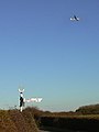 Gliding away - geograph.org.uk - 1599232.jpg 479 × 640; 45 KB
-
 Hall Farm Barn, Kneeton.jpg 1,024 × 683; 329 KB
-
 House on the old A46 - geograph.org.uk - 2887720.jpg 640 × 480; 98 KB
-
 Kirkland's Yard, Kneeton - geograph.org.uk - 3933270.jpg 960 × 1,280; 345 KB
-
 Kneeton churchyard, Nottinghamshire.jpg 1,200 × 800; 255 KB
-
 Kneeton Fingerpost - geograph.org.uk - 1020254.jpg 640 × 427; 65 KB
-
 Kneeton House - geograph.org.uk - 5124942.jpg 1,600 × 1,064; 374 KB
-
 Kneeton junction - geograph.org.uk - 1020252.jpg 640 × 427; 58 KB
-
 Kneeton postbox ref NG13 115 - geograph.org.uk - 3933237.jpg 1,280 × 1,280; 499 KB
-
 Kneeton postbox ref NG13 116 - geograph.org.uk - 3933242.jpg 960 × 1,280; 450 KB
-
 Lilac and Pinfold Cottages, Kneeton - geograph.org.uk - 3933264.jpg 1,280 × 960; 288 KB
-
 Main Street, Kneeton - geograph.org.uk - 3933248.jpg 1,280 × 960; 279 KB
-
 Millyard Cottage, Kneeton - geograph.org.uk - 3933256.jpg 1,280 × 960; 221 KB
-
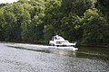
 Moored below College Wood - geograph.org.uk - 6253846.jpg 1,024 × 768; 184 KB
-
 New A46 - geograph.org.uk - 2124087.jpg 640 × 480; 100 KB
-
 New A46 - geograph.org.uk - 2124141.jpg 640 × 480; 97 KB
-
 New A46 towards Leicester - geograph.org.uk - 2887716.jpg 640 × 480; 49 KB
-
 Newfield and cones - geograph.org.uk - 2843215.jpg 1,024 × 768; 175 KB
-
 Notts fingerpost - geograph.org.uk - 1599219.jpg 479 × 640; 124 KB
-
 Old Barn at Old Hall Farm - geograph.org.uk - 5124936.jpg 1,600 × 1,064; 411 KB
-
 Old Smithy - geograph.org.uk - 5124979.jpg 1,600 × 1,064; 442 KB
-
 Red Lodge and the new A46 - geograph.org.uk - 2843220.jpg 1,024 × 768; 176 KB
-
 Red Lodge Lane heading east - geograph.org.uk - 2887711.jpg 640 × 480; 42 KB
-

-
 River Trent - geograph.org.uk - 1977751.jpg 640 × 426; 121 KB
-
 Road Ahead Closed - geograph.org.uk - 2843801.jpg 1,024 × 768; 87 KB
-
 Road junction near Kneeton - geograph.org.uk - 1599224.jpg 640 × 432; 62 KB
-
 Shipman's Wood next to the River Trent - geograph.org.uk - 4886100.jpg 800 × 548; 121 KB
-
 Slack's Lane - geograph.org.uk - 1599241.jpg 640 × 479; 149 KB
-
 Slack's Lane - geograph.org.uk - 2124162.jpg 640 × 480; 144 KB
-
 Slack's Lane towards Kneeton - geograph.org.uk - 2887702.jpg 640 × 480; 73 KB
-
 Slack's Lane towards Kneeton - geograph.org.uk - 2887706.jpg 640 × 480; 46 KB
-
 Slack's Lane, Kneeton - geograph.org.uk - 3933261.jpg 1,280 × 960; 290 KB
-
 Small barn in Kneeton - geograph.org.uk - 2843789.jpg 1,024 × 768; 124 KB
-
 St Helen's Church - geograph.org.uk - 5127711.jpg 1,600 × 1,067; 424 KB
-
 St.Helen's church - geograph.org.uk - 5485276.jpg 1,024 × 683; 190 KB
-
 St.Helen's church interior - geograph.org.uk - 5485287.jpg 1,024 × 683; 168 KB
-
 St.Helen's font - geograph.org.uk - 5485285.jpg 1,024 × 683; 224 KB
-
 Start of new bridleway on Slack's Lane, Kneeton - geograph.org.uk - 4195759.jpg 1,024 × 768; 468 KB
-
 The footpath from East Bridgford - geograph.org.uk - 2843418.jpg 1,024 × 768; 248 KB
-
 The new A46 - geograph.org.uk - 2887696.jpg 640 × 480; 57 KB
-
 The old school, Kneeton - geograph.org.uk - 2843829.jpg 1,024 × 768; 207 KB
-
 The River Trent and Ewan's Wood - geograph.org.uk - 6253839.jpg 1,024 × 768; 183 KB
-
 Up the hill into Kneeton - geograph.org.uk - 2843428.jpg 1,024 × 768; 224 KB
-
 Vicarage Lane - geograph.org.uk - 2843834.jpg 1,024 × 768; 173 KB
-
 Vicarage Lane, Kneeton - geograph.org.uk - 2843423.jpg 1,024 × 768; 294 KB
-
 View from Red Lodge Lane - geograph.org.uk - 3933271.jpg 1,280 × 960; 286 KB
-
 View towards Kneeton - geograph.org.uk - 2843813.jpg 1,024 × 768; 200 KB
-
 A46, Fosse Way - geograph.org.uk - 264366.jpg 640 × 427; 63 KB
-
 Bridgeford Roar, Kneeton Village - geograph.org.uk - 46916.jpg 640 × 480; 124 KB
-
 Bridleway to the River Trent - geograph.org.uk - 46928.jpg 640 × 553; 113 KB
-
 Car Colston Approach. - geograph.org.uk - 84737.jpg 640 × 480; 138 KB
-
 Closes Side Lane - geograph.org.uk - 46896.jpg 640 × 480; 132 KB
-
 Cornerside Cottage, Screeveton - geograph.org.uk - 84705.jpg 640 × 480; 109 KB
-
 Farm entrance - geograph.org.uk - 264372.jpg 640 × 427; 74 KB
-
 Farmland at Stoney Dale - geograph.org.uk - 264404.jpg 640 × 427; 72 KB
-
 Farmland at Stoney Dale - geograph.org.uk - 264409.jpg 640 × 427; 74 KB
-
 Farmland near Kneeton - geograph.org.uk - 251230.jpg 640 × 427; 71 KB
-
 Farmland off Slack's Lane, Kneeton - geograph.org.uk - 251240.jpg 640 × 427; 86 KB
-
-
 Lodge Lane at Stony Dale - geograph.org.uk - 264384.jpg 640 × 427; 81 KB
-
 Mill Farm - geograph.org.uk - 46907.jpg 640 × 480; 129 KB
-
 River Trent - geograph.org.uk - 588906.jpg 640 × 427; 69 KB
-
 Somewhere UNDER the rainbow ^^ - geograph.org.uk - 295727.jpg 640 × 351; 24 KB
-
 Stony Dale - geograph.org.uk - 264399.jpg 640 × 427; 69 KB
-
 Telecommunications Mast - geograph.org.uk - 46911.jpg 640 × 480; 65 KB
-
 Top Field Farm - geograph.org.uk - 51966.jpg 640 × 480; 118 KB
-
 Trent Hills Farm, Flintham - geograph.org.uk - 251246.jpg 640 × 480; 105 KB


