Category:Koarnjum
| Object location | | View all coordinates using: OpenStreetMap |
|---|
village in Friesland, Netherlands   | |||||
| Upload media | |||||
| Instance of | |||||
|---|---|---|---|---|---|
| Location |
| ||||
 | |||||
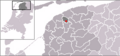
English: Cornjum is a village in Leeuwarderadeel, a municipality in the Dutch province of Friesland.
Nederlands: Koarnjum (Nederlands, niet-officieel: Cornjum) is een dorp in de Friese gemeente Leeuwarderadeel.
Subcategories
This category has the following 2 subcategories, out of 2 total.
Media in category "Koarnjum"
The following 8 files are in this category, out of 8 total.
-
 LocatieCornjum.png 280 × 130; 46 KB
-
 Map - NL - Leeuwarderadeel - Wijk 01 Zuid - Buurt 01 Cornjum.svg 375 × 375; 16 KB
-

-
 2022 Koarnjum, De Wier.jpg 3,531 × 2,349; 4.22 MB
-
 2022 Koarnjum, Martenawei.jpg 2,373 × 1,584; 1.96 MB
-
 2022 Koarnjum, sicht op De Wier en de Nikolaastsjerke.jpg 3,042 × 2,026; 2.77 MB
-
 De brugwijzers.JPG 2,592 × 3,888; 4.35 MB
-
 Map NL Ljouwerteradiel Koarnjum.png 800 × 500; 34 KB


