Category:Korenmolen, Oostvoorne
| Object location | | View all coordinates using: OpenStreetMap |
|---|
windmill in Oostvoorne, Netherlands  | |||||
| Upload media | |||||
| Instance of |
| ||||
|---|---|---|---|---|---|
| Location | Oostvoorne, South Holland, Netherlands | ||||
| Street address |
| ||||
| Located on street |
| ||||
| Has use | |||||
| Heritage designation |
| ||||
| Source of energy | |||||
 | |||||
|
This is a category about rijksmonument number 38892
|
| Address |
|
Media in category "Korenmolen, Oostvoorne"
The following 14 files are in this category, out of 14 total.
-
 Interieur meelpijp met bak, korenmolen - Oostvoorne - 20176045 - RCE.jpg 1,200 × 1,200; 312 KB
-
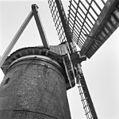
 Korenmolen aan de Molendijk, detail molenkap. - Oostvoorne - 20176037 - RCE.jpg 1,200 × 1,200; 245 KB
-
 Korenmolen aan de Molendijk, detail molenkap. - Oostvoorne - 20176038 - RCE.jpg 1,195 × 1,200; 275 KB
-

-
 Korenmolen aan de Molendijk, interieur maalstenen - Oostvoorne - 20176040 - RCE.jpg 1,200 × 1,200; 308 KB
-

-

-

-

-
 Korenmolen interieur maalstenen. - Oostvoorne - 20176041 - RCE.jpg 1,200 × 1,200; 239 KB
-
 Korenmolen, interieur bovenwiel met schijf - Oostvoorne - 20176042 - RCE.jpg 1,200 × 1,200; 219 KB
-
 Korenmolen, interieur spoorwiel. - Oostvoorne - 20176043 - RCE.jpg 1,200 × 1,200; 255 KB
-
 Korenmolen, interieur trap met evenaar op begane grond - Oostvoorne - 20176044 - RCE.jpg 1,200 × 1,193; 328 KB
-
 Oostvoorne korenmolen.jpg 1,606 × 1,854; 1.7 MB


