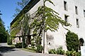
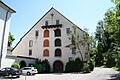
Category:Kornhaus (Kloster Sankt Katharinental)
| Object location | | View all coordinates using: OpenStreetMap |
|---|
Granary of the former Dominican Monastery of St Katharine  | |||||
| Upload media | |||||
| Instance of | |||||
|---|---|---|---|---|---|
| Part of | |||||
| Location |
| ||||
| Street address |
| ||||
| Heritage designation | |||||
 | |||||
|
This is a category about a cultural property of national significance in Switzerland with KGS number 9055
|
Media in category "Kornhaus (Kloster Sankt Katharinental)"
The following 5 files are in this category, out of 5 total.
-
 Katharinenthal Kornhaus1.JPG 3,456 × 2,304; 5.56 MB
-
 Katharinenthal Kornhaus2.JPG 3,456 × 2,304; 3.93 MB
-
 St Katharinenthal Kornhaus 01.jpg 2,698 × 3,459; 3.17 MB
-
 St Katharinenthal Kornhaus 02.jpg 2,541 × 2,971; 2.45 MB
-
 St Katharinenthal Kornhaus 03.jpg 4,088 × 2,826; 8.89 MB


