Category:Korte Steigerstraat 15, Zaltbommel
| Object location | | View all coordinates using: OpenStreetMap |
|---|
building in Zaltbommel, Netherlands  | |||||
| Upload media | |||||
| Instance of | |||||
|---|---|---|---|---|---|
| Location | Zaltbommel, Gelderland, Netherlands | ||||
| Street address |
| ||||
| Located on street | |||||
| Heritage designation |
| ||||
 | |||||
|
This is a category about rijksmonument number 40213
|
| Address |
|
Media in category "Korte Steigerstraat 15, Zaltbommel"
The following 4 files are in this category, out of 4 total.
-
 Hoek Korte Steigerstraat 17-15 - Zaltbommel - 20220454 - RCE.jpg 1,200 × 808; 173 KB
-
 Korte Steigerstraat 15-17, voorgevels - Zaltbommel - 20220444 - RCE.jpg 803 × 1,200; 194 KB
-
 Korte Steigerstraat 15.jpg 3,000 × 4,000; 740 KB
-
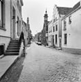 Overzicht Korte Steigerstraat naar het zuiden - Zaltbommel - 20219590 - RCE.jpg 1,192 × 1,200; 271 KB


