Category:Kostroma Bridge
| Object location | | View all coordinates using: OpenStreetMap |
|---|
 | |||||
| Upload media | |||||
| Instance of | |||||
|---|---|---|---|---|---|
| Location |
| ||||
| Date of official opening |
| ||||
 | |||||
Media in category "Kostroma Bridge"
The following 19 files are in this category, out of 19 total.
-
 Blue hour view of Kostroma Bridge.jpg 3,872 × 2,592; 1.88 MB
-
-
 Kostroma 22 (8086594284).jpg 2,680 × 1,725; 1.58 MB
-
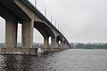
 Kostroma automobile bridge.jpg 3,008 × 2,000; 3.3 MB
-
 Kostroma bridge.jpg 4,252 × 2,835; 6.63 MB
-
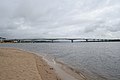
 Kostroma, Bridge - panoramio.jpg 1,408 × 1,056; 564 KB
-
 Kostroma, Kostroma Oblast, Russia - panoramio (9).jpg 4,928 × 3,264; 11.3 MB
-
 Volga-bridge-kostroma.jpg 3,456 × 2,304; 2.46 MB
-
 Wolga Kostroma Panorama.jpg 4,840 × 1,012; 848 KB
-
 Вид на мост и Заволжье - panoramio.jpg 1,557 × 2,336; 864 KB
-
 Кострома современный значок.jpg 4,000 × 2,034; 1.36 MB
-
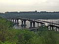
 Кострома. Автомобильный мост через Волгу - panoramio.jpg 2,560 × 1,920; 2.41 MB
-
 Кострома. Автомобильный мост через Волгу вечером.jpg 2,560 × 1,920; 2.66 MB
-
 Кострома. Река Волга. Автомобильный мост - panoramio.jpg 2,680 × 1,725; 1.56 MB
-
 Костромской мост в 2008 году.jpg 2,304 × 1,536; 736 KB
-
 Костромской мост.jpg 537 × 807; 83 KB
-
 Мост в Костроме.jpg 807 × 538; 133 KB
-
 Мост через Волгу-Кострома - panoramio.jpg 18,659 × 5,000; 7.99 MB
-
 Панорама Ипатьевской слободы - panoramio.jpg 2,928 × 600; 225 KB


.jpg)


.jpg)


