<nowiki>Kraftwerk Stroppel; Stroppel power station; Laufwasserkraftwerk an der Limmat am Limmatspitz im Gebiet Stroppel in Untersiggenthal im Kanton Aargau, Schweiz; run-of-river power station on the Limmat in Untersiggenthal in the canton of Aargau, Switzerland</nowiki>
Stroppel power station
run-of-river power station on the Limmat in Untersiggenthal in the canton of Aargau, Switzerland


 Kraftwerk Stroppel Steg am Limmat Kraftwerkskanal, Untersiggenthal AG 20180910-jag9889.jpg 4,608 × 3,456; 8.64 MB
 KW Stroppel 02.jpg 2,736 × 1,824; 3.27 MB
 KW Stroppel Kanal.jpg 2,736 × 1,824; 3.48 MB
 KW Stroppel Kanaleinlauf.jpg 2,736 × 1,824; 3.36 MB
 KW Stroppel Wasserschloss.jpg 2,736 × 1,824; 2.96 MB
 KW Stroppel Wehr.jpg 2,736 × 1,824; 4.23 MB
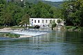 KW Stroppel.jpg 2,736 × 1,824; 3.31 MB
 Limmat - Vogelsang (Gebenstorf) IMG 6781.JPG 3,264 × 2,448; 4.85 MB
 Stroppel Infotafel 03.jpg 2,736 × 1,824; 2.96 MB


_IMG_6781.JPG)
