Category:Kreuzweg (Bad Camberg)
| Object location | | View all coordinates using: OpenStreetMap |
|---|
This is the category of the Hessian Kulturdenkmal (cultural monument) with the ID 50512 (Wikidata)
|
 | |||||
| Upload media | |||||
| Instance of | |||||
|---|---|---|---|---|---|
| Location | Bad Camberg, Limburg-Weilburg, Giessen Government Region, Hesse, Germany | ||||
| Street address |
| ||||
| Heritage designation | |||||
 | |||||
Media in category "Kreuzweg (Bad Camberg)"
The following 23 files are in this category, out of 23 total.
-
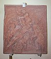
 Bad Camberg, Kreuzweg zur Kreuzkapelle, Station 1, Detail.JPG 1,752 × 1,872; 1.64 MB
-
 Bad Camberg, Kreuzweg zur Kreuzkapelle, Station 1, Original.JPG 3,264 × 4,032; 8.54 MB
-
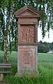
 Bad Camberg, Kreuzweg zur Kreuzkapelle, Station 1.JPG 3,096 × 4,792; 8.96 MB
-
 Bad Camberg, Kreuzweg zur Kreuzkapelle, Station 2, Detail.JPG 2,264 × 2,584; 2.79 MB
-
 Bad Camberg, Kreuzweg zur Kreuzkapelle, Station 2, Original.JPG 2,696 × 3,104; 5.13 MB
-
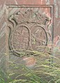
 Bad Camberg, Kreuzweg zur Kreuzkapelle, Station 2, Wappen.JPG 2,808 × 4,216; 6.59 MB
-
 Bad Camberg, Kreuzweg zur Kreuzkapelle, Station 2.JPG 3,021 × 4,728; 2.81 MB
-
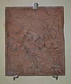
 Bad Camberg, Kreuzweg zur Kreuzkapelle, Station 3, Detail.JPG 2,121 × 2,393; 1.05 MB
-
 Bad Camberg, Kreuzweg zur Kreuzkapelle, Station 3, Original.JPG 3,072 × 3,600; 6.87 MB
-
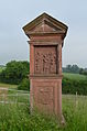
 Bad Camberg, Kreuzweg zur Kreuzkapelle, Station 3.JPG 3,264 × 4,928; 6.41 MB
-
 Bad Camberg, Kreuzweg zur Kreuzkapelle, Station 4, Detail.JPG 2,376 × 2,672; 3.02 MB
-
 Bad Camberg, Kreuzweg zur Kreuzkapelle, Station 4, Original.JPG 1,996 × 2,151; 2.63 MB
-
 Bad Camberg, Kreuzweg zur Kreuzkapelle, Station 4.JPG 3,264 × 4,928; 5.71 MB
-
 Bad Camberg, Kreuzweg zur Kreuzkapelle, Station 5, Detail.JPG 2,688 × 2,848; 3.82 MB
-
 Bad Camberg, Kreuzweg zur Kreuzkapelle, Station 5, Original.JPG 2,904 × 3,440; 6.45 MB
-
 Bad Camberg, Kreuzweg zur Kreuzkapelle, Station 5, Wappen.JPG 1,944 × 2,904; 2.85 MB
-
 Bad Camberg, Kreuzweg zur Kreuzkapelle, Station 5.JPG 3,264 × 4,928; 6.99 MB
-
 Bad Camberg, Kreuzweg zur Kreuzkapelle, Station 6, Detail.JPG 2,403 × 2,681; 1.13 MB
-
 Bad Camberg, Kreuzweg zur Kreuzkapelle, Station 6, Original.JPG 2,968 × 3,192; 6 MB
-
 Bad Camberg, Kreuzweg zur Kreuzkapelle, Station 6, Wappen.JPG 2,407 × 3,342; 1.53 MB
-
 Bad Camberg, Kreuzweg zur Kreuzkapelle, Station 6.JPG 2,840 × 4,672; 6.49 MB
-
 Bad Camberg, Kreuzweg zur Kreuzkapelle, Station 7, Original.JPG 3,000 × 3,416; 6.15 MB
-
 Bad Camberg, Kreuzweg zur Kreuzkapelle, Station 7.JPG 3,264 × 4,928; 7.76 MB


