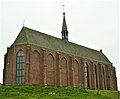
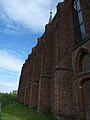
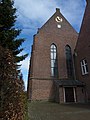
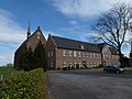
Category:Kruisherenklooster, Sint Agatha
| Object location | | View all coordinates using: OpenStreetMap |
|---|
 | |||||
| Upload media | |||||
| Instance of | |||||
|---|---|---|---|---|---|
| Location | Sint Agatha, Land van Cuijk, North Brabant, Netherlands | ||||
| Architectural style | |||||
| Occupant |
| ||||
 | |||||
|
This is a category about rijksmonument number 11630
|
| Address |
|
Subcategories
This category has the following 2 subcategories, out of 2 total.
Media in category "Kruisherenklooster, Sint Agatha"
The following 91 files are in this category, out of 91 total.
-
 11630 klooster St. Agatha bij Cuijk 2.jpg 2,272 × 1,704; 2.35 MB
-
 11630 klooster St. Agatha bij Cuijk.jpg 3,162 × 1,620; 2.32 MB
-
 Bakhuis (latijnse school) - Cuijk - 20052147 - RCE.jpg 1,200 × 958; 301 KB
-
 Bankje - Sint Agatha - 20340958 - RCE.jpg 1,192 × 1,200; 464 KB
-
 Bankje bij een van de vijvers in de tuin - Sint Agatha - 20340957 - RCE.jpg 1,200 × 1,200; 484 KB
-
 Bijgebouw - Sint Agatha - 20005249 - RCE.jpg 1,200 × 788; 184 KB
-
 Conventus St.Agathae prope Cuick 1620, objectnr A 57978 (crop).jpg 945 × 678; 490 KB
-
 Conventus St.Agathae prope Cuick 1855, objectnr A 58044 (crop).jpg 1,006 × 661; 522 KB
-
 Entrance gate Monastry Klooster Sint Agatha - panoramio.jpg 4,928 × 3,264; 6.02 MB
-
 Excursie LGOG Maastricht naar St-Agathaklooster in Cuyk, 1934.jpg 800 × 503; 153 KB
-
 Gedeelte nieuwbouw - Sint Agatha - 20005250 - RCE.jpg 1,200 × 788; 237 KB
-
 Gedeelte nieuwbouw - Sint Agatha - 20005251 - RCE.jpg 1,200 × 788; 251 KB
-
 Gedeelte nieuwbouw - Sint Agatha - 20005252 - RCE.jpg 1,200 × 788; 150 KB
-
 Josephus Leurs, prior Kruisherenklooster Maastricht (C Delin, 1781).jpg 629 × 865; 150 KB
-
 Kloostermuur - Sint Agatha - 20005258 - RCE.jpg 1,200 × 788; 274 KB
-
 Kruisherenklooster te Sint Agatha t Klooster S Aegten (titel op object), RP-P-OB-73.653.jpg 4,760 × 3,474; 2.74 MB
-
 Kruisherenklooster, Sint Agatha (1).JPG 2,048 × 1,536; 1.48 MB
-
 Kruisherenklooster, Sint Agatha (2).JPG 2,048 × 1,536; 457 KB
-
 Kruisherenklooster, Sint Agatha (3).JPG 2,048 × 1,536; 1.5 MB
-
 Kruisherenklooster, Sint Agatha (4).JPG 1,817 × 1,504; 707 KB
-
 Kruisherenklooster, Sint Agatha, hoofdvleugel.JPG 4,320 × 3,240; 5.35 MB
-
 Kruisherenklooster, Sint Agatha, kloosterkerk, steunberen.JPG 3,240 × 4,320; 5.06 MB
-
 Kruisherenklooster, Sint Agatha, kloosterkerk.JPG 3,240 × 4,320; 5.18 MB
-
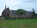
 Kruisherenklooster, Sint Agatha, overzichtsfoto.JPG 4,320 × 3,240; 5.42 MB
-
 Kruisherenklooster, Sint Agatha, poortgebouw, binnenplaatszijde.JPG 4,320 × 3,240; 5.55 MB
-
 Kruisherenklooster, Sint Agatha, zijvleugel.JPG 4,320 × 3,240; 5.64 MB
-
 Latijnse school - Sint Agatha - 20005255 - RCE.jpg 1,200 × 788; 208 KB
-
 Latijnse school - Sint Agatha - 20005256 - RCE.jpg 1,200 × 788; 231 KB
-
 Latijnse school - Sint Agatha - 20005257 - RCE.jpg 1,200 × 781; 199 KB
-
 Latijnse school, voorgevel - Sint Agatha - 20005259 - RCE.jpg 1,200 × 788; 229 KB
-
 Monasterysintagatha.jpg 2,048 × 1,536; 666 KB
-
 Monastry mainbuilding Klooster Sint Agatha - panoramio.jpg 4,928 × 3,264; 6.46 MB
-

-
 Overzicht - Sint Agatha - 20005246 - RCE.jpg 1,200 × 803; 172 KB
-
-

-
-
 Overzicht binnenhof, begraafplaats - Sint Agatha - 20350214 - RCE.jpg 1,196 × 1,200; 359 KB
-
 Overzicht complex - Sint Agatha - 20340923 - RCE.jpg 1,193 × 1,200; 271 KB
-
 Overzicht complex - Sint Agatha - 20340924 - RCE.jpg 1,190 × 1,200; 328 KB
-
 Overzicht complex - Sint Agatha - 20340925 - RCE.jpg 1,200 × 1,200; 277 KB
-
 Overzicht complex - Sint Agatha - 20340926 - RCE.jpg 1,195 × 1,200; 348 KB
-
 Overzicht complex - Sint Agatha - 20340927 - RCE.jpg 1,198 × 1,200; 348 KB
-
 Overzicht complex - Sint Agatha - 20340928 - RCE.jpg 1,176 × 1,200; 314 KB
-
 Overzicht complex met kloostermuur op de voorgrond - Sint Agatha - 20340942 - RCE.jpg 1,181 × 1,200; 286 KB
-
 Overzicht complex met kloostermuur op de voorgrond - Sint Agatha - 20340943 - RCE.jpg 1,183 × 1,200; 337 KB
-
 Overzicht complex met omgeving - Sint Agatha - 20340921 - RCE.jpg 1,200 × 1,179; 310 KB
-
 Overzicht complex met omgeving - Sint Agatha - 20340922 - RCE.jpg 1,181 × 1,200; 365 KB
-
 Overzicht kloostercomplex vanuit het oosten - Sint Agatha - 20340947 - RCE.jpg 1,183 × 1,200; 347 KB
-
 Overzicht kloostermuur - Sint Agatha - 20340941 - RCE.jpg 1,183 × 1,200; 302 KB
-
 Overzicht kloostermuur met zitbankje - Sint Agatha - 20340946 - RCE.jpg 1,179 × 1,200; 276 KB
-
 Overzicht kloostermuur om het complex - Sint Agatha - 20340944 - RCE.jpg 1,183 × 1,200; 269 KB
-
 Overzicht kloostermuur om het complex - Sint Agatha - 20340945 - RCE.jpg 1,188 × 1,200; 431 KB
-
 Overzicht muur om het complex, westzijde - Sint Agatha - 20340932 - RCE.jpg 1,185 × 1,200; 340 KB
-
 Overzicht ommuurde complex met omgeving - Sint Agatha - 20340920 - RCE.jpg 1,183 × 1,200; 359 KB
-

-
 Overzicht poortgebouw- binnenzijde - Sint Agatha - 20340937 - RCE.jpg 1,200 × 794; 193 KB
-
 Overzicht poortgebouw- buitenzijde - Sint Agatha - 20340935 - RCE.jpg 1,181 × 1,200; 298 KB
-
 Overzicht tuin - Sint Agatha - 20340951 - RCE.jpg 1,183 × 1,200; 444 KB
-
 Overzicht tuin - Sint Agatha - 20340952 - RCE.jpg 1,192 × 1,200; 453 KB
-
 Overzicht van de zuidgevel - Sint Agatha - 20005269 - RCE.jpg 1,200 × 960; 352 KB
-
 Overzicht vijver - Sint Agatha - 20340959 - RCE.jpg 1,190 × 1,200; 473 KB
-
 Overzicht vijver in de tuin - Sint Agatha - 20340953 - RCE.jpg 1,190 × 1,200; 455 KB
-
 Overzicht vijver in de tuin - Sint Agatha - 20340954 - RCE.jpg 1,192 × 1,200; 352 KB
-

-

-
 Overzicht vleugel van het complex - Sint Agatha - 20340930 - RCE.jpg 1,179 × 1,200; 406 KB
-
 Overzicht voorgevel poortgebouw - Sint Agatha - 20348458 - RCE.jpg 1,188 × 1,200; 370 KB
-
 Overzicht voorgevel poortgebouw - Sint Agatha - 20348462 - RCE.jpg 1,181 × 1,200; 359 KB
-
 Poortgebouw - Sint Agatha - 20005247 - RCE.jpg 1,200 × 788; 292 KB
-
 Poortgebouw - Sint Agatha - 20005248 - RCE.jpg 1,200 × 788; 198 KB
-
 Sint Agatha - Gedenkplaat Kruisherenklooster.jpg 4,608 × 3,456; 4.6 MB
-
 Sint Agatha - Heiligenbeeld 1 in de toegangspoort van het Kruisherenklooster.jpg 3,456 × 4,608; 3.55 MB
-
 Sint Agatha - Heiligenbeeld 2 in de toegangspoort van het Kruisherenklooster.jpg 3,456 × 4,608; 3.15 MB
-
 Sint Agatha - Heiligenbeeld 3 in de toegangspoort van het Kruisherenklooster.jpg 3,456 × 4,608; 3.32 MB
-
 Sint Agatha - Reliëf Kruisherenklooster.jpg 4,608 × 3,456; 4.86 MB
-
 Sint Agatha, blason des chanoines de la Sainte-Croix.jpg 639 × 479; 235 KB
-
 Sint Agatha, le couvent des chanoines de la Sainte-Croix.jpg 3,072 × 2,304; 2.54 MB
-
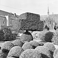 Tuin, vormgesnoeide taxusbomen - Sint Agatha - 20340960 - RCE.jpg 1,200 × 1,200; 402 KB
-
 Voorgevel en linker zijgevel - Sint Agatha - 20370313 - RCE.jpg 1,200 × 1,179; 297 KB
-
 Voormalige Latijnse school, achtergevel - Sint Agatha - 20005263 - RCE.jpg 1,200 × 788; 229 KB
-
 Voormalige Latijnse school, achtergevel - Sint Agatha - 20005264 - RCE.jpg 1,200 × 788; 282 KB
-
 Voormalige Latijnse school, gevelsteen - Sint Agatha - 20005265 - RCE.jpg 1,200 × 788; 276 KB
-
 Voormalige Latijnse school, interieur - Sint Agatha - 20005266 - RCE.jpg 1,200 × 788; 206 KB
-
 Voormalige Latijnse school, interieur - Sint Agatha - 20005267 - RCE.jpg 788 × 1,200; 256 KB
-
 Voormalige Latijnse school, interieur - Sint Agatha - 20005268 - RCE.jpg 788 × 1,200; 234 KB
-
 Voormalige Latijnse school, voor- en zijgevel - Sint Agatha - 20005260 - RCE.jpg 1,200 × 788; 251 KB
-
 Voormalige Latijnse school, voor- en zijgevel - Sint Agatha - 20005261 - RCE.jpg 788 × 1,200; 290 KB
-
 Voormalige Latijnse school, zijgevel - Sint Agatha - 20005262 - RCE.jpg 1,200 × 788; 255 KB
-
 Voormalige wasserij - Sint Agatha - 20005253 - RCE.jpg 1,200 × 788; 234 KB
-
 Voormalige wasserij - Sint Agatha - 20005254 - RCE.jpg 1,200 × 788; 210 KB


_-_Cuijk_-_20052147_-_RCE.jpg)


.jpg)
.jpg)


.jpg)

,_RP-P-OB-73.653.jpg)
.JPG)
.JPG)
.JPG)
.JPG)


.jpg)


