Category:Lägern
Alemannisch: D Lägere isch de öschtlichschti Usläufer vom Jura. De höchschti Punkt vo dem Bärg ligt bi 859 Meter uf em Burghorn.
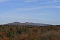
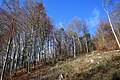
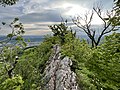
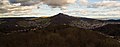
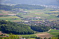
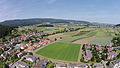
Deutsch: Die Lägern (seltener: der Lägern, veraltet auch Lägeren) ist ein langgezogener schmaler Höhenrücken zwischen Baden (AG) und Dielsdorf (ZH) in den Schweizer Kantonen Aargau und Zürich.
English: The Lägern is the easternmost part of the Swiss Jura mountains, forming the boundary between the cantons of Zurich and Aargau. Its highest elevation is the Burghorn at 859 m.
Français : Le Lägern, situé en Suisse, est le pli le plus oriental du massif du Jura, il est à la limite entre les cantons de Zurich et d'Argovie. Son point culminant est le Altlägeren à 866 m d'altitude.
| Object location | | View all coordinates using: OpenStreetMap |
|---|
mountain of Switzerland  | |||||
| Upload media | |||||
| Instance of | |||||
|---|---|---|---|---|---|
| Made from material | |||||
| Location |
| ||||
| Width |
| ||||
| Length |
| ||||
| Mountain range | |||||
| Topographic prominence |
| ||||
| Topographic isolation |
| ||||
| Elevation above sea level |
| ||||
| Parent peak | |||||
 | |||||
Subcategories
This category has the following 8 subcategories, out of 8 total.
B
H
L
- Lägerngrat (25 F)
P
- Planetenweg Lägern (13 F)
R
- Ruine Alt-Lägern (5 F)
S
W
- Walhalla (Wettingen) (6 F)
- Wettinger Horn (12 F)
Media in category "Lägern"
The following 88 files are in this category, out of 88 total.
-
 Albis - Uetliberg - Schlieren - Lägern Burghorn 20100524 16-26-00.jpg 4,288 × 2,848; 1.92 MB
-
 Baden Felsen.jpg 2,000 × 1,500; 836 KB
-
 Biriloo Otelfingen.jpg 2,448 × 3,264; 7.52 MB
-
 Blick von Birrhard auf die Laegern.jpg 2,634 × 459; 339 KB
-
 Blüemlisalp v Laegern 160717.jpg 5,472 × 3,648; 3.11 MB
-
 Boppelsen - Otelfingen - Lägern Burghorn 20100524 17-23-04.JPG 4,288 × 2,848; 6.28 MB
-
 Boppelsen Lägern 2027.jpg 640 × 427; 43 KB
-
 Bruno-Weber-Park - Lägern - Dietikon Weinberg 2014-10-17 14-46-54.JPG 4,928 × 3,264; 8.63 MB
-
 Buchs - Lägern - Dänikon 2012-05-13 15-56-54 (P7000).JPG 3,648 × 2,736; 3.83 MB
-
 Buchs ZH 036.jpg 3,888 × 2,592; 2.46 MB
-
 Bözberg Lägernblick 8054.jpg 3,888 × 2,592; 2.36 MB
-
 Dachsleren-Schleinikon - Lägern Burghorn 20100524 16-27-18.JPG 4,288 × 2,848; 2.98 MB
-
 Dielsdorf Regensberg kaj Laegern 033.jpg 3,872 × 2,592; 762 KB
-

-
 Dänikon 324.jpg 1,600 × 1,200; 394 KB
-
 Ehrendingen - Lägern Burghorn 20100524 16-25-12.JPG 4,288 × 2,848; 6.39 MB
-
 Ennetbaden - Schartenfels - Baden IMG 6730.jpg 4,176 × 2,772; 3.9 MB
-
 ETH-BIB-Baden, Lägeren-LBS H1-023931.tif 6,744 × 4,687; 90.47 MB
-
 ETH-BIB-Lägern-LBS H1-013689.tif 6,810 × 4,694; 91.56 MB
-
 ETH-BIB-Lägern-LBS H1-013690.tif 6,808 × 4,695; 91.55 MB
-
 ETH-BIB-Lägern-Matte mit HTZ-Dia 247-05225.tif 3,467 × 2,777; 27.67 MB
-

-
 Furttal - Glatttal - Lägern Burghorn 20100524 17-22-44.JPG 4,288 × 2,848; 3.23 MB
-
 Furttal - Limmatal - Albis - Pfannenstiel - Lägern Burghorn 20100524 16-23-12.JPG 4,288 × 2,848; 6.28 MB
-
 Geissberg Ueberschiebung.jpg 3,264 × 2,448; 860 KB
-
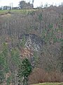 Gipsgruebe bei Ehrendingen.jpg 2,448 × 3,264; 612 KB
-
 Katzensee (oberer Katzensee) - Lägern - Affoltern 2011-08-28 19-02-54.jpg 4,000 × 2,666; 3.32 MB
-
 Katzensee (oberer Katzensee) IMG 3867.jpg 3,086 × 2,315; 3.63 MB
-
 Laegern 047.jpg 3,888 × 2,592; 2.64 MB
-
 Laegern 1302.jpg 3,888 × 2,592; 3.45 MB
-
 Laegern 2270.jpg 3,888 × 2,592; 7.66 MB
-
 Laegern 4904.jpg 3,428 × 520; 422 KB
-
 Laegern Blick von Neuenhof.jpg 3,888 × 1,068; 1.13 MB
-
 Laegern Grat.jpg 4,032 × 3,024; 5.34 MB
-
 Laegern kun radarturo de Skyguide vidita de Oberweningen 074.jpg 3,872 × 2,592; 2.33 MB
-
 Laegern WestView Baldegg 150110.jpg 4,065 × 1,600; 1.29 MB
-
 Laegern.jpg 2,549 × 993; 318 KB
-
 Lagerbühne MAVERLO (4).jpg 3,264 × 2,448; 1.91 MB
-
 Limmattal 3445.jpg 3,888 × 2,592; 2.73 MB
-
 Limmattal Lägern.jpg 3,888 × 2,592; 2.62 MB
-
 Lägern - Furttal-Glatttal - Regensberg 20100524 18-37-36.JPG 4,288 × 2,848; 5.86 MB
-
 Lägern - Jura-Höhenweg 20100524 16-08-30.JPG 4,288 × 2,848; 5.51 MB
-
 Lägern - Jura-Höhenweg 20100524 16-24-42.jpg 2,522 × 3,800; 1.33 MB
-
 Lägern - Katzensee (oberer Katzensee) 20100523 16-59-34.JPG 4,074 × 2,704; 2.64 MB
-
 Lägern - Katzensee (oberer Katzensee) 20100523 17-04-44.JPG 4,176 × 2,772; 2.67 MB
-
 Lägern - Regensdorf-Watt - Katzensee 2011-08-28 19-05-18.jpg 4,288 × 2,848; 3.95 MB
-
 Lägern - Schartenfels 20100524 15-05-02.JPG 2,848 × 4,288; 6.37 MB
-
 Lägern 1579.jpg 640 × 427; 30 KB
-
 Lägern 8801.jpg 3,888 × 2,592; 4.16 MB
-
 Lägern 9847.jpg 3,888 × 2,065; 1.78 MB
-
 Lägern Feuerlilie 0015.JPG 1,280 × 960; 340 KB
-
 Lägern Frühling 8657.jpg 3,888 × 2,592; 7.23 MB
-
 Lägern Frühling 8658.jpg 2,592 × 3,888; 6.97 MB
-
 Lägern Infotafel Schichtstufen 5584.jpg 2,362 × 3,799; 3.95 MB
-
 Lägern und Schartenfels.jpg 3,888 × 2,592; 3.53 MB
-
 Lägern von Osten.jpg 990 × 680; 257 KB
-
 Lägern von Witschgenbüel.jpg 3,264 × 2,448; 5.95 MB
-
 Lägern.jpg 3,888 × 2,592; 4.39 MB
-
 Neeracherried 19 14 18 375000.jpeg 4,032 × 2,268; 2.01 MB
-
 Neeracherried 19 15 03 828000.jpeg 4,032 × 2,268; 2.2 MB
-
 Neeracherried 19 15 14 385000.jpeg 4,032 × 2,268; 2.52 MB
-
 Niederweningen - Lägern Burghorn 20100524 16-26-52.JPG 4,288 × 2,848; 6.05 MB
-
 Otelfingen - Hüttikon - Lägern Burghorn 20100524 17-23-56.JPG 4,288 × 2,848; 3.13 MB
-
 Otelfingen - Lägern Burghorn 20100524 17-21-28.JPG 4,288 × 2,848; 3.03 MB
-
 Pano Laegern S 140101.jpg 21,533 × 3,067; 5.71 MB
-
 Panorama Lägern 01.jpg 26,237 × 2,510; 8.97 MB
-
 Regensberg - Lägern 20100524 18-15-54.JPG 4,288 × 2,848; 6.31 MB
-
 Regensberg - Lägern 20100524 18-19-48.JPG 4,288 × 2,848; 6.11 MB
-
 Regensberg Sicht Laegern 2014.jpg 3,272 × 2,454; 2.63 MB
-
 Regensdorf - Geissberg 20100523 16-01-22.JPG 4,288 × 2,848; 6.31 MB
-
 Regensdorf - Geissberg 20100523 16-08-44.JPG 4,288 × 2,848; 6.62 MB
-
 Regensdorf - Lägern - Geissberg 20100523 16-15-20.JPG 4,288 × 2,848; 2.4 MB
-
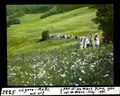
 Schwestern im Minilager.jpg 2,848 × 2,136; 2.85 MB
-
 Stadlerberg, Egg und Lägern.jpg 5,435 × 2,068; 6.78 MB
-
 Swissair HB-IMF crashsite.jpg 1,000 × 705; 264 KB
-
 Tafel Laegern Gratweg.JPG 2,448 × 3,264; 3.08 MB
-
 Wanderwegweiser Lägern Burghorn 859.jpg 1,512 × 2,016; 760 KB
-
 Wanderwegweiser Lägernsattel 785.jpg 2,016 × 1,512; 1.21 MB
-
 Wettingen 468 Lägern.jpg 3,888 × 2,592; 3.57 MB
-
 Wettingen Laegern im Winter.jpg 3,888 × 2,592; 2.96 MB
-
 Wettingen Lägern1.jpg 3,888 × 2,592; 4.52 MB
-
 Wettingen Staumauer Bruecke Laegern 8411.JPG 3,888 × 2,592; 3.44 MB
-
 Wettingen Staumauer Eisenbahnbruecke 8413.JPG 3,888 × 2,592; 3.63 MB
-
 Wettinger Stausee1 Laegern.jpg 3,888 × 2,592; 2.82 MB
-
 Würenlos 2014-06-07 15.11.39.jpg 4,384 × 2,466; 2.85 MB
-
 Zürich - Käferberg - Affoltern IMG 3192.jpg 3,264 × 2,448; 2.72 MB
-
 Zürich - Käferberg - Affoltern IMG 3193.jpg 3,264 × 2,448; 2.64 MB
-
 Zürichhorn 2015.JPG 5,184 × 3,456; 6.85 MB


.JPG)


_-_L%C3%A4gern_-_Affoltern_2011-08-28_19-02-54.jpg)
_IMG_3867.jpg)


.jpg)


_20100523_16-59-34.JPG)
_20100523_17-04-44.JPG)


