Category:Lage der A 18 (Groningen)
| Object location | | View all coordinates using: OpenStreetMap |
|---|
 | |||||
| Upload media | |||||
| Instance of |
| ||||
|---|---|---|---|---|---|
| Location | Groningen, Netherlands | ||||
| Street address |
| ||||
| Located on street | |||||
| Heritage designation |
| ||||
 | |||||
|
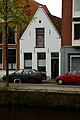
This is a category about rijksmonument number 18542
|
| Address |
|
Media in category "Lage der A 18 (Groningen)"
The following 3 files are in this category, out of 3 total.
-
 18542 Lage der A 18 Groningen NL.jpg 3,647 × 5,475; 10.06 MB
-
 Overzicht - Groningen - 20093674 - RCE.jpg 1,200 × 959; 236 KB
-
 Voorgevel - Groningen - 20094008 - RCE.jpg 1,200 × 1,197; 261 KB

