Category:Lamberhurst
village in Kent, England, UK  | |||||
| Upload media | |||||
| Instance of | |||||
|---|---|---|---|---|---|
| Location | Tunbridge Wells, Kent, South East England, England | ||||
| Said to be the same as | Lamberhurst (Wikimedia duplicated page, civil parish) | ||||
 | |||||
Subcategories
This category has the following 11 subcategories, out of 11 total.
B
- Bewl Water (128 F)
C
- The Chequers, Lamberhurst (6 F)
H
- Hayden Wood (6 F)
L
- Lamberhurst War Memorial (3 F)
M
O
S
- The Swan, Lamberhurst (2 F)
Media in category "Lamberhurst"
The following 200 files are in this category, out of 835 total.
(previous page) (next page)-
 'Juliet's balcony' at Scotney Castle - geograph.org.uk - 6021555.jpg 3,000 × 4,000; 4.09 MB
-
 A Bridge and Gate at Scotney Castle - geograph.org.uk - 75345.jpg 640 × 480; 79 KB
-
 A Fungus near a Footpath - geograph.org.uk - 75367.jpg 640 × 480; 75 KB
-

-
 A line of trees - geograph.org.uk - 1744167.jpg 640 × 430; 147 KB
-

-
 A rather fine living fence, Clay Hill Rd - geograph.org.uk - 1759177.jpg 640 × 430; 140 KB
-
 A small tributary of the River Teise - geograph.org.uk - 1703154.jpg 640 × 427; 81 KB
-
 A strip of Maize stubble - geograph.org.uk - 1703144.jpg 640 × 427; 81 KB
-
 A very small waterfall, Brown's Wood - geograph.org.uk - 1760394.jpg 640 × 430; 200 KB
-
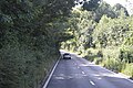
 A21 - geograph.org.uk - 3307191.jpg 1,024 × 768; 141 KB
-
 A21 at River Teise bridge - geograph.org.uk - 3078011.jpg 640 × 428; 58 KB
-
 A21 at Stonecrouch - geograph.org.uk - 333972.jpg 640 × 480; 78 KB
-
 A21 crossing the River Teise - geograph.org.uk - 4750315.jpg 640 × 426; 69 KB
-
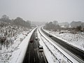
 A21 dual carriageway northbound near Lamberhurst - geograph.org.uk - 3512833.jpg 1,600 × 915; 285 KB
-
 A21 heading for Hastings - geograph.org.uk - 333974.jpg 640 × 480; 106 KB
-
 A21 Lamberhurst By-pass - geograph.org.uk - 1515539.jpg 640 × 427; 55 KB
-
 A21 Lamberhurst By-pass Road bridge - geograph.org.uk - 1515532.jpg 640 × 427; 77 KB
-
 A21 near Bewl Water - geograph.org.uk - 4272216.jpg 640 × 525; 82 KB
-
 A21 near Lamberhurst - geograph.org.uk - 3078029.jpg 640 × 428; 101 KB
-
 A21 near Lamberhurst - geograph.org.uk - 3261338.jpg 2,464 × 1,632; 1.02 MB
-
 A21 near Lamberhurst Quarter - geograph.org.uk - 3078055.jpg 640 × 428; 77 KB
-
-
 A21 passes Lindridge Lodge Farm - geograph.org.uk - 2994136.jpg 3,352 × 2,574; 1.69 MB
-
 A21 passes roadside fruit stall south of Old Swan Farm - geograph.org.uk - 2994123.jpg 3,070 × 2,484; 1.36 MB
-
 A21 south of Key's Green - geograph.org.uk - 2994108.jpg 3,648 × 2,736; 2.69 MB
-
 A21 Southbound - geograph.org.uk - 3307196.jpg 1,024 × 768; 133 KB
-
 A21 towards Hastings - geograph.org.uk - 3524756.jpg 2,461 × 1,489; 2.01 MB
-
 A21 towards Kipping's Cross - geograph.org.uk - 3487843.jpg 1,600 × 957; 326 KB
-
 A21, approaching Scotney Castle Roundabout - geograph.org.uk - 5960530.jpg 1,024 × 681; 176 KB
-
 A21, Lamberhurst bypass - geograph.org.uk - 3769883.jpg 640 × 481; 70 KB
-
 A21, Lamberhurst bypass - geograph.org.uk - 3769884.jpg 640 × 484; 73 KB
-
 A21, Lamberhurst bypass - geograph.org.uk - 3769885.jpg 640 × 430; 60 KB
-
 A21, Lamberhurst bypass - geograph.org.uk - 4272221.jpg 640 × 531; 91 KB
-
 A21, Lamberhurst bypass - geograph.org.uk - 4272225.jpg 640 × 591; 67 KB
-
 A21, Lamberhurst bypass - geograph.org.uk - 4272230.jpg 640 × 430; 63 KB
-
 A21, Lamberhurst bypass - geograph.org.uk - 4750312.jpg 640 × 426; 67 KB
-
 A21, Lamberhurst bypass - geograph.org.uk - 5960528.jpg 1,024 × 681; 145 KB
-
 A21, Lamberhurst bypass - geograph.org.uk - 6018684.jpg 1,024 × 681; 157 KB
-
 A21, northbound - geograph.org.uk - 4272234.jpg 640 × 465; 98 KB
-
 A21, northbound - geograph.org.uk - 4272238.jpg 640 × 573; 104 KB
-
 A21, southbound - geograph.org.uk - 4750304.jpg 640 × 426; 84 KB
-
 A21, southbound - geograph.org.uk - 4750306.jpg 640 × 426; 69 KB
-
 A21, southbound - geograph.org.uk - 4750308.jpg 640 × 426; 72 KB
-
 A21, southbound - geograph.org.uk - 4750310.jpg 640 × 426; 69 KB
-
 A21, southbound - geograph.org.uk - 4750320.jpg 640 × 426; 102 KB
-
 A21, southbound - geograph.org.uk - 4750322.jpg 640 × 426; 80 KB
-
 A21, southbound - geograph.org.uk - 5960523.jpg 1,024 × 681; 217 KB
-
 A21, southbound - geograph.org.uk - 5960527.jpg 1,024 × 681; 192 KB
-
 A21, southbound - geograph.org.uk - 5960532.jpg 1,024 × 681; 252 KB
-
 A262 - geograph.org.uk - 6031845.jpg 1,024 × 681; 118 KB
-
 A262 north of Forstal Farm - geograph.org.uk - 3919164.jpg 3,918 × 2,647; 2.04 MB
-
 A262 off the A21 - geograph.org.uk - 4750311.jpg 640 × 426; 47 KB
-
 A262 south of Elphicks Wood - geograph.org.uk - 2997555.jpg 3,648 × 2,736; 1.81 MB
-
 Access Lane to Whiskett's Farm - geograph.org.uk - 3474245.jpg 4,320 × 3,240; 4.98 MB
-
 Access Road over the A21 - geograph.org.uk - 4052965.jpg 640 × 323; 52 KB
-
 Access road to Sandhurst Farm - geograph.org.uk - 2392844.jpg 3,072 × 2,304; 2.08 MB
-
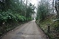
 Access road to Scotney Castle - geograph.org.uk - 1701698.jpg 640 × 427; 95 KB
-
-
 Access road towards Old Farm - geograph.org.uk - 2391895.jpg 3,072 × 2,304; 1.84 MB
-
 Access track for Furnace Mill - geograph.org.uk - 1658850.jpg 640 × 479; 97 KB
-
-

-

-

-

-
 Approaching the main road - geograph.org.uk - 293720.jpg 640 × 427; 128 KB
-
 Avards Bakery, High St, Lamberhurst - geograph.org.uk - 1704976.jpg 640 × 427; 63 KB
-
 B2162 - geograph.org.uk - 6018685.jpg 1,024 × 681; 151 KB
-
 B2162 southbound - geograph.org.uk - 4344421.jpg 640 × 480; 112 KB
-
 B2169 - geograph.org.uk - 5381480.jpg 640 × 426; 54 KB
-
 B2169 - geograph.org.uk - 6018683.jpg 1,024 × 744; 135 KB
-
 B2169 off A21 - geograph.org.uk - 5982387.jpg 1,024 × 681; 188 KB
-
 B2169 to Lamberhurst - geograph.org.uk - 2721236.jpg 640 × 406; 60 KB
-
 Barn Shaw, Clay Hill Rd - geograph.org.uk - 1759162.jpg 640 × 430; 199 KB
-
 Barn, Little Dunk's Farm - geograph.org.uk - 1742669.jpg 640 × 430; 115 KB
-
 Barnfield Oast, Mount Pleasant, Lamberhurst - geograph.org.uk - 6359771.jpg 3,264 × 2,448; 374 KB
-
 Barns, Great Coldharbour Farm - geograph.org.uk - 1742568.jpg 640 × 461; 69 KB
-
 Barns, Hoathly Farm - geograph.org.uk - 1759084.jpg 640 × 430; 138 KB
-
 Bayham Abbey - geograph.org.uk - 1337104.jpg 640 × 425; 84 KB
-
 Bayham Abbey - geograph.org.uk - 4966956.jpg 4,896 × 3,672; 5.88 MB
-
 Bayham Abbey - geograph.org.uk - 4966996.jpg 3,971 × 2,547; 3.47 MB
-
 Bayham Abbey, Little Bayham - geograph.org.uk - 3388976.jpg 640 × 447; 169 KB
-
 Bayham Hall, Bayham Abbey - geograph.org.uk - 1349982.jpg 640 × 427; 94 KB
-
 Bayham Old Abbey - geograph.org.uk - 1758872.jpg 640 × 258; 61 KB
-

-
 Bench near Colliers Wood Pond - geograph.org.uk - 1513018.jpg 640 × 427; 117 KB
-
 Bend ahead on the A21 - geograph.org.uk - 3078047.jpg 640 × 428; 90 KB
-
 Bewl Bridge Lane - geograph.org.uk - 5964891.jpg 1,024 × 681; 253 KB
-

-
 Bewl Water turn off, A21 - geograph.org.uk - 5196575.jpg 640 × 426; 87 KB
-
 Bewl Water turning - geograph.org.uk - 4847261.jpg 640 × 426; 85 KB
-
 Bewl Water turning - geograph.org.uk - 5982384.jpg 1,024 × 681; 171 KB
-
 Bewl Water.jpg 1,024 × 683; 214 KB
-
 Black Sheep - geograph.org.uk - 3307178.jpg 1,024 × 767; 112 KB
-
 Bluebells in Furnace Wood - geograph.org.uk - 2389309.jpg 2,304 × 3,072; 3.59 MB
-

-
 Boat house at Scotney Castle - geograph.org.uk - 2923392.jpg 640 × 480; 119 KB
-
 Boat house at Scotney Castle - geograph.org.uk - 2923402.jpg 640 × 480; 120 KB
-

-
 Boggy hollow in a woodland - geograph.org.uk - 1760451.jpg 640 × 430; 197 KB
-
 Boggy woodland, Hook Green Wood - geograph.org.uk - 1704035.jpg 640 × 427; 102 KB
-
 Bracken by the path near Weir Field Shaw - geograph.org.uk - 1757453.jpg 640 × 430; 159 KB
-
 Bridge over A21, Lamberhurst - geograph.org.uk - 3109989.jpg 1,600 × 899; 320 KB
-
 Bridge over the A21 - geograph.org.uk - 3307188.jpg 1,024 × 768; 92 KB
-
 Bridge over the A21 - geograph.org.uk - 3474150.jpg 4,101 × 3,228; 2.51 MB
-
 Bridge over the Lamberhurst By-pass - geograph.org.uk - 1701546.jpg 640 × 427; 57 KB
-
 Bridge over the Lamberhurst by-pass - geograph.org.uk - 1701558.jpg 640 × 427; 77 KB
-
 Brooklands Wood - geograph.org.uk - 1744153.jpg 640 × 430; 128 KB
-
 Brooklands Wood in winter - geograph.org.uk - 1744151.jpg 640 × 430; 203 KB
-
 Broomfield, Hoghole Lane - geograph.org.uk - 1703137.jpg 640 × 427; 99 KB
-

-
 Brown Trout sign - geograph.org.uk - 2139951.jpg 480 × 640; 86 KB
-
 Brown's Wood - geograph.org.uk - 1759227.jpg 640 × 430; 192 KB
-
 Brown's Wood - geograph.org.uk - 1759230.jpg 640 × 430; 199 KB
-
 Burnt out vehicle, Weir Field Shaw - geograph.org.uk - 1757445.jpg 640 × 430; 168 KB
-

-
 Camping near the basin - geograph.org.uk - 609866.jpg 640 × 480; 125 KB
-
 Canadian geese at Scotney Castle - geograph.org.uk - 2929825.jpg 640 × 480; 140 KB
-
 Chancel, St Mary's church, Lamberhurst - geograph.org.uk - 3817090.jpg 2,035 × 3,072; 5.02 MB
-
 Chequers Inn sign - geograph.org.uk - 5526013.jpg 2,782 × 2,782; 2.22 MB
-
 Chequers Pumping Station, Lamberhurst - geograph.org.uk - 3087955.jpg 640 × 480; 119 KB
-
 Chevrons, A21 - geograph.org.uk - 3769887.jpg 640 × 430; 75 KB
-
 Clay Hill Cottages - geograph.org.uk - 4771538.jpg 640 × 428; 125 KB
-
 Clay Hill Rd - geograph.org.uk - 1758855.jpg 640 × 430; 157 KB
-
 Clay Hill Rd - geograph.org.uk - 1758862.jpg 640 × 430; 151 KB
-
 Clay Hill Rd - geograph.org.uk - 1758883.jpg 640 × 430; 135 KB
-
 Clay Hill Rd - geograph.org.uk - 1759208.jpg 640 × 430; 154 KB
-
 Clay Hill Rd - geograph.org.uk - 1759235.jpg 640 × 430; 186 KB
-
 Clay Hill Rd and Mount Pleasant junction - geograph.org.uk - 1759159.jpg 640 × 399; 115 KB
-
 Clay Hill Rd heading north - geograph.org.uk - 1759168.jpg 640 × 430; 188 KB
-
 Clay Hill Rd heading north - geograph.org.uk - 1759198.jpg 640 × 430; 164 KB
-
 Clay Hill Rd heading uphill - geograph.org.uk - 1759191.jpg 640 × 430; 167 KB
-
 Clay Hill Rd in the woods - geograph.org.uk - 1759234.jpg 640 × 430; 198 KB
-
 Clay Hill Rd through Brown's Wood - geograph.org.uk - 1759223.jpg 640 × 430; 190 KB
-
 Clay Hill Rd, Hoathly Farm - geograph.org.uk - 1759064.jpg 640 × 430; 159 KB
-
-
 Clay Hill Road Bridge over the Teise - geograph.org.uk - 1758899.jpg 640 × 330; 94 KB
-
 Clay Hill Road emerges from Clay Hill Wood - geograph.org.uk - 3039032.jpg 2,256 × 1,496; 911 KB
-
 Claypit Wood - geograph.org.uk - 1701656.jpg 640 × 427; 115 KB
-

-

-

-
 Collier's Wood - geograph.org.uk - 1701687.jpg 640 × 427; 125 KB
-
 Coneybury Wood - geograph.org.uk - 1758121.jpg 640 × 430; 125 KB
-

-
 Conifers, Tong's Wood - geograph.org.uk - 1760396.jpg 640 × 430; 151 KB
-
 Converted barn by Scotney Castle - geograph.org.uk - 2924849.jpg 640 × 480; 114 KB
-
 Cooksbroom Wood - geograph.org.uk - 1760699.jpg 640 × 430; 193 KB
-
 Cooksbroom Wood - geograph.org.uk - 1761131.jpg 640 × 430; 128 KB
-
 Coppiced hedge - geograph.org.uk - 1760685.jpg 640 × 530; 90 KB
-

-

-
 Coppiced trees, Hook Green Wood - geograph.org.uk - 1704043.jpg 640 × 427; 130 KB
-
 Coppiced trees, Toll Wood, Hoghole Lane - geograph.org.uk - 1703092.jpg 640 × 427; 135 KB
-
 Coppicing in Colliers Wood - geograph.org.uk - 1513022.jpg 640 × 427; 130 KB
-
 Coppicing, Clayhill Wood - geograph.org.uk - 1759249.jpg 640 × 430; 191 KB
-
 Coppicing, Cooksbroom Wood - geograph.org.uk - 1761090.jpg 640 × 430; 200 KB
-

-
 Countryside beside the A21 - geograph.org.uk - 3474140.jpg 4,320 × 3,240; 3.11 MB
-
 Countryside near Lamberhurst - geograph.org.uk - 3039050.jpg 2,256 × 1,496; 708 KB
-
 Cowl of Oast House - geograph.org.uk - 6262724.jpg 3,456 × 3,456; 418 KB
-
 Crossroads at Hook Green - geograph.org.uk - 3039025.jpg 2,256 × 1,496; 910 KB
-
 Cuckoo Lane - geograph.org.uk - 1742586.jpg 640 × 430; 141 KB
-
 Cuckoo Lane - geograph.org.uk - 1742590.jpg 640 × 430; 150 KB
-
 Cuckoo Lane - geograph.org.uk - 1742609.jpg 640 × 430; 148 KB
-
 Cuckoo Lane - geograph.org.uk - 2701698.jpg 640 × 430; 66 KB
-
 Cuckoo Lane - geograph.org.uk - 5982392.jpg 1,024 × 681; 163 KB
-
 Damselfly near Hook Green - geograph.org.uk - 2392934.jpg 3,072 × 2,304; 1.65 MB
-
 Derelict building, Weir Field Shaw - geograph.org.uk - 1757455.jpg 640 × 430; 144 KB
-
 Derelict shed, Scotney Castle Estate - geograph.org.uk - 1701743.jpg 640 × 427; 101 KB
-

-
 Disused stableblock, Weir Field Shaw - geograph.org.uk - 1757442.jpg 640 × 403; 116 KB
-
 Doll's house at Scotney Castle on Christmas Eve 1872 - geograph.org.uk - 6021577.jpg 4,000 × 3,000; 4.68 MB
-
 Doll's house at Scotney Castle on Christmas Eve 1872 - geograph.org.uk - 6021580.jpg 4,000 × 3,000; 4.83 MB
-
 Downhill Road, Lamberhurst - geograph.org.uk - 1513078.jpg 640 × 427; 107 KB
-
 Downhill to Dundale - geograph.org.uk - 2884334.jpg 3,872 × 2,592; 4.91 MB
-

-
 Driveway off Mount Pleasant Lane - geograph.org.uk - 1761187.jpg 640 × 430; 175 KB
-
 Dundale Farm - geograph.org.uk - 2389677.jpg 3,072 × 1,728; 2.1 MB
-
 Dundale farm - geograph.org.uk - 2884368.jpg 3,872 × 2,592; 4.36 MB
-
 Dundale farm - geograph.org.uk - 2884386.jpg 3,872 × 2,592; 4.44 MB
-
 Dundale farm surrounds - geograph.org.uk - 2884349.jpg 3,872 × 2,592; 4.91 MB
-
 Dundale Road - geograph.org.uk - 3916452.jpg 3,072 × 2,112; 4.18 MB
-
 Dundale Road through Dundale wood - geograph.org.uk - 3916463.jpg 3,296 × 2,136; 4.76 MB
-

-

-
 Elephant's Head sign - geograph.org.uk - 2139931.jpg 640 × 640; 101 KB
-
 Ellis Wood - geograph.org.uk - 1759186.jpg 640 × 430; 119 KB
-
 Ellis Wood - geograph.org.uk - 1760434.jpg 640 × 430; 136 KB
-
 Entrance clearing, Great Sandhurst Wood - geograph.org.uk - 3073138.jpg 640 × 480; 170 KB
-

-
 Entrance to Bayham Abbey - geograph.org.uk - 5455436.jpg 640 × 480; 95 KB
-
 Entrance to Owl House - geograph.org.uk - 1660244.jpg 640 × 479; 117 KB
-
 Entrance to Owl House Fruit Farm - geograph.org.uk - 3039058.jpg 2,256 × 1,496; 925 KB
-
 Entrance to Pepper Pot Farm - geograph.org.uk - 3039040.jpg 2,256 × 1,496; 898 KB
-
-
 Entrance to Woodbridge Farm - geograph.org.uk - 1704125.jpg 640 × 427; 66 KB
-
 Ex-orchards near Owl House - geograph.org.uk - 1760452.jpg 640 × 430; 118 KB
-
 Ex-orchards near Owl House Farm - geograph.org.uk - 1761052.jpg 640 × 430; 117 KB


_-_geograph.org.uk_-_5475524.jpg)
_-_geograph.org.uk_-_5475527.jpg)
_-_geograph.org.uk_-_5475530.jpg)
_-_geograph.org.uk_-_5475531.jpg)
_-_geograph.org.uk_-_5475532.jpg)


