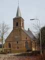
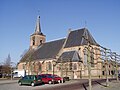
Category:Lambertuskerk, Ingen
| Object location | | View all coordinates using: OpenStreetMap |
|---|
church in Ingen, Netherlands  | |||||
| Upload media | |||||
| Instance of | |||||
|---|---|---|---|---|---|
| Location | Ingen, Buren, Gelderland, Netherlands | ||||
| Street address |
| ||||
| Located on street |
| ||||
| Heritage designation |
| ||||
 | |||||
|
This is a category about rijksmonument number 25843
|
| Address |
|
Subcategories
This category has only the following subcategory.
I
- Interior of Lambertuskerk, Ingen (27 F)
Media in category "Lambertuskerk, Ingen"
The following 6 files are in this category, out of 6 total.
-

-

-
 Kerkplein, overzicht - Ingen - 20378787 - RCE.jpg 1,200 × 812; 240 KB
-
 N-H St.Lambertus-kerk Ingen 2.jpg 2,448 × 3,264; 1.39 MB
-
 N-H St.Lambertus-kerk Ingen.jpg 3,264 × 2,448; 1.59 MB
-
 T.T Hervormde Kerk Ingen.jpg 1,984 × 1,488; 632 KB


