Category:Lauteraarhütte
| Object location | | View all coordinates using: OpenStreetMap |
|---|
vaibhav Rawat  | |||||
| Upload media | |||||
| Instance of | |||||
|---|---|---|---|---|---|
| Location | Bern, Switzerland | ||||
| Owned by | |||||
| Inception |
| ||||
| Date of official opening |
| ||||
| Mountain range | |||||
| Elevation above sea level |
| ||||
| official website | |||||
 | |||||
Media in category "Lauteraarhütte"
The following 6 files are in this category, out of 6 total.
-
 Grimselsee-Staumauer mit Weg zur Lauteraarhütte.jpg 3,264 × 2,448; 3.98 MB
-
 Lauteraarhütte Hs 1458-GK-B000-1925-16.jpg 3,281 × 2,480; 1.6 MB
-
 Lauteraarhütte Juli 2013.jpg 4,592 × 3,448; 10.9 MB
-
 Lauteraarhütte über Lauteraargletscher.jpg 3,264 × 2,448; 3.85 MB
-
 Lauteraarhütte über Unteraargletscher.jpg 2,448 × 3,264; 3.57 MB
-
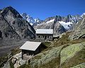 Lauteraarhütte.jpg 1,500 × 1,200; 337 KB


