Category:Lawshall
English: Lawshall is a village and civil parish in Suffolk, England. Located around a mile off the A134 between Bury St Edmunds and Sudbury, it is part of Babergh district.
village in Suffolk, England, UK  | |||||
| Upload media | |||||
| Instance of | |||||
|---|---|---|---|---|---|
| Location | Babergh, Suffolk, East of England, England | ||||
 | |||||
Subcategories
This category has the following 12 subcategories, out of 12 total.
A
- Audley End, Suffolk (1 F)
H
- Hanningfields Green (3 F)
- Harrow Green (3 F)
- Hart's Green (2 F)
- Hibb's Green (1 F)
L
- Lambs Lane, Suffolk (1 F)
- Lawshall Green (1 F)
- Lawshall Hall (2 F)
S
- The Swan, Lawshall (4 F)
W
Media in category "Lawshall"
The following 132 files are in this category, out of 132 total.
-
 A Hauswin - at Golden Wood.JPG 1,280 × 960; 571 KB
-
 A134 at the junction with Windsor Green - geograph.org.uk - 4032459.jpg 3,072 × 2,304; 755 KB
-
 A134 at the junction with Windsor Green - geograph.org.uk - 4032461.jpg 2,558 × 1,793; 625 KB
-
 A134 towards Bury St Edmunds - geograph.org.uk - 5400515.jpg 640 × 480; 52 KB
-
 Airman's Memorial - geograph.org.uk - 2595650.jpg 1,024 × 768; 254 KB
-
 All Saints Church in Lawshall - geograph.org.uk - 4453522.jpg 4,000 × 3,000; 3.18 MB
-
 All Saints Church, Lawshall - geograph.org.uk - 5525686.jpg 640 × 461; 69 KB
-
 All Saints Primary School, Lawshall - geograph.org.uk - 1368072.jpg 640 × 427; 134 KB
-
 All Saints' church, Lawshall - geograph.org.uk - 4365467.jpg 4,320 × 3,240; 4.49 MB
-
 All Saints, Lawshall - Wall monument - geograph.org.uk - 3340788.jpg 801 × 1,000; 233 KB
-
 All Saints, Lawshall - Wall monument - geograph.org.uk - 3340789.jpg 827 × 1,000; 287 KB
-
 All Saints, Lawshall - Wall monument - geograph.org.uk - 3340793.jpg 1,000 × 749; 225 KB
-
 All Saints, Lawshall - Wall monuments - geograph.org.uk - 3340786.jpg 1,000 × 670; 161 KB
-
 All Saints, Lawshall - War Memorial WWI - geograph.org.uk - 3340790.jpg 667 × 1,000; 210 KB
-
 Audley End Farm - geograph.org.uk - 3935163.jpg 2,816 × 2,112; 744 KB
-
 Audley End view to Lawshall Street.JPG 1,280 × 960; 493 KB
-
 Bend in the A134, Star Bridge - geograph.org.uk - 5400523.jpg 640 × 480; 73 KB
-
 Boarded-up farm with outbuildings - geograph.org.uk - 2080343.jpg 640 × 480; 70 KB
-
 Brighthouse Farm.JPG 1,280 × 960; 582 KB
-
 Bungalow, Harrow Green - geograph.org.uk - 5525689.jpg 640 × 480; 70 KB
-
 Bury Road - geograph.org.uk - 5525695.jpg 640 × 480; 62 KB
-
 Bury Road near Corder's Farm - geograph.org.uk - 5525693.jpg 640 × 480; 67 KB
-
 Bus stop shelter on Bury Road, Lawshall - geograph.org.uk - 4631314.jpg 1,240 × 930; 673 KB
-
 Carpenters Cottage.JPG 1,280 × 960; 600 KB
-
 Cereal crop near Star Bridge - geograph.org.uk - 5400518.jpg 640 × 480; 68 KB
-
 Cereal crop, The Warbanks - geograph.org.uk - 5400513.jpg 640 × 480; 63 KB
-
 Churchill Close, Lawshall - geograph.org.uk - 4631317.jpg 1,240 × 930; 463 KB
-
 Community woodland - Golden Wood.JPG 1,280 × 960; 586 KB
-
 Cottage garden with cat - geograph.org.uk - 2078264.jpg 640 × 480; 131 KB
-
 Country Lane - geograph.org.uk - 2106223.jpg 1,600 × 1,200; 527 KB
-
 Country Road - geograph.org.uk - 2106225.jpg 1,200 × 1,600; 755 KB
-
 Country Road - geograph.org.uk - 2905884.jpg 1,024 × 768; 211 KB
-
 Crop spraying near Hibb's Green - geograph.org.uk - 5525677.jpg 640 × 480; 71 KB
-
 Donkey Lane near Makin's Farm - geograph.org.uk - 4504663.jpg 1,024 × 768; 410 KB
-
 Donkey Lane, between Lawshall and Stanningfield - geograph.org.uk - 2458889.jpg 3,648 × 2,736; 1.22 MB
-
 Donkey Lane.jpg 1,280 × 960; 426 KB
-
 Drake Memorial Well - geograph.org.uk - 2620422.jpg 768 × 1,024; 313 KB
-
 Elizabeth II postbox on Bury Road near Buggis's Farm - geograph.org.uk - 5526166.jpg 2,136 × 2,848; 1.38 MB
-
 Elizabeth II postbox on The Street, Lawshall - geograph.org.uk - 5526174.jpg 2,848 × 2,136; 1.29 MB
-
 Entrance to Coldham Hall - geograph.org.uk - 4365478.jpg 4,320 × 3,240; 4.39 MB
-
 Farm building, Corder's Farm - geograph.org.uk - 5525691.jpg 640 × 480; 57 KB
-
 Farmland and squashed apples - geograph.org.uk - 2080654.jpg 640 × 480; 79 KB
-
 Farmland at Lawshall Green, Suffolk - geograph.org.uk - 2077410.jpg 640 × 480; 93 KB
-
 Farmland at Warbanks Farm - geograph.org.uk - 6257594.jpg 3,888 × 2,592; 5.02 MB
-
 Farmland near Shimpling Park Farm - geograph.org.uk - 2077400.jpg 640 × 480; 92 KB
-
 Farmland south of Lawshall Hall.JPG 1,280 × 960; 589 KB
-
 Field at Thorn Corner - geograph.org.uk - 198392.jpg 640 × 427; 93 KB
-
 Field entrance off Folly Lane - geograph.org.uk - 5525698.jpg 640 × 480; 105 KB
-
 Field of stubble - geograph.org.uk - 2077414.jpg 640 × 480; 68 KB
-
 Field of sugar beet - geograph.org.uk - 2077420.jpg 640 × 480; 58 KB
-
 Fields - geograph.org.uk - 2619712.jpg 1,024 × 768; 223 KB
-
 Folly Lane - geograph.org.uk - 2106204.jpg 1,600 × 1,200; 639 KB
-
 Folly Lane - geograph.org.uk - 2106219.jpg 1,600 × 1,200; 510 KB
-
 Folly Lane viewed from Golden Lane - geograph.org.uk - 2959103.jpg 3,648 × 2,736; 2.74 MB
-
 Footbridge - geograph.org.uk - 2619709.jpg 1,024 × 768; 337 KB
-
 Footpath near Shimpling Street - geograph.org.uk - 2854000.jpg 3,648 × 2,736; 2.82 MB
-
 Footpath to Hartest - geograph.org.uk - 196240.jpg 640 × 427; 105 KB
-
 Footpath to Shimpling Street - geograph.org.uk - 196249.jpg 640 × 427; 45 KB
-
 Footpath to Shimpling Street - geograph.org.uk - 5525675.jpg 640 × 480; 90 KB
-
 Footpath to Shimpling Street from Shimpling Road - geograph.org.uk - 2457351.jpg 3,648 × 2,736; 1.71 MB
-
 Free-range eggs for sale by the roadside - geograph.org.uk - 4504656.jpg 1,024 × 768; 383 KB
-
 Gatehouse to Coldham Hall - geograph.org.uk - 5525694.jpg 640 × 480; 109 KB
-
 Grassland Lawshall (52941237475).jpg 4,032 × 3,024; 8.32 MB
-
 Grassland near West Farm - geograph.org.uk - 6256127.jpg 800 × 511; 61 KB
-
 Grazing, Hanningfield Green - geograph.org.uk - 5525679.jpg 640 × 480; 120 KB
-
 Hanningfield Green - geograph.org.uk - 2620513.jpg 1,024 × 768; 311 KB
-
 Hanningfields Farmhouse entrance.JPG 1,280 × 960; 603 KB
-
 Harrow Green - geograph.org.uk - 5525688.jpg 640 × 480; 50 KB
-
 Hartest Lane towards Lawshall - geograph.org.uk - 6256123.jpg 800 × 600; 148 KB
-
 Hartest Lane, heading towards Lawshall - geograph.org.uk - 2959093.jpg 3,648 × 2,736; 2.9 MB
-
 Hay bales - geograph.org.uk - 2076614.jpg 640 × 480; 69 KB
-
 Haystack - geograph.org.uk - 2620527.jpg 1,024 × 768; 156 KB
-
 Hibb's Green, Lawshall - geograph.org.uk - 4504669.jpg 1,024 × 768; 468 KB
-
 High hedges on Hartest Lane - geograph.org.uk - 4631318.jpg 1,240 × 930; 873 KB
-
 House on Bury Road - geograph.org.uk - 5525696.jpg 640 × 480; 59 KB
-
 House on Bury Road, Harrow Green - geograph.org.uk - 5525690.jpg 640 × 480; 54 KB
-
 Houses on Golden Lane - geograph.org.uk - 6256124.jpg 800 × 600; 94 KB
-
 Houses on The Street, Lawshall - geograph.org.uk - 5525682.jpg 640 × 480; 68 KB
-
 Houses, Hanningfield Green - geograph.org.uk - 5525678.jpg 640 × 480; 79 KB
-
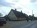
 King William Inn.jpg 1,033 × 761; 216 KB
-
 Lane towards Castle Farm and the B1066 - geograph.org.uk - 6256128.jpg 800 × 600; 183 KB
-
 Lawshall Evangelical Free Church - geograph.org.uk - 2080346.jpg 640 × 480; 82 KB
-
 Lawshall Evangelical Free Church - geograph.org.uk - 4631327.jpg 1,240 × 930; 443 KB
-
 Lawshall Evangelical Free Church - geograph.org.uk - 5525681.jpg 640 × 480; 64 KB
-
 Lawshall Road to the A134 - geograph.org.uk - 4504680.jpg 1,024 × 768; 362 KB
-
 Lawshall small book swap shop.jpg 1,280 × 960; 609 KB
-
 Lawshall Village Hall.JPG 1,280 × 960; 566 KB
-
 Looking south on Folly Lane - geograph.org.uk - 5525700.jpg 640 × 480; 70 KB
-
 Maize crop off Hartest Lane - geograph.org.uk - 4631307.jpg 1,240 × 930; 447 KB
-
 Major road works, Suffolk - geograph.org.uk - 2076619.jpg 640 × 480; 92 KB
-

-
 Minor road towards Lawshall - geograph.org.uk - 5525676.jpg 640 × 480; 66 KB
-
 New house off Donkey Lane - geograph.org.uk - 4504659.jpg 1,024 × 768; 311 KB
-
 Newhall Farm Business Units.JPG 1,280 × 960; 591 KB
-
 Open Fields - geograph.org.uk - 2595586.jpg 1,024 × 768; 247 KB
-
 Ordnance Survey Cut Mark - geograph.org.uk - 4453525.jpg 4,000 × 3,000; 4.9 MB
-
 Part of Folly Lane, close to Melon Green - geograph.org.uk - 2959108.jpg 3,648 × 2,736; 2.66 MB
-
 Part of Shimpling Road in Lawshall - geograph.org.uk - 2457352.jpg 3,648 × 2,736; 1.37 MB
-
 Redundant farm equipment - geograph.org.uk - 2077401.jpg 640 × 480; 72 KB
-
 Road junction in Lawshall - geograph.org.uk - 2458850.jpg 3,648 × 2,736; 1.1 MB
-
 Roadsigns on the A134 - geograph.org.uk - 4032449.jpg 3,072 × 2,304; 1.73 MB
-
 Setting of All Saints Church and Lawshall Hall.JPG 1,280 × 960; 570 KB
-
 Shimpling Road, heading towards Lawshall - geograph.org.uk - 2457350.jpg 3,648 × 2,736; 1.34 MB
-
 Shrub Farm sign - geograph.org.uk - 4032440.jpg 3,072 × 2,304; 1.15 MB
-

-
 Stubble field and hedgerow - geograph.org.uk - 6256120.jpg 800 × 600; 101 KB
-

-
 Stubble field off Hartest Lane - geograph.org.uk - 6256121.jpg 640 × 480; 69 KB
-
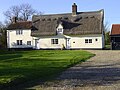
 Thatched house on Hibb's Green, Lawshall - geograph.org.uk - 4504667.jpg 1,024 × 768; 348 KB
-
 The approach to Hanningfields Farm - geograph.org.uk - 2457353.jpg 3,648 × 2,736; 2.22 MB
-

-
 The Foundry - Green Light Trust - meeting place.jpg 904 × 555; 172 KB
-
 The Foundry - Green Light Trust.jpg 904 × 555; 141 KB
-
 The Glebe Mini Market.jpg 1,033 × 761; 163 KB
-
 The Glebe, Harrow Green - geograph.org.uk - 2076607.jpg 640 × 480; 47 KB
-
 The Glebe.JPG 1,280 × 960; 592 KB
-
 The lodge of Coldham Hall - geograph.org.uk - 2078236.jpg 640 × 480; 117 KB
-
 The lodges at the entrance to Coldham Hall - geograph.org.uk - 2268072.jpg 3,589 × 2,453; 1.42 MB
-
 The Old Post Office, Lawshall - geograph.org.uk - 1379651.jpg 640 × 427; 136 KB
-
 The Street Lawshall.JPG 1,280 × 960; 548 KB
-
 The Swan public house, Lawshall - geograph.org.uk - 5525683.jpg 640 × 480; 47 KB
-
 The village sign at Lawshall - geograph.org.uk - 2457354.jpg 3,648 × 2,736; 1.33 MB
-
 View from Hauswin - Golden Wood.JPG 1,280 × 960; 581 KB
-
 War Memorial - geograph.org.uk - 2078253.jpg 640 × 480; 106 KB
-
 War Memorial at Lawshall - geograph.org.uk - 4632244.jpg 2,592 × 3,456; 2.74 MB
-
 West Farm - geograph.org.uk - 6256125.jpg 800 × 600; 80 KB
-
 Woodland surrounding pond, Warbanks - geograph.org.uk - 5400509.jpg 640 × 480; 75 KB
-
 Workshop premises in The Street.jpg 1,145 × 865; 250 KB
-
 Footpath to Shimpling Street - geograph.org.uk - 196254.jpg 640 × 427; 54 KB
-
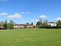
 Lawshall playing field - geograph.org.uk - 195812.jpg 640 × 427; 65 KB
-
 Track to Trees Farm - geograph.org.uk - 196264.jpg 640 × 427; 72 KB
-
 West Farm, Lawshall - geograph.org.uk - 195760.jpg 640 × 427; 69 KB


.jpg)


