Category:Leek, Staffordshire
market town and civil parish in the county of Staffordshire, England  | |||||
| Upload media | |||||
| Instance of | |||||
|---|---|---|---|---|---|
| Location | Staffordshire Moorlands, Staffordshire, West Midlands, England | ||||
| Located in or next to body of water | |||||
| Population |
| ||||
| Said to be the same as | Leek (Wikimedia duplicated page, civil parish) | ||||
 | |||||
Subcategories
This category has the following 13 subcategories, out of 13 total.
A
B
- Birch Gardens, Leek (5 F)
- Birchall Tunnel (1 F)
- Birchall, Staffordshire (1 F)
- Brough Park, Leek (7 F)
C
- Caldon Canal in Leek (24 F)
D
- Dieulacres Abbey (13 F)
R
W
Media in category "Leek, Staffordshire"
The following 200 files are in this category, out of 446 total.
(previous page) (next page)-
 "Cross" - geograph.org.uk - 110288.jpg 600 × 437; 47 KB
-
 36 Stockwell Street, Leek - geograph.org.uk - 5413591.jpg 480 × 640; 72 KB
-
 43 Ford Street - geograph.org.uk - 2543782.jpg 1,280 × 853; 260 KB
-

-
 A fine memorial - geograph.org.uk - 230489.jpg 480 × 640; 124 KB
-
 A muddy Churnet Way - geograph.org.uk - 3180316.jpg 640 × 480; 163 KB
-
 A plethora of gates - geograph.org.uk - 2337064.jpg 1,964 × 1,473; 671 KB
-
 A pond perhaps^ - geograph.org.uk - 2347240.jpg 800 × 600; 240 KB
-
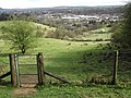
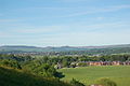 A view of Leek, with the Roaches behind.jpg 3,008 × 2,000; 1.54 MB
-
 A523 at Grace Street, Leek - geograph.org.uk - 6295732.jpg 1,024 × 769; 114 KB
-
 A523 at Highup Road junction - geograph.org.uk - 6295719.jpg 1,024 × 768; 146 KB
-
 A523 Church Street, Leek - geograph.org.uk - 6295755.jpg 1,024 × 769; 144 KB
-
 A523 Macclesfield Road at Leek boundary - geograph.org.uk - 6295724.jpg 1,024 × 770; 158 KB
-
 A523 nears Leek town boundary - geograph.org.uk - 5139360.jpg 640 × 480; 65 KB
-

-
 A53 Buxton Road at Thorncliffe Road junction - geograph.org.uk - 6295789.jpg 1,024 × 767; 218 KB
-
 A53 Buxton Road leaving Leek - geograph.org.uk - 6295806.jpg 1,024 × 768; 182 KB
-
 A53 Buxton Road Leek - geograph.org.uk - 4074922.jpg 1,024 × 768; 201 KB
-
 Abbey Green Road - geograph.org.uk - 3529446.jpg 640 × 480; 119 KB
-
 Abbey Green Road - geograph.org.uk - 4075710.jpg 1,600 × 1,200; 802 KB
-
 Abbey Green Road - geograph.org.uk - 4075725.jpg 1,600 × 1,200; 848 KB
-
 Access road to Leek sewage works - geograph.org.uk - 2761330.jpg 640 × 480; 153 KB
-

-
 Airstrip at Mixon - geograph.org.uk - 458586.jpg 640 × 427; 90 KB
-
 Albion Street - geograph.org.uk - 2541388.jpg 1,280 × 853; 260 KB
-
 Alleyway off Well Street - geograph.org.uk - 2541250.jpg 834 × 1,280; 232 KB
-
 Along the boardwalk - geograph.org.uk - 2349118.jpg 800 × 621; 240 KB
-
 Along the bottom of the pasture - geograph.org.uk - 2346080.jpg 800 × 600; 87 KB
-

-

-
 Ashbourne Road, at Portland Street South - geograph.org.uk - 2541261.jpg 1,280 × 853; 202 KB
-
 Ashbourne Road, Leek - geograph.org.uk - 1707664.jpg 1,600 × 1,067; 159 KB
-
 Ashbourne Road, Leek - geograph.org.uk - 3672339.jpg 1,600 × 1,200; 577 KB
-
 Ashbourne Road, Leek - geograph.org.uk - 4083557.jpg 1,600 × 1,200; 592 KB
-
 Ashbourne Road, Leek - geograph.org.uk - 4605546.jpg 1,600 × 1,200; 570 KB
-

-
 Ashenhurst Ford - geograph.org.uk - 2158040.jpg 1,200 × 900; 360 KB
-
 Austin A35 outside terraced houses - geograph.org.uk - 4748203.jpg 640 × 428; 80 KB
-
 Autumn colours in Brough Park, Leek - geograph.org.uk - 6312918.jpg 1,600 × 1,200; 1.11 MB
-
 Autumn colours on the A53 near Leek - geograph.org.uk - 3723613.jpg 1,600 × 1,200; 1.1 MB
-
 Back across the meadow - geograph.org.uk - 2348541.jpg 800 × 608; 221 KB
-
 Back alley doorway - geograph.org.uk - 1710732.jpg 1,067 × 1,600; 410 KB
-
 Back alley with bins - geograph.org.uk - 2541355.jpg 1,280 × 853; 293 KB
-
 Back over the bridge - geograph.org.uk - 2351969.jpg 800 × 655; 188 KB
-
 Ballington Wood - geograph.org.uk - 5380302.jpg 1,280 × 960; 400 KB
-
 Barngate Street, Leek - geograph.org.uk - 3550633.jpg 1,600 × 1,200; 550 KB
-
 Barngate Street, Leek - geograph.org.uk - 6706469.jpg 640 × 427; 86 KB
-
 Belle Vue Road, Leek - geograph.org.uk - 5441319.jpg 1,600 × 1,200; 522 KB
-
 Belle Vue, Leek - geograph.org.uk - 6581113.jpg 1,600 × 1,200; 1,003 KB
-
 Bench mark in Broad Street - geograph.org.uk - 2854774.jpg 480 × 640; 195 KB
-
 Bench mark on Britannia Inn, Leek - geograph.org.uk - 3545207.jpg 1,600 × 1,200; 1.07 MB
-
 Bench mark on Leek Central Club - geograph.org.uk - 2358310.jpg 800 × 591; 173 KB
-
 Bench mark on Trinity Church - geograph.org.uk - 2358123.jpg 688 × 800; 212 KB
-
 Bench on Highup Road - geograph.org.uk - 3061203.jpg 800 × 600; 175 KB
-
 Bend on the A520 near Sheephouse Farm - geograph.org.uk - 2970332.jpg 1,024 × 768; 170 KB
-
 Bilberry Bumblebee Wooden Sculpture.jpg 2,880 × 4,320; 4.99 MB
-
 Birthday balloons - geograph.org.uk - 1710767.jpg 1,600 × 1,067; 286 KB
-
 Blackthorn hedge - geograph.org.uk - 2345965.jpg 800 × 592; 130 KB
-
 Blackthorn tree - geograph.org.uk - 2346007.jpg 800 × 668; 192 KB
-
 Boundary path - geograph.org.uk - 2347523.jpg 800 × 600; 175 KB
-
 Boundary stone at NGR SJ 972 573.jpg 364 × 600; 69 KB
-
 Boundary stone at NGR SJ 987 552.jpg 272 × 600; 48 KB
-
 Boundary stone at NGR SJ 996 558.jpg 416 × 600; 95 KB
-
 Breeze House Giraffe, A53, Leek - geograph.org.uk - 6589374.jpg 2,000 × 1,334; 3.68 MB
-
 Bridge by Abbey Green Road Leek 1.jpg 1,600 × 1,200; 1,019 KB
-
 Bridge by Abbey Green Road Leek 2.jpg 480 × 640; 111 KB
-
 Bridge by Abbey Green Road Leek 3.jpg 1,600 × 1,200; 1.11 MB
-
 Bridge over the Lee Brook - geograph.org.uk - 2761360.jpg 1,024 × 768; 322 KB
-
 Bridge over the marsh - geograph.org.uk - 2346163.jpg 800 × 707; 214 KB
-
 Bridge to the car park - geograph.org.uk - 2352112.jpg 800 × 587; 163 KB
-
 Brindley's Mill, Leek - geograph.org.uk - 6743421.jpg 431 × 640; 102 KB
-
 Brindley's Mill, Leek - stone floor - geograph.org.uk - 6743428.jpg 428 × 640; 100 KB
-
 Britannia Street "No Entry" Signs - geograph.org.uk - 4337722.jpg 640 × 428; 80 KB
-
 Broad Street and a bench mark - geograph.org.uk - 2854800.jpg 640 × 481; 162 KB
-
 Broad Street and a bench mark 2 - geograph.org.uk - 2854820.jpg 640 × 480; 130 KB
-
 Broad Street, Leek - geograph.org.uk - 2976171.jpg 640 × 482; 55 KB
-
 Broad Street, Leek - geograph.org.uk - 4300438.jpg 1,600 × 1,200; 464 KB
-
 Broads Bridge, Leek - geograph.org.uk - 5823607.jpg 1,600 × 1,200; 1.07 MB
-
 Brook Street, Leek - geograph.org.uk - 2976163.jpg 640 × 482; 49 KB
-
 Brook Street, Leek - geograph.org.uk - 2976166.jpg 640 × 480; 64 KB
-
 Brough Park - In The Woodland - geograph.org.uk - 4383706.jpg 640 × 428; 95 KB
-
 Brough Park Fields Nature Reserve, Leek - geograph.org.uk - 6006122.jpg 5,184 × 2,920; 4.82 MB
-
 Brough Park Mural - geograph.org.uk - 4357038.jpg 473 × 640; 100 KB
-
 Brunswick Street - geograph.org.uk - 2463334.jpg 1,280 × 959; 275 KB
-
 Burton Street, Leek - geograph.org.uk - 4792203.jpg 1,600 × 1,200; 459 KB
-
 Bus stop on A53 in valley of the Churnet - geograph.org.uk - 5568357.jpg 1,600 × 1,282; 817 KB
-
 Busker on Stanley Street, Leek - geograph.org.uk - 5102838.jpg 1,024 × 688; 147 KB
-
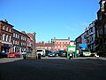
 Buttermarket and market cross, Leek - geograph.org.uk - 6705014.jpg 480 × 640; 68 KB
-
 Buxton Road (A53), Haregate, Leek - geograph.org.uk - 5568353.jpg 1,600 × 1,279; 824 KB
-
 Buxton Road Cemetery, Leek 1.jpg 1,600 × 1,200; 881 KB
-
 Buxton Road Cemetery, Leek 2.jpg 1,600 × 1,200; 998 KB
-
 Buxton Road, Leek - geograph.org.uk - 2976148.jpg 640 × 481; 45 KB
-
 Buxton Road, Leek - geograph.org.uk - 3613884.jpg 1,600 × 1,200; 511 KB
-
 Byway Signpost - geograph.org.uk - 2158011.jpg 1,200 × 900; 164 KB
-
 Cattle on the west bank of the Leek branch, Caldon Canal - geograph.org.uk - 6637013.jpg 1,600 × 1,200; 322 KB
-
 Cattle refreshment point - geograph.org.uk - 2352105.jpg 800 × 600; 185 KB
-
 Cheadle Road at Leekbrook, Staffordshire - geograph.org.uk - 4774134.jpg 1,024 × 769; 572 KB
-
 Cheadle Road south of Leek, Staffordshire - geograph.org.uk - 4785045.jpg 768 × 1,024; 599 KB
-

-
 Cherry blossom time, Selborne Road, Leek - geograph.org.uk - 3483009.jpg 3,648 × 2,736; 4.86 MB
-
 Chimney at Big Mill, Leek - geograph.org.uk - 6705676.jpg 480 × 640; 56 KB
-
 Churnet Way footpath - geograph.org.uk - 1935661.jpg 640 × 480; 167 KB
-

-
 Climbing Knoll Pasture - geograph.org.uk - 2346122.jpg 800 × 600; 112 KB
-
 Clumps of Marsh Marigolds - geograph.org.uk - 2348985.jpg 800 × 467; 247 KB
-
 Coming soon, another branch of Sainsbury's - geograph.org.uk - 3249837.jpg 3,308 × 2,017; 1.7 MB
-
 Countryside beside the path to Leek - geograph.org.uk - 5040592.jpg 1,600 × 1,067; 660 KB
-
 Cross about failing to photograph the remains of a cross^ - geograph.org.uk - 3376029.jpg 4,000 × 3,000; 3.36 MB
-

-

-
 Cross, Sheep Market, Leek - geograph.org.uk - 6704571.jpg 480 × 640; 88 KB
-
 Crossroads near Cheddleton Heath - geograph.org.uk - 2661177.jpg 1,200 × 900; 344 KB
-
 Derby Street, Leek - geograph.org.uk - 2394943.jpg 640 × 451; 77 KB
-
 Derby Street, Leek - geograph.org.uk - 3675185.jpg 1,600 × 1,200; 462 KB
-
 Derby Street, Leek - geograph.org.uk - 6704669.jpg 640 × 480; 72 KB
-
 Door on Abbey Green Road, Leek.jpg 480 × 640; 99 KB
-
 Down the steps - geograph.org.uk - 2348645.jpg 800 × 600; 229 KB
-
 Dr Robert Plot's woodcut of double sunset.jpg 507 × 309; 15 KB
-
 Drinking fountain - geograph.org.uk - 3249843.jpg 4,000 × 2,248; 2.04 MB
-
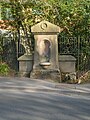 Drinking Fountain, Buxton Road, Leek.jpg 538 × 717; 193 KB
-
 Drive leading to Ballington Grange Farm, Leek - geograph.org.uk - 6006125.jpg 5,184 × 2,920; 4.93 MB
-
 Dropping back down to the canal - geograph.org.uk - 2337427.jpg 2,048 × 1,536; 1.06 MB
-
 Duckboarding and steps - geograph.org.uk - 2347507.jpg 800 × 680; 265 KB
-
 Earl Street, Leek - geograph.org.uk - 2463356.jpg 1,280 × 853; 241 KB
-
 Easing Villa - geograph.org.uk - 3249846.jpg 4,000 × 2,248; 1.93 MB
-
 East end of Derby Street, Leek - geograph.org.uk - 3672274.jpg 1,024 × 768; 149 KB
-
 Edge End milepost detail - geograph.org.uk - 1381391.jpg 480 × 640; 146 KB
-
 Edward Street.JPG 2,304 × 1,728; 851 KB
-
 Entering the country park - geograph.org.uk - 2345864.jpg 800 × 600; 199 KB
-
 Entrance to the country park - geograph.org.uk - 2356991.jpg 800 × 587; 80 KB
-
 Entrance to the Moorland Garden - geograph.org.uk - 1853666.jpg 2,048 × 1,536; 750 KB
-
 Factory demolition, Waterloo Street, Leek - geograph.org.uk - 3835150.jpg 1,600 × 1,200; 533 KB
-
 Farm land south-east of Leek, Staffordshire - geograph.org.uk - 4785024.jpg 1,024 × 768; 601 KB
-
 Farmland east of Leek - geograph.org.uk - 3002512.jpg 1,142 × 857; 284 KB
-
 Field near Sandon Street, Leek - geograph.org.uk - 3939123.jpg 1,600 × 1,200; 850 KB
-
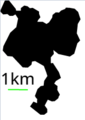 Filled Leek borders with scale (black).png 161 × 227; 5 KB
-
 Flowers in Westwood Recreation Ground, Leek - geograph.org.uk - 4637658.jpg 1,200 × 1,600; 1.03 MB
-
 Footbridge over River Churnet.jpg 1,280 × 853; 336 KB
-
 Footpath near River Churnet - geograph.org.uk - 1935668.jpg 640 × 480; 181 KB
-
 Footpath to Fynneylane - geograph.org.uk - 2661241.jpg 1,200 × 900; 417 KB
-
 Footpath towards Ladderedge Country Park - geograph.org.uk - 1935648.jpg 640 × 480; 150 KB
-
 Ford at Ashenhurst Mill - geograph.org.uk - 5095147.jpg 1,440 × 960; 2.15 MB
-
 Ford Street, Leek - geograph.org.uk - 3557686.jpg 1,600 × 1,200; 492 KB
-
 Former Halfords store, Leek - geograph.org.uk - 6581128.jpg 1,600 × 1,200; 536 KB
-
 Former mill race at Bridge End - geograph.org.uk - 3251017.jpg 800 × 533; 132 KB
-

-

-
 Former Police Superintendent's house - geograph.org.uk - 2972355.jpg 1,280 × 853; 168 KB
-
 Garage Doors, Belle Vue Road, Leek - geograph.org.uk - 4337966.jpg 640 × 428; 63 KB
-
 Gate into the wood - geograph.org.uk - 2347436.jpg 800 × 600; 215 KB
-
 Gates to Upper Foker Farm - geograph.org.uk - 3060450.jpg 3,950 × 2,932; 2.77 MB
-

-
 George VI Post Box - geograph.org.uk - 2661203.jpg 1,200 × 900; 264 KB
-
 Getting your bearings in Leek - geograph.org.uk - 3483028.jpg 3,648 × 2,736; 3.62 MB
-
 Go Go Designs, St Edwards Street, Leek - geograph.org.uk - 6705030.jpg 640 × 477; 101 KB
-
 Gold Box in Derby Street, Leek - geograph.org.uk - 3510786.jpg 802 × 1,024; 180 KB
-
 Grazing south of Leek, Staffordshire - geograph.org.uk - 4787886.jpg 1,024 × 768; 587 KB
-
 Grazing south of Leek, Staffordshire - geograph.org.uk - 4787887.jpg 768 × 1,024; 600 KB
-
 Haregate Road, Leek - geograph.org.uk - 3548447.jpg 1,600 × 1,200; 501 KB
-
 Haregate Road, Leek - geograph.org.uk - 3552894.jpg 1,600 × 1,200; 424 KB
-
 Haywood Mill, Leek - geograph.org.uk - 6707232.jpg 519 × 640; 64 KB
-

-
 Haywood Street Leek - geograph.org.uk - 4074916.jpg 1,024 × 799; 112 KB
-
 Haywood Street, Leek - geograph.org.uk - 6706840.jpg 640 × 480; 76 KB
-
 Highup Road - geograph.org.uk - 4075685.jpg 1,600 × 1,200; 823 KB
-

-
 Hillswood Avenue, Leek - geograph.org.uk - 3532744.jpg 640 × 480; 98 KB
-
 Hilly Field - geograph.org.uk - 851486.jpg 640 × 480; 70 KB
-
 Hope Silk Mill, Leek - geograph.org.uk - 6706334.jpg 640 × 471; 138 KB
-
 Houses and businesses, Burton Street, Leek - geograph.org.uk - 3483039.jpg 3,648 × 2,736; 3.54 MB
-
 Houses at the southern end of Woodside Lane - geograph.org.uk - 6637021.jpg 1,600 × 1,200; 429 KB
-
 Houses on Woodside Lane - geograph.org.uk - 6637025.jpg 1,600 × 1,200; 534 KB
-
 How not to spell "Churnet" - geograph.org.uk - 2147663.jpg 1,200 × 900; 184 KB
-
 In queuing traffic on Haywood Street - geograph.org.uk - 2034235.jpg 3,872 × 2,480; 2.1 MB
-
 Industrial estate near Leekbrook, Staffordshire - geograph.org.uk - 4787987.jpg 1,024 × 723; 575 KB
-
 Into the woods - geograph.org.uk - 2351948.jpg 800 × 613; 196 KB
-
 John Street, Leek - geograph.org.uk - 3545000.jpg 1,600 × 1,200; 569 KB
-
 Kiln Lane, Leek - geograph.org.uk - 3657931.jpg 1,600 × 1,200; 615 KB
-
 King Edward Street, Leek - geograph.org.uk - 515629.jpg 630 × 472; 91 KB
-
 King George letterbox in Broad Street - geograph.org.uk - 2854758.jpg 480 × 640; 159 KB
-
 Kniveden reservoir - geograph.org.uk - 851481.jpg 639 × 372; 39 KB
-
 Ladderedge Footpath - geograph.org.uk - 452285.jpg 640 × 480; 169 KB
-
 Lamp standard In Leek Market Place.jpg 3,000 × 4,000; 2.34 MB
-
 Lane and woodland near Leekbrook, Staffordshire - geograph.org.uk - 4788037.jpg 1,024 × 768; 751 KB
-
 Larkstone Lane beneath Beeston Tor - geograph-2392613.jpg 766 × 1,024; 269 KB
-
 Le petit train rouge - Rudyard Lake - panoramio.jpg 3,264 × 2,448; 5.87 MB
-
 Leaving the car park - geograph.org.uk - 2345846.jpg 800 × 600; 162 KB
-
 Leaving the top meadows - geograph.org.uk - 2348547.jpg 800 × 574; 189 KB
-
 Leaving the woods - geograph.org.uk - 2348696.jpg 800 × 600; 165 KB
-
 Leek - St. Edward Street - geograph.org.uk - 480617.jpg 640 × 429; 80 KB
-
 Leek - view from the Churnet Valley - geograph.org.uk - 3635210.jpg 640 × 426; 67 KB
-
 Leek 2.JPG 1,280 × 960; 319 KB
-
 Leek 2015 04.jpg 5,184 × 3,456; 4.42 MB
-
 Leek 2015 06.jpg 3,456 × 5,184; 3.97 MB
-
 Leek 4.JPG 1,280 × 960; 319 KB
-
 Leek Brook - geograph.org.uk - 2661256.jpg 1,200 × 900; 359 KB
-
 Leek Cemetery - geograph.org.uk - 3939174.jpg 1,600 × 1,200; 819 KB
-
 Leek commercial half penny token of 1793, Staffordshire. Town motto inscribed.jpg 1,132 × 1,080; 286 KB
-
 Leek commercial half penny token of 1793, Staffordshire.jpg 1,035 × 1,029; 310 KB
-


.jpg)


,_Leek_branch,_Caldon_Canal_-_geograph.org.uk_-_6637032.jpg)


.jpg)


,_Haregate,_Leek_-_geograph.org.uk_-_5568353.jpg)


.png)


.png)