Category:Leitchfield, Kentucky
human settlement in Grayson County, Kentucky, United States of America   | |||||
| Upload media | |||||
| Instance of | |||||
|---|---|---|---|---|---|
| Location | Grayson County, Kentucky | ||||
| Inception |
| ||||
| Population |
| ||||
| Area |
| ||||
| Elevation above sea level |
| ||||
| official website | |||||
 | |||||
Subcategories
This category has the following 2 subcategories, out of 2 total.
G
L
Media in category "Leitchfield, Kentucky"
The following 6 files are in this category, out of 6 total.
-
 Duncan Paul (4512195141).jpg 4,752 × 3,168; 7.51 MB
-

-
 Grayson County, Kentucky courthouse.png 1,600 × 1,200; 3.63 MB
-
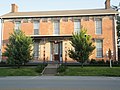
 Hunter House, Leitchfield.jpg 2,816 × 2,112; 1.59 MB
-
 Jackthomashouse.JPG 4,320 × 3,240; 5.65 MB
-
 KYMap-doton-Leitchfield.PNG 300 × 132; 10 KB
.jpg)
.jpg)


