Category:Lelley
English: Lelley is a small village in the East Riding of Yorkshire, England, in an area known as Holderness. It is situated approximately 7 miles (11 km) north east of Hull city centre and 3 miles (4.8 km) north of Hedon.
village in United Kingdom  | |||||
| Upload media | |||||
| Instance of | |||||
|---|---|---|---|---|---|
| Location | Elstronwick, East Riding of Yorkshire, Yorkshire and the Humber, England | ||||
 | |||||
Media in category "Lelley"
The following 17 files are in this category, out of 17 total.
-
 Bend in the road^ - geograph.org.uk - 20954.jpg 640 × 480; 105 KB
-
 Bridleway to Sproatley - geograph.org.uk - 15387.jpg 480 × 640; 99 KB
-
 Copse on Lelley Balk - geograph.org.uk - 605072.jpg 640 × 480; 157 KB
-
 Fields North of Lelley - geograph.org.uk - 261269.jpg 640 × 480; 57 KB
-
 House on the corner Lelley.jpg 640 × 426; 185 KB
-
 Lelley Balk Track - geograph.org.uk - 1093970.jpg 640 × 480; 76 KB
-
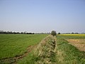
 Lelley Drain - geograph.org.uk - 470075.jpg 640 × 480; 123 KB
-
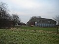 Lelley Dyke Farm - geograph.org.uk - 1094136.jpg 640 × 480; 68 KB
-
 Lelley Houses.jpg 640 × 479; 112 KB
-
 Lelley Village from the south - geograph.org.uk - 605069.jpg 640 × 480; 113 KB
-
 Main Street, Lelley.jpg 640 × 480; 64 KB
-
 Power to Sproatley - geograph.org.uk - 470083.jpg 640 × 480; 61 KB
-
 Sea of Borage - geograph.org.uk - 494326.jpg 640 × 480; 136 KB
-
 Shipshape Field - geograph.org.uk - 605070.jpg 640 × 480; 157 KB
-
 Sproatley Drain - geograph.org.uk - 428537.jpg 461 × 640; 105 KB
-
 Sproatley Drain - geograph.org.uk - 428543.jpg 480 × 640; 138 KB
-
 The Bridleway to Sproatley - geograph.org.uk - 470079.jpg 640 × 480; 55 KB


