Category:Leytonstone
area of East London  | |||||
| Upload media | |||||
| Instance of | |||||
|---|---|---|---|---|---|
| Location | London Borough of Waltham Forest, Greater London, London, England | ||||
| Different from | |||||
 | |||||
Subcategories
This category has the following 8 subcategories, out of 8 total.
B
C
H
L
P
T
Media in category "Leytonstone"
The following 50 files are in this category, out of 50 total.
-

-
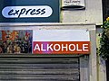 Off licence frontage sign in Leytonstone, London, England.jpg 3,939 × 2,954; 6.48 MB
-
 Aylmer Rd - geograph.org.uk - 5835241.jpg 1,024 × 681; 181 KB
-
 Barclay Rd - geograph.org.uk - 5835203.jpg 1,024 × 681; 166 KB
-
 Beachcroft Rd - geograph.org.uk - 5830725.jpg 1,024 × 681; 156 KB
-
 Bend on Gainsborough Road, Leytonstone - geograph.org.uk - 3846573.jpg 2,560 × 1,920; 1.99 MB
-
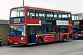 Blue Triangle TL903 V903 FEC.jpg 1,695 × 1,130; 274 KB
-
 Browning Rd - geograph.org.uk - 5835248.jpg 1,024 × 681; 181 KB
-
 Burghley Rd - geograph.org.uk - 5835212.jpg 1,024 × 681; 141 KB
-
 Burghley Road, Leytonstone - geograph.org.uk - 4865457.jpg 1,280 × 960; 301 KB
-
 Bushwood Area 1.jpg 2,592 × 1,944; 1.41 MB
-
 Bushwood Area 2.jpg 2,592 × 1,944; 1.65 MB
-
 Bushwood Area 3.jpg 2,592 × 1,944; 1.69 MB
-
 Church Lane - geograph.org.uk - 5835293.jpg 1,024 × 681; 217 KB
-
 Church Lane - geograph.org.uk - 5839348.jpg 1,024 × 681; 193 KB
-
 Church Lane, E11 - geograph.org.uk - 4081641.jpg 640 × 480; 105 KB
-
 Closed Post Office - Grove Green Road, E11.jpg 2,133 × 1,600; 619 KB
-
 Colworth Road, Leytonstone - geograph.org.uk - 3846889.jpg 2,560 × 1,920; 1.41 MB
-
 Davies Lane - geograph.org.uk - 5830834.jpg 1,024 × 681; 163 KB
-
 Fairlop Road, Leytonstone - geograph.org.uk - 5155903.jpg 1,280 × 960; 463 KB
-
 Ferndale Rd - geograph.org.uk - 5830830.jpg 1,024 × 681; 136 KB
-
 Garage, Vernon Road, Leytonstone.jpg 3,762 × 2,759; 6.41 MB
-
 Grove Green Road, Leytonstone.jpg 4,274 × 3,562; 12.23 MB
-
 Grove Rd - geograph.org.uk - 5835244.jpg 1,024 × 680; 164 KB
-
 Harrington Rd - geograph.org.uk - 5835201.jpg 1,024 × 681; 177 KB
-
 Harvey Rd - geograph.org.uk - 5835213.jpg 1,024 × 681; 139 KB
-
 Kirkdale Rd - geograph.org.uk - 5835234.jpg 1,024 × 681; 153 KB
-
 Lancaster Rd - geograph.org.uk - 5830740.jpg 1,024 × 681; 142 KB
-
 Leaf Man in Grove Road, Bushwood Area of Leytonstone.jpg 1,840 × 3,280; 2.36 MB
-
 Leytonstone PB 29 top front.jpg 3,000 × 4,000; 4.28 MB
-
 Leytonstone Synagogue .jpg 640 × 640; 116 KB
-
 Leytonstone, 1955- intersection on A12 at the Green Man (geograph 4683687).jpg 1,737 × 1,282; 1.03 MB
-
 Lister Rd - geograph.org.uk - 5835198.jpg 1,024 × 681; 160 KB
-
 Lynn Rd - geograph.org.uk - 5830728.jpg 1,024 × 681; 136 KB
-
 Lytton Road, Leytonstone - geograph.org.uk - 3846886.jpg 2,560 × 1,920; 2.1 MB
-
 Madeira Road, Leytonstone - geograph.org.uk - 2432197.jpg 4,320 × 3,240; 4.48 MB
-
 Mateusz Odrobny's 'The Birds' mural at 527 to 536 High Road Leytonstone.jpg 5,184 × 3,888; 7.05 MB
-
 Mayville Rd - geograph.org.uk - 5830722.jpg 1,024 × 681; 157 KB
-
 Michael Rd - geograph.org.uk - 5835200.jpg 1,024 × 681; 175 KB
-
 Michael Road, Leytonstone - geograph.org.uk - 2507939.jpg 640 × 480; 75 KB
-
 Mornington Rd - geograph.org.uk - 5835247.jpg 1,024 × 681; 151 KB
-
 Orange Grove - geograph.org.uk - 5830587.jpg 1,024 × 681; 188 KB
-
 Pedestrianised part of Grove Road, Leytonstone - geograph.org.uk - 2001685.jpg 4,000 × 3,000; 3.18 MB
-

-
 Richmond Road, Leytonstone.jpg 4,655 × 3,104; 8.83 MB
-
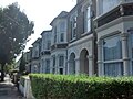
 Roads in Leytonstone - geograph.org.uk - 2507957.jpg 640 × 480; 68 KB
-
 Seascape House, Church Lane - geograph.org.uk - 5835295.jpg 1,024 × 681; 149 KB
-
 West St - geograph.org.uk - 5830708.jpg 1,024 × 681; 147 KB
-
 Woodlands Road, Leytonstone - geograph.org.uk - 2432210.jpg 4,320 × 3,240; 4.66 MB
-
 Wrought Iron and rustic wall, Belgrave Road,Leytonstone, E11. Postcard, 1912.jpg 1,044 × 1,614; 242 KB


.jpg)


